

Walking the Old Vegas Trail to Railroad Pass
/
A view of Las Vegas from the Old Vegas Trail with snow-covered Mt. Charleston in the background
We’re always looking for new paths in the greater Las Vegas area for our hikes. AllTrails is a great resource and we recently found a new trail close to home that’s only lightly trafficked. Just the thing for social distancing and still getting outside and exercising.

Maybe romantic, but graffiti nonetheless.
The Old Vegas Trail to Railroad Pass trail is just one of a large network of interconnecting trails in the shadow of the River Mountains in Henderson, Nevada. The trailhead with a small parking area is less than 20 miles from the house, so it was a quick trip to get onto the path and starting walking.
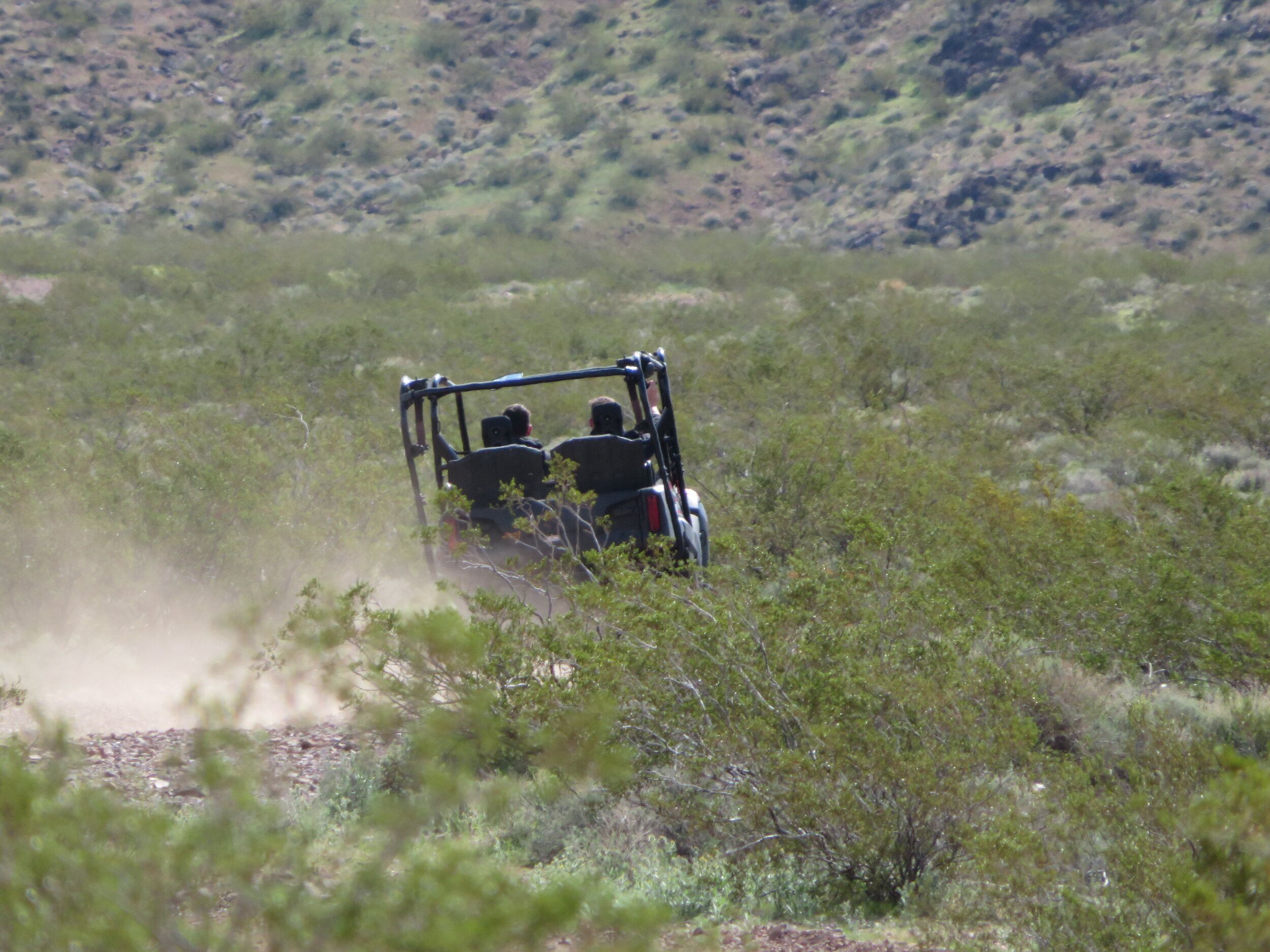
The trail begins on a rough gravel road shared by off-road vehicles… primarily ATVs and dirt bikes
The 6-mile loop trail is rated as moderate and starts out as a rough, gravel road shared by off-road vehicles… primarily ATVs and dirt bikes as well as mountain bikers and of course, us. We were pleasantly surprised by the courtesy of the off-road vehicles. We stepped off the road to get out of their way, but they slowed down significantly, minimizing the suffocating dust cloud that rose in their wake.

Hold onto your hat, David. It was really windy when we reached the saddle.
The initial mile or so is a constant uphill grade with an elevation gain of about 900’. We finally veered off the ORV track and headed onto the walking/mountain biking trail. We reached a saddle that offered spectacular vistas of both the Las Vegas Valley on the north side and the Boulder City valley including the pristine Cascata Resort Golf Club on the south side.

The greens of the Cascata Golf Course were especially striking.
Once on the saddle, the wind nearly blew us away. The trail narrowed considerably and we found it a challenge to hold onto our hats, use our trekking sticks and keep our balance. Thank goodness we were walking and not on mountain bikes. The trail in places was barely wide enough for us, never mind a mountain bike and the rocky drop-off beside us would have been disastrous if we’d fallen… not to mention we probably would have lost our hats. This black, double-diamond, advanced bike trail, by the way, is called The Shit. I kid you not!

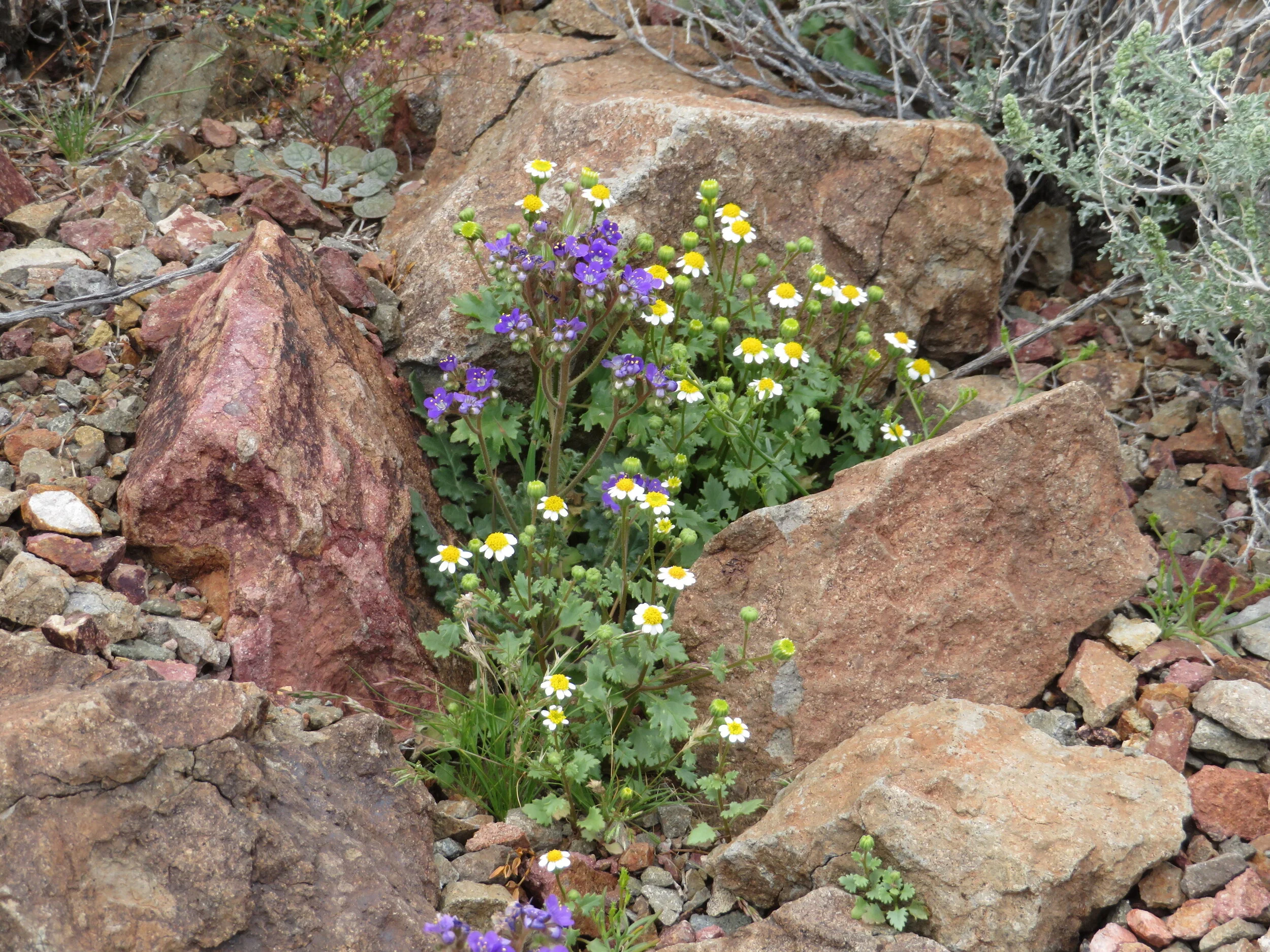
The trail led us over rocks and ruts, up and down the skinny path, across slippery shale and scree as we traversed the contour of the mountainside. When we began to walk, there were a few wildflowers, but nothing outstanding. As we progressed on the south side of the mountain, the flowers became more prolific, more varied and more colorful. Want a closer look? Click on the image to enlarge it.


Great vistas!
Finally, we began our descent. We could see the railroad tracks that were once used to supply materials for the Boulder (aka Hoover) Dam Project. They have been restored and the tracks are now used for the Nevada Southern Railroad, a tourist train, that runs from Boulder City a few miles to nowhere. For folks with more energy, the tracks are also used for pedal carts.

Since there’s only one track, the pedal carts pedal one direction and get picked up on the other end. This photo was taken before the ‘shelter in place’ edict took effect in Nevada. No more pedal carting for a while.
The final mile or so was easy going. The wind had calmed down and what wind was left was behind us. The trail was fairly flat and we were heading down for a change, instead of up. Since this is one of a huge network of trails in the area and it’s so lightly traveled, we figure it’s one we’ll visit again, hopefully soon.