

Harpers Ferry and A Walk on the Appalachian Trail
/
We were still awaiting the results of our PCR tests and Brennan still wasn’t home from his business trip, so we had some time to kill on our way to Richmond. No problem, we can always find plenty to see and do. We’d visited the Harper’s Ferry National Historic Park a few years ago, but we thought we’d return and since the midpoint of the Appalachian Trail runs through this town, it might be an opportunity to suss it out. We had a plan. *Note the actual midpoint of the trail is somewhere a few miles north in Pennsylvania, but Harpers Ferry is considered the ‘psychological midpoint’ to most hikers.

West Virginia is a beautiful state. Known as ‘the mountain state’, the Blue Ridge Mountains of the Appalachian range run right down its spine. No matter where you go in the state, you seem to be going either up or down. Nestled in the Shenandoah Valley, the lower section of Harpers Ferry, because it’s located at the confluence of the Potomac and Shenandoah Rivers, is the state’s low point. Prior to the Civil War, Harpers Ferry was a manufacturing town and a transportation hub. Because of its strategic river location, it was devastated by the war and changed hands between the Confederates and the Union armies eight times. Today, with a population of only ~300 people, the town survives on tourism. Its largest employer is the National Park Service (NPS) and the historic park is definitely worth a visit.

Probably the most significant single event in the town’s history was John Brown’s raid on the Harpers Ferry Armory in 1859 in an effort to arm slaves and incite a rebellion. The raid failed, most of the raiders were captured and John Brown was tried and hung in nearby Charles Town. We visited the small John Brown Museum operated by the NPS.

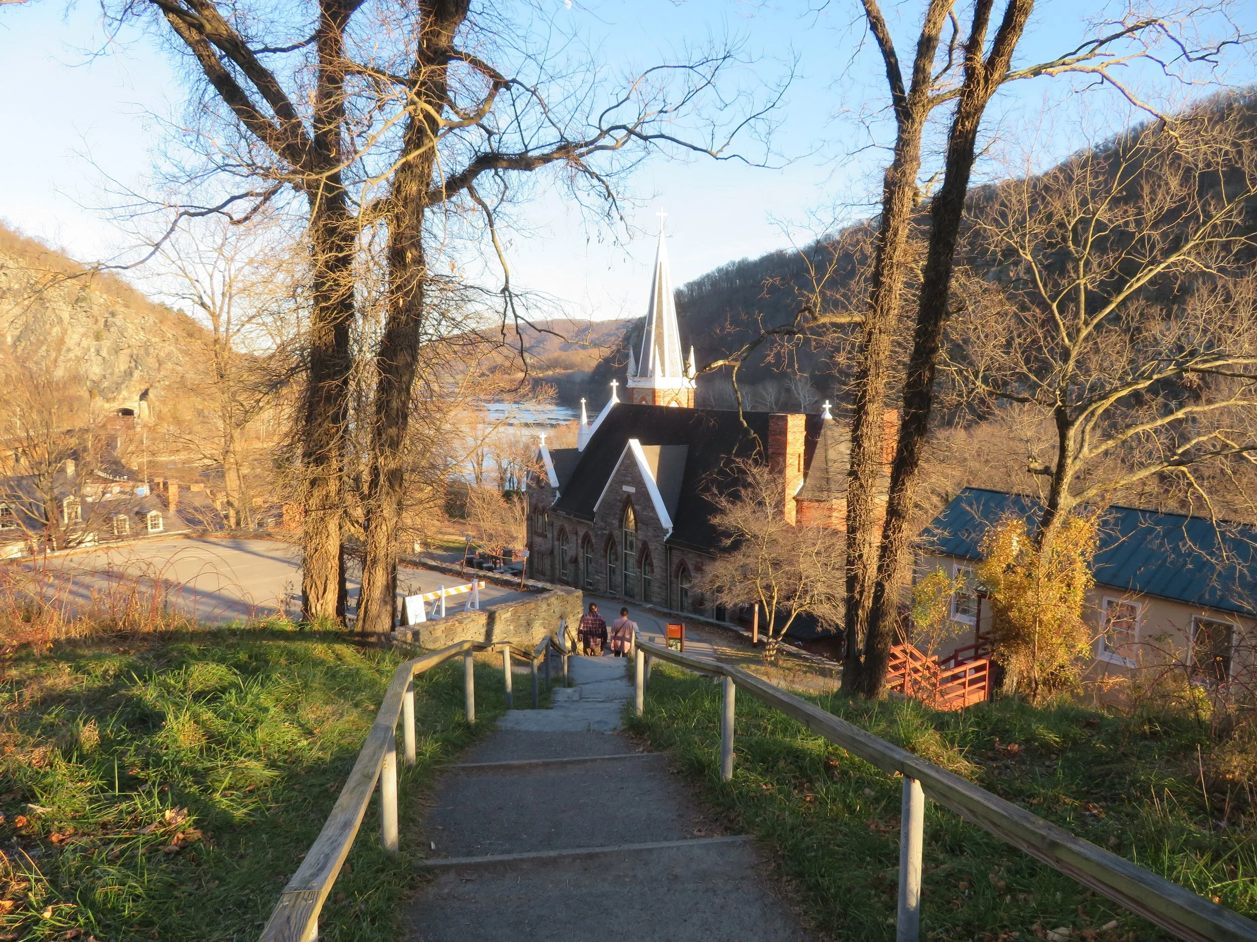
Many historic buildings line the town’s lower town streets, most furnished as they might have been during the Civil War era. We meandered along the streets and through the alleyways, peeking into buildings and absorbing some of the history that was presented.

Many of the historic buildings were furnished as they might have been during the Civil War era.
The Visitor Center is located outside the town proper and provides brochures, maps and additional historical insight primarily into the Civil War activities that took place here. Key battle sites such as Bolivar Heights, Maryland Heights, Loudon Heights, and Schoolhouse Ridge are all open for exploration. We picked up our park info and set out to see more of the town. A frequent shuttle runs between the visitor center and the downtown area, but the path along the river was a much more pleasant alternative.

We crossed a long walkway that ran beside the railroad tracks across the Potomac River. The views of the confluence of the Potomac and Shenandoah Rivers were awesome.

On the opposite side of the river, we followed signs to the Appalachian Trail. This portion of the path is shared by the Appalachian Trail, the C&O Canal Trail, and the Potomac Heritage Trail. Harpers Ferry is located at the point where Maryland, Virginia, and West Virginia meet, so Maryland was just across the river and the Virginia state line wasn’t far away.

The train still runs along these tracks.

Appalachian Trail Sign… only 4 miles of the trail actually goes through West Virginia. Harpers Ferry is considered by hikers to be the half-way point along the Appalachian Trail.

Majestic St. Peters Church dominates the town’s skyline.
There are only four miles of Appalachian Trail in West Virginia and we walked a couple… with the return trip, a total of four miles, just not the entire distance within the state. The trail was up and down and a bit slippery in parts, but in general, pleasant and good walking on a woodsy, well-maintained, well-marked trail.

appalachian Trail Conservancy Headquarters
We had previously stopped by the Appalachian Trail Conservancy Headquarters located here and headed off on a trail recommended by the folks there which took us through the woods to the lower town with lots of scenic overlooks. We’re considering the Appalachian Trail as a possible long walk in the future… 2100 miles from Georgia to Maine. We’re discussing the possibility of walking sections of the trail rather than attempting it in one fell swoop. The trail was steep but interesting. Jefferson Rock, shown below, was named after Thomas Jefferson who observed the town below from this vantage point, as did Merriweather Lewis.


View of the river and the town below from Jefferson Rock. You can understand why Jefferson might have appreciated this viewing spot.
After two days on the local trails and exploring the town and historic park, it was time to head to Richmond. Brennan was home and waiting for us and our PCR tests were both negative. All was well and we were looking forward to our visit with Brennan and Hannah in their new digs in Richmond.
Next time… some rambling around Richmond, Virginia. Join us.