

Cycling the C & O Canal Towpath - 1
/
When we finished cycling the Great Allegheny Passage (GAP) the other day, we were at the western terminus of the Chesapeake & Ohio (C&O) Canal Towpath cycling route. Unlike the GAP which is a converted railroad line, the C&O trail is a towpath that follows the course of the Potomac River 184.5 miles from Cumberland, Maryland to Washington, DC. The towpath was originally created to aid commerce between the US capital and its expanding western frontier. Today, it’s a quiet, wooded multi-use trail along the remains of the canal.

The towpath runs alongside a hand-dug canal which was begun in 1828 and completed 22 years later in 1850. More than 35,000 workers were employed in the construction of the canal at a cost of $11 million (big bucks back in those days). It was built 12 feet wide as a track for mules which were used to pull canal boats laden with coal, grain, lumber, whiskey and other cargo, to and from ports along the canal. By the time it was completed, the canal was already obsolete as the B&O Railroad had already completed its link to the west and it reached significantly further than Cumberland.
The canal was still used until 1924 and then nearly abandoned. Floods and nature overtook the path, but the remnants of the canal and many of its structures remain. The federal government purchased the land including the canal and towpaths from the B&O Railroad in 1938 and the CCC did considerable reconstruction and renovation for its use as the C&O Recreational Waterway. A devastating flood in 1942 halted the reconstruction work and no more funds were appropriated. Then, because of WWII, thoughts of further reconstruction were totally abandoned for several years. A feasibility study in 1950 considered several options for its use including a highway corridor. Fortunately, that plan was nixed. In January 1961, President Eisenhower declared the C&O Canal a national historical monument, but it wasn’t until 1971 that Congress approved it as a national historical park. President Nixon signed into law.
Back to the present…
We needed to return to Connellsville to retrieve Blanche. We booked a hotel room in Cumberland where we stashed the bikes, then took the Amtrak Capitol Limited from Cumberland, arriving in Connellsville around 10:15 pm. Question: Can you get seasick on a train? We had a little motion sickness when the train first started out… swaying back and forth on the tracks, but it dissipated after a few minutes.

We’ve ridden lots of trains in Europe and local trains here in the US, but hadn’t ridden an Amtrak train before. The seats were ‘up top’ and spacious. They reclined and had footrests. Once we got used to the motion and the scenery speeding by, it was quite comfy.
We picked up Blanche at the Connellsville Amtrak station… she was rested and glad to see us… and drove back to Cumberland, arriving around midnight. We took a lay day in Cumberland to recoup before starting our next cycling adventure. It rained off and on during the day. Unfortunately the Visitor Center was closed, but we wandered around town to see what there was to see.
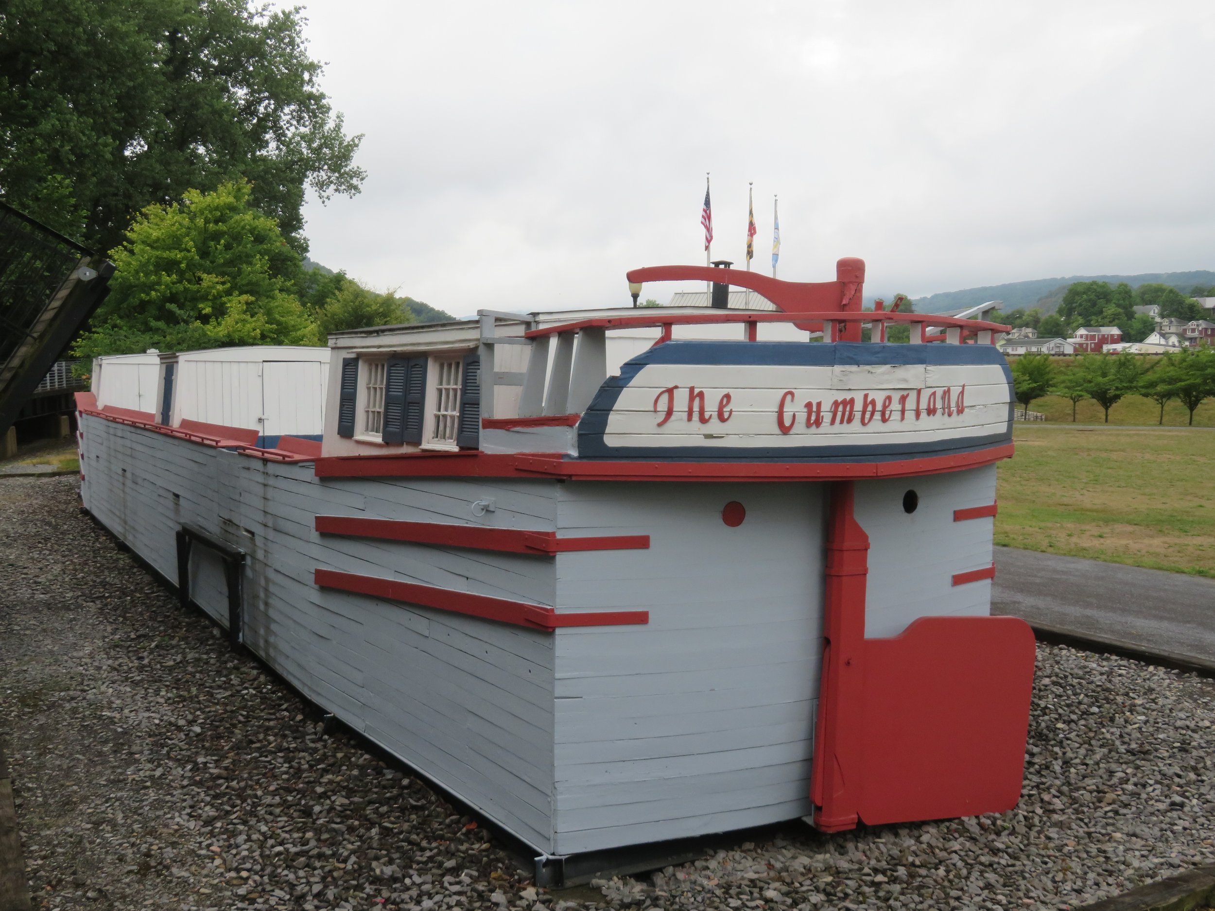
A canal boat replica, ‘The‘Cumberland’, was on display just a couple hundred yards up the trail near the C&O Visitor Center.
A traditional Irish Celtic Cross stands near the towpath commemorating the Irishmen who died building the Canal and the B&O Railroad from 1828-1850.

A statue of a towpath mule stands in front of the C&O Canal NPS Visitor Center which shares the old Western Maryland Railroad Station with the scenic train.

Historic Downtown Cumberland is a pleasant enough little city. The views from a short distance up the trail were great.

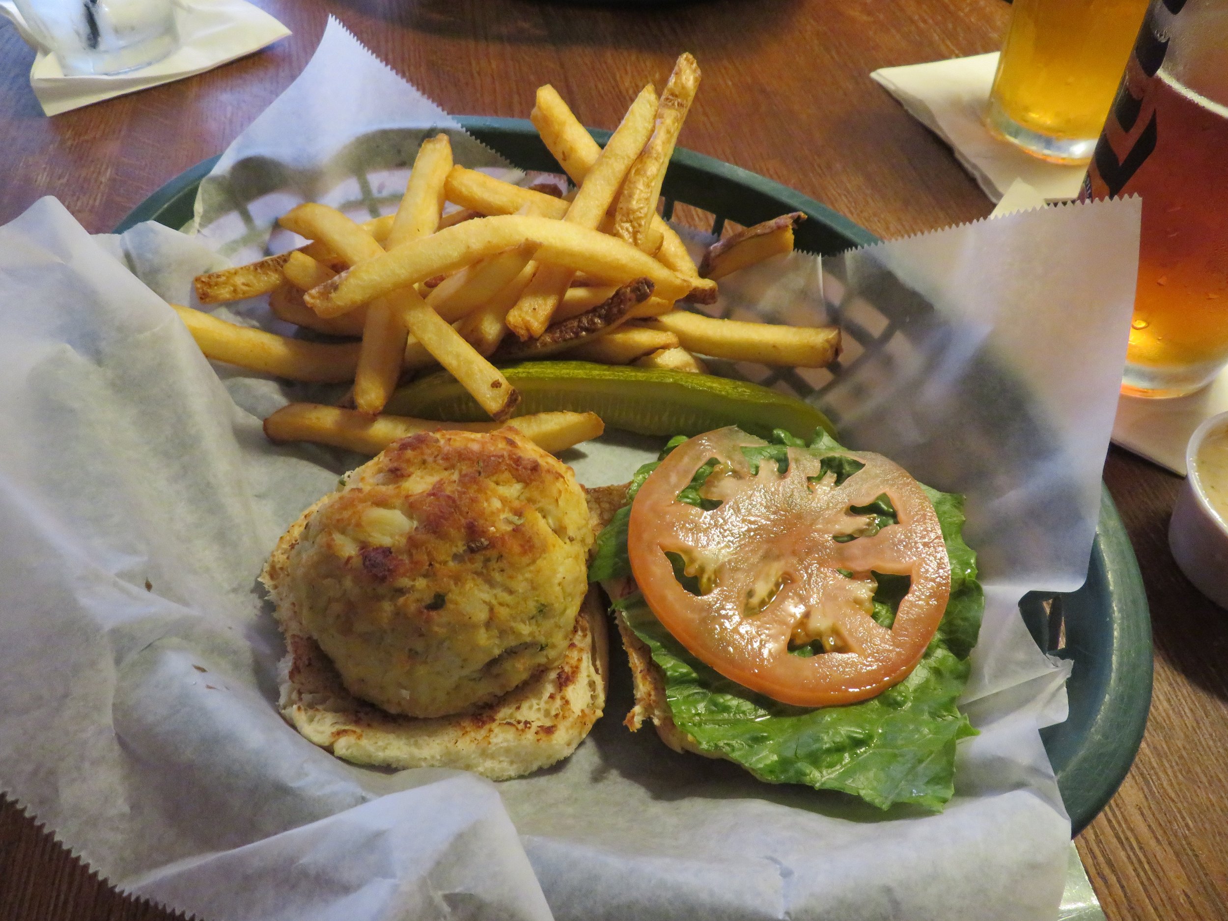
We stopped at the Baltimore Street Grill for a crab cake sandwich at lunchtime. After all, we are in Maryland.
Day 1 - Cumberland to Spring Gap - 24 miles
And so we begin…


We checked out of the hotel and left Blanche in the hotel parking lot. It had rained hard all through the night, but was clear by morning. The trail, however, was very, very wet and muddy. Initially, we tried to avoid the mud puddles to keep the bikes and us clean. We soon gave up on that plan. The trail is fairly narrow, not the original 12’ width that accommodated the mules, so when the mud and water extended the entire width of the trail, we just plowed right through. We rode under trestles, over aqueducts and through a ton of mud.

As we rode, the canal was on one side of us and the Potomac River on the other, many times occluded by dense foliage. The trail is thickly wooded and a canopy of tall trees provides shade while riding. Much of the canal is waterless now, but the parts that do have water are fairly stagnant. The algae was so thick, it looked as though one could walk on it, but the wildlife didn’t seem to have a problem with it at all. At milepost 180, we stopped along the algae-covered canal to check out turtles, blue-winged teals, and a green heron.


There were hordes of dragonflies cruising low over the water looking for breakfast. We could hear bullfrogs croaking along the water’s edge.

Cattails and swamp rose mallow rose up from the edges of the canal along with thick reeds.

On the river side of the trail, we noticed blackberry brambles and stopped for a snack.


We turned around at about 6 miles up the road (12 miles RT) and made our way back to Cumberland. The bikes were a mess, as were we. The Fairfield Inn right on the trail offers bikers a hose for washing off their bikes and we made good use of it.
We loaded the bikes into Blanche and headed to a nearby Walmart to stock up then headed to the Spring Gap Campground, not realizing reservations were required in advance.. Once we figured out we needed reservations either via phone or website, we didn’t have a phone signal. We drove a couple of miles away to get a phone signal then realized we foolishly hadn’t written down the campsites that were acceptable… some of them were pretty muddy. Grrrrr! We drove back to the campground, figured out which sites were good, then drove back for a cell phone signal. The website wouldn’t allow us to reserve the campsite for two consecutive nights even though they appeared available, so we gave up and tried calling. After finally getting through an interminable selection of automated options, we found ourselves in an endless loop and were bounced back to where we started. Double grrrr! In frustration, we opted to go to nearby Lock 75 on the towpath for which we’d seen signage and have some lunch.
The towpath and lock were located a short distance behind a large grassy park with picnic tables, grills and there were vaulted toilets nearby. According to the NPS rules, overnight parking in designated areas is allowed. We decided to stay where we were for free and without the reservation hassles.

As an aside, there are the remains of 74 locks along the towpath that once raised and lowered boats. There are also several lockhouses which originally accommodated the lockkeepers and their families. Seven of the lockhouses have been restored and are available for overnight guests. All are quite expensive and none have electricity or running water, but the experience might have been fun.

It was late afternoon when we decided to cycle back to the point we’d reached from the Cumberland end earlier in the day… 6 miles RT. It was so pleasant, we continued on the trail as far as Spring Gap, another 6 miles RT. When got back to Blanche, the bikes were caked with dirt and mud once again. We rode about 1/4 mile down the trail and ended up washing our bikes and gear once again at one of the hand pumps we’d seen located strategically along the path. It was a slow process, but we got most of the dirt off the bikes… and ourselves. A good first day.

Day 2 - Spring Gap to MP (mile post) 159 - 29 miles RT
We moved Blanche to another designated parking area in Oldtown figuring we’d stay there for the night. We enjoyed splitting our day yesterday and decided to do the same today. In the morning, we rode about 15 miles RT from Oldtown back to Spring Gap.

It was slow going compared to the GAP. The trail was narrow and bumpy, packed dirt with lots of pot holes, rocks, and tree roots to provide extra jolts. One area was thick with shale which had calved from a rock face and was a bit tricky riding through. It’s been hot and muggy, but cool enough while riding, making our own breeze under the dappled light provided by the tall trees.
There were lots of critters on the trail today. Kamikaze squirrels and rabbits darted out just in front of us, barely escaping our bike tires. A deer dashed across the trail about 10’ in front of me then watched us from the other side of the canal.

A red-spotted purple butterfly (I had to look that one up) flew by and then stopped for a photo opp.

Several black rat snakes stretched across the trail. They’re usually fast enough to get out of the way, but I unfortunately ran over one. He luckily limped away before David got him, too.
A gang of wild turkeys caused a small traffic jam, and only after some coaxing decided to leave the trail.

Several large woodchucks ran across the trail, then peeked out at us from the dense foliage on the other side. There were the usual ducks, turtles and herons on the canal. Yellow water lilies were just beginning to bloom.

We’d stop every five miles or so for a butt break and sometimes a snack. There are benches on the trail, but there are also 30+ campgrounds for those who prefer to camp right on the trail.

Back at Blanche, we parked the bikes and walked 1/4 mile to the Oldtown Schoolhouse Kitchen. Interestingly, this tiny town restaurant is located in the vacated Oldtown high school which closed in 2000. The restaurant uses the old school kitchen and the cafeteria is the dining area. The meals were simple… breakfasts, sandwiches, etc., but adequate for our needs.

We rested when we got back to Blanche then in late afternoon, started out for the second half of our day’s ride to MP 159. Before hitting the towpath, we took a slight detour to check out Maryland’s only privately operated toll bridge across the Potomac, connecting Oldtown, MD and Green Spring, WV. It’s kind of a rickety affair and only passable during low water. We asked the toll for bikes and it was free, but we declined the opportunity in favor of getting onto the towpath.

We got to MP 159 and turned around. Our plan was to stay in Oldtown for the night, but we met Jim, a teacher from New York, on our return trip. He and his riding partner were also riding the C&O, but his partner had a serious problem with his bike on the top of the PawPaw Tunnel trail detour which could not be repaired on site. Their car was back in Cumberland and Jim was riding back to Cumberland (another 20 miles from where we met him) to get the car and then drive back to rescue his buddy. We offered him a ride which he accepted. We all rode back to Blanche, loaded up the bikes and drove back to Cumberland and dropped Jim off at his car.
Rather than staying at Oldtown for the night, we decided we’d drive a bit further to the Paw Paw Campground and spend the night there. We were all positioned for our next day’s ride.

Join us next time as we continued along the C&O Canal Towpath. We’re getting better at negotiating the trail and you won’t feel the bumps hardly at all. ;-)