

A Side Trip to Skagway
/Retracing our route on the Alaska Highway was not quite as exciting as the first time through, but there were definitely some sights we missed first time around and we aimed to visit some of them now. From Whitehorse, the South Klondike Highway turnoff is 10 miles east. A scenic, interesting 98 miles south through the Carcross Desert and over the White Pass of the Coast Range ends in Skagway, Alaska. Like Point Roberts, WA and Haines, AK, Skagway is another U.S. pene-exclave, i.e. you can’t reach it by land unless you travel through another country, in this case Canada.

The scenery is particularly beautiful along this route. We stopped at an overlook of Emerald Lake. The views below were exquisite… Aurora Borealis swirls of blues and greens in the lake below.

The Carcross Desert, billed as the World’s Smallest Desert, isn’t really a desert at all. Despite its sand dunes and its arid appearance, it’s really the remains of an ancient glacial lake.

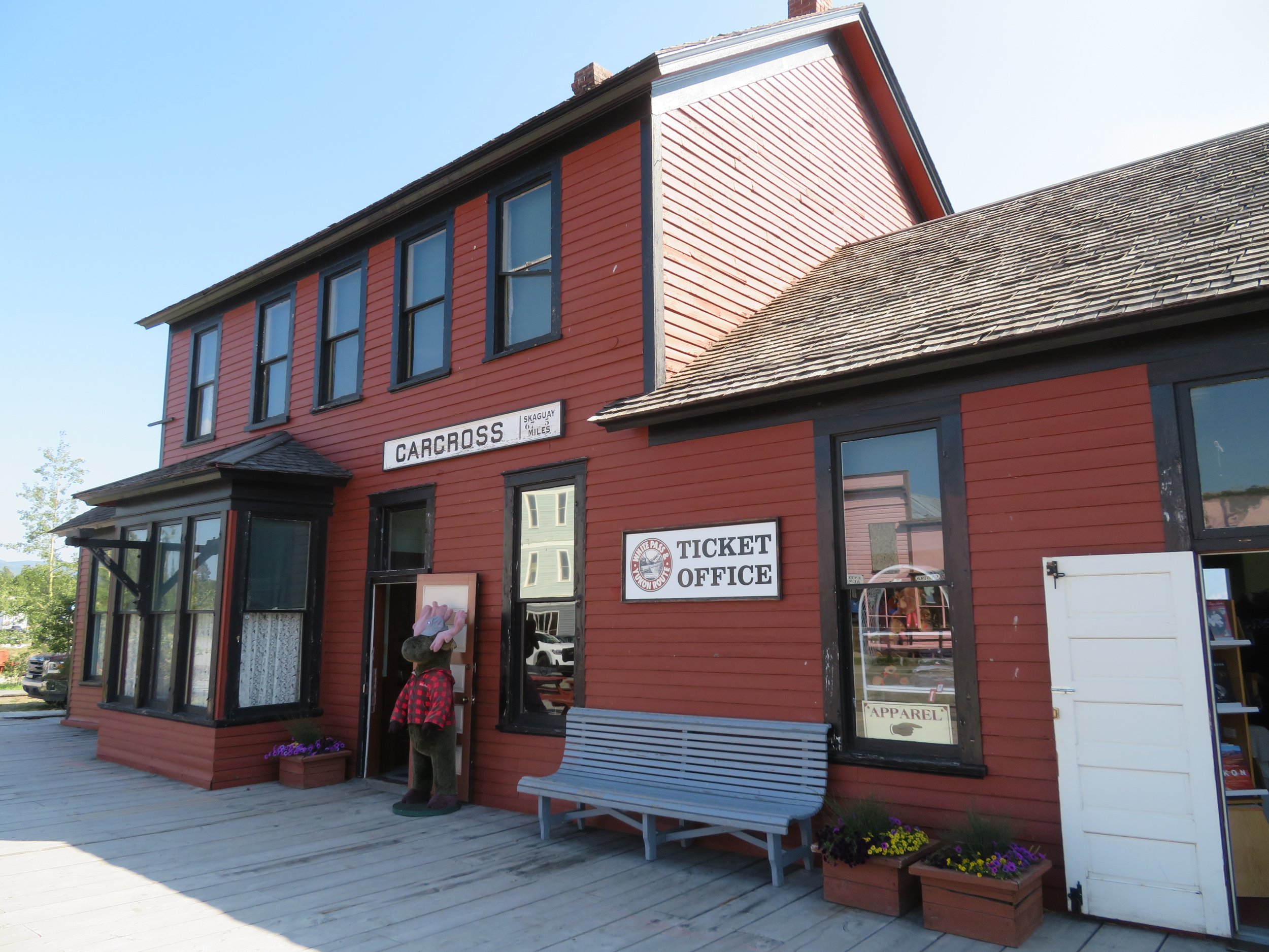
We turned off the South Klondike Highway to visit the little town of Carcross, once known as Caribou Crossing.

It’s a cute little town and despite its size, it offers lots to see. We parked just across the railroad tracks from Carcross Commons, home of the Visitor Center, several shops, boutiques and restaurants. At the Visitor Center, we picked up a town walking tour brochure and set out to explore.


Nearby Carcross Commons are the remains of the hull of the old stern-wheeler, SS Tutshi which was rebuilt by local volunteers and subsequently nearly destroyed by a fire in July 1990. In the old days, all passengers and freight were offloaded from the train here in Carcross and transferred to stern-wheelers for the rest of their trip to Whitehorse and Dawson City.


Carcross was a major stop for gold seekers heading to the Klondike. It was also a major stop for the White Pass & Yukon Route railroad from 1900 until regular service ceased in 1982. Nearly, 125 years from its first run, Carcross is still a stop on the historic White Pass & Yukon Route tourist train route that runs from Skagway April through October. The old railroad station now sells tickets but also acts as an interpretive center and souvenir outlet.
The day was beautiful and the walk through town was interesting. Some of the buildings have been restored like the old Caribou Hotel, established in 1901 and now a Yukon heritage site. Inside, the Surly Bird Saloon offered sarsaparilla and birch beer.


The Matthew Watson General Store is one of the oldest operating stores in the Yukon - a fixture during the gold rush days selling general merchandise and miner’s supplies. It’s still in business today but offers mostly souvenirs.

A row of historic old log cabins stands along Bennett Street, the most interesting of which was the Bobby Watson House, built by a miner and then subsequently sold to Matthew Watson, owner of the general store and now a private residence of Watson’s heirs.

We followed a path between the cabins to the shores of Bennett Lake with a surprisingly awesome sandy beach. A footbridge took us to the middle of Bennett Lake where we waited patiently for the 1:15 train to arrive from Skagway so we could photograph it.

We returned to the South Klondike Highway. The road was climbing, climbing, climbing. Views of Summit Lake were gorgeous.

Finally, up and over White Pass, through U.S. Customs and we were back in Alaska, gaining an hour as we entered the Alaska Time Zone once again.
Skagway is an historic town and a gateway to the Klondike. It’s beautiful, sitting at the head of the Lynn Canal with its backdrop of the Coast Mountains. Tidy and very commercial, its buildings along Broadway are fronted in Victorian Rustic facades. It’s kind of a storybook town on the cruise ship circuit. High-end jewelry and native art stores do their best to attract cruise ship visitors on their way down the board-walked street. Three big ships were docked when we arrived.

Interesting to note: When we’d visited Haines, Alaska a couple of months ago, we were only ~20 miles from Skagway… by boat. There is, however, no bridge between the two towns and thus to drive it would have been ~250 miles.
We stopped first at the Visitor Center to get the lay of the land. Housed in the old Arctic Brotherhood Hall built in 1899, the building’s unique facade of 8,838 pieces of driftwood makes it a great photo op.

The headquarters for the Klondike Gold Rush National Historic Park are on Broadway as well. The historic park has an interpretive center and several other historic buildings in town as well as several other venues in the old Dyea area about 10 miles from Skagway.

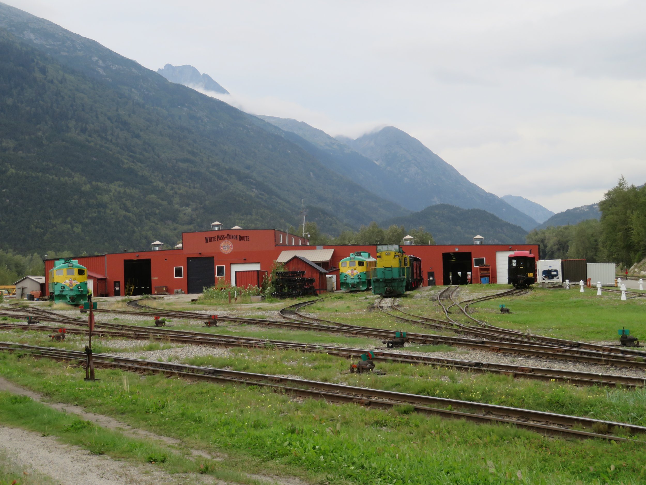
The historic White Pass & Yukon Route Railroad begins here, transporting visitors up over White Pass through the mountains on its way to Carcross.

We had lunch at the Skagway Brewing Company. Established in 1897, it is considered by many to be the oldest brewery in Alaska.

We walked and wandered from one end of town to the other. The railroad barn is located on the northeast end of town. Several engines were ‘resting’ when we walked by.
Beyond the railroad barn, on the outskirts of town is the Goldrush Cemetery. Tree-covered and scattered along a rocky hillside, gravestones marked the sites of those who died during the gold rush years and were buried here.


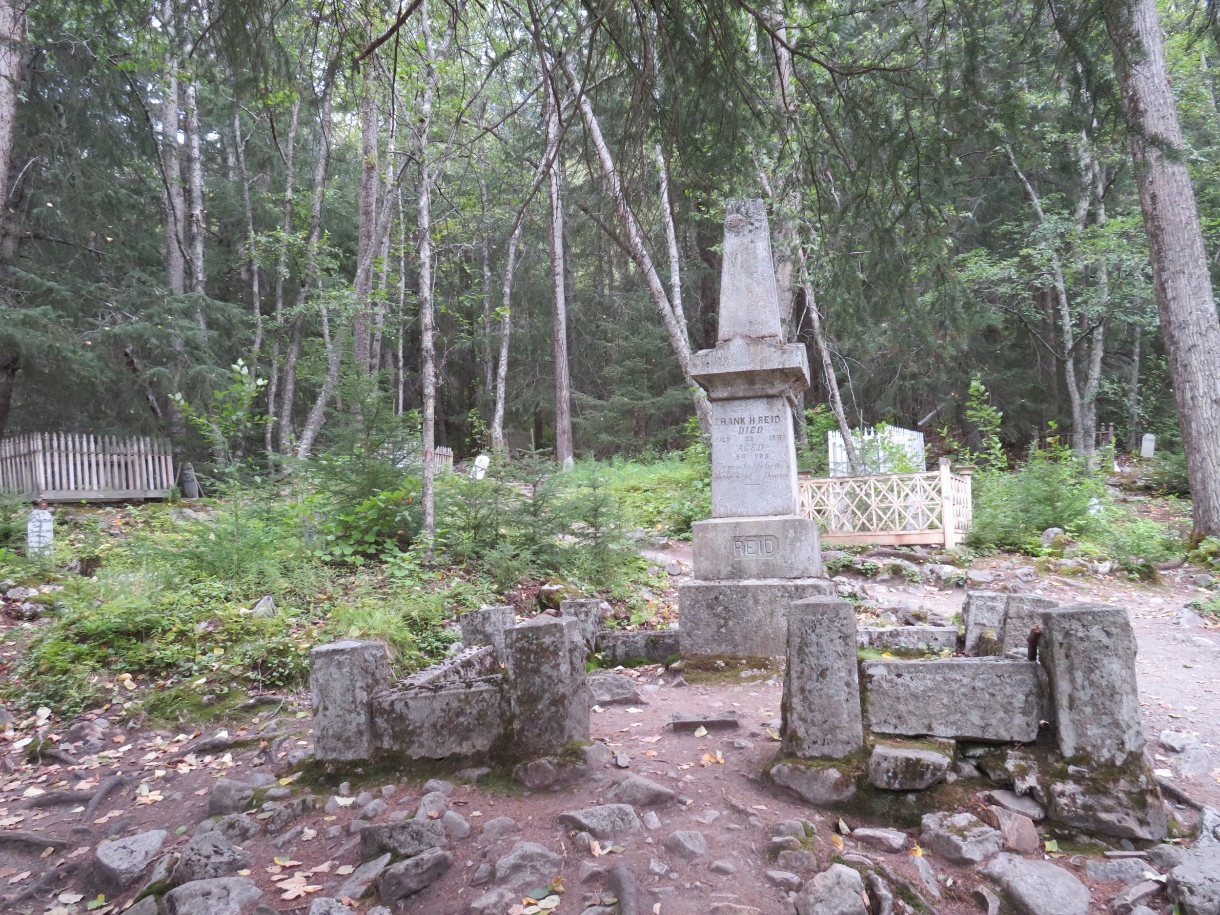
One infamous celebrity interred here is Jefferson ‘Soapy’ Smith, a con-artist and crime boss known for bilking miners and naive would-be prospectors and anyone else he could swindle. We remembered Soapy from his notorious history in Denver and Creede, Colorado. He was shot and killed in Skagway in 1898.


The RV parks in downtown Skagway were quite expensive and were barely more than parking lots, charging extra for showers and Wi-Fi. The alternative was heading out of town to the campgrounds at Dyea (DYE-yee), originally an alternate port and boomtown for gold stampeders with access to the Chilkoot Trail, but now an historic townsite.
The 10+ mile Dyea Road crawls up a mountainside for a great overlook of Skagway below, then turns to gravel and winds around and down to sea level once again. Incidentally, the best cell coverage in town was while parked at that overlook.

We found a great campsite at the National Park campground. Snug and comfortable in Blanche, we heard a knock on the door around 9pm. A park ranger told us there had been some bear ‘incidents’ where a black bear had destroyed several campsites and they were closing the campground. We were asked to leave immediately.
Being inside Blanche we weren’t too worried, but complied and, following the ranger’s suggestion and vague directions, headed 2-3 miles further up Dyea Road to the Municipal Campground alongside the Taiya River. We enjoyed this new campground so much, we stayed for another two nights.

One reason the town of Dyea didn’t survive was that it did not have a good deep water port which Skagway does. Gold seekers were required to portage their supplies up to a mile over tidal flats to get to the town and the trailhead for the Chilkoot Trail. We walked the ‘streets’ of the old Dyea townsite one morning. There’s nothing left but a few pilings, some memories and NPS interpretive signs.


We also walked through the nearby Slide Cemetery, a sad place where dozens of would-be prospectors were killed in an avalanche on April 3, 1898… the Palm Sunday Snow Slide.

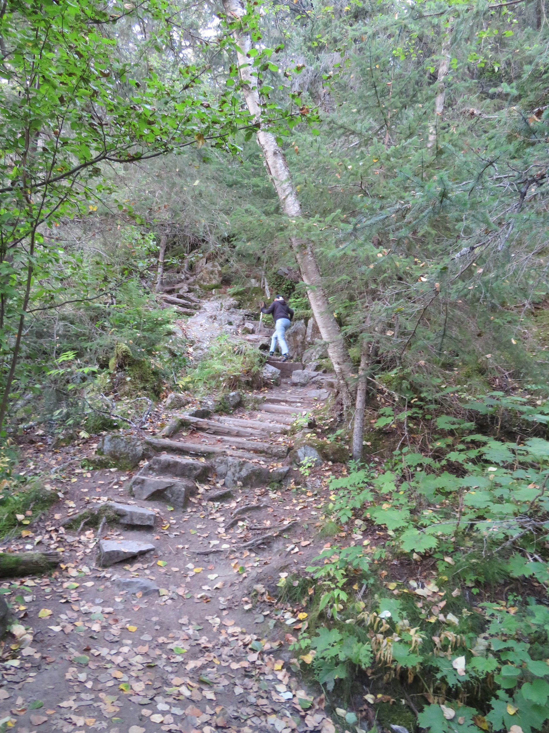
The Chilkoot Trail, now an historic landmark, was one of the two trails over the Coast Range to the Klondike. We walked only 1/2 mile up this steep, rugged trail and wondered how the gold seekers managed to climb this trail with their 1,000 pounds of required supplies. David will provide more information about the Chilkoot Trail in his next Blue View.


The absolute best part of our time at Dyea was the wildlife. Each time we drove by the Taiya River tidal flats to and from the campground, we spotted eagles. Bald eagles were perched on tree snags in the river.

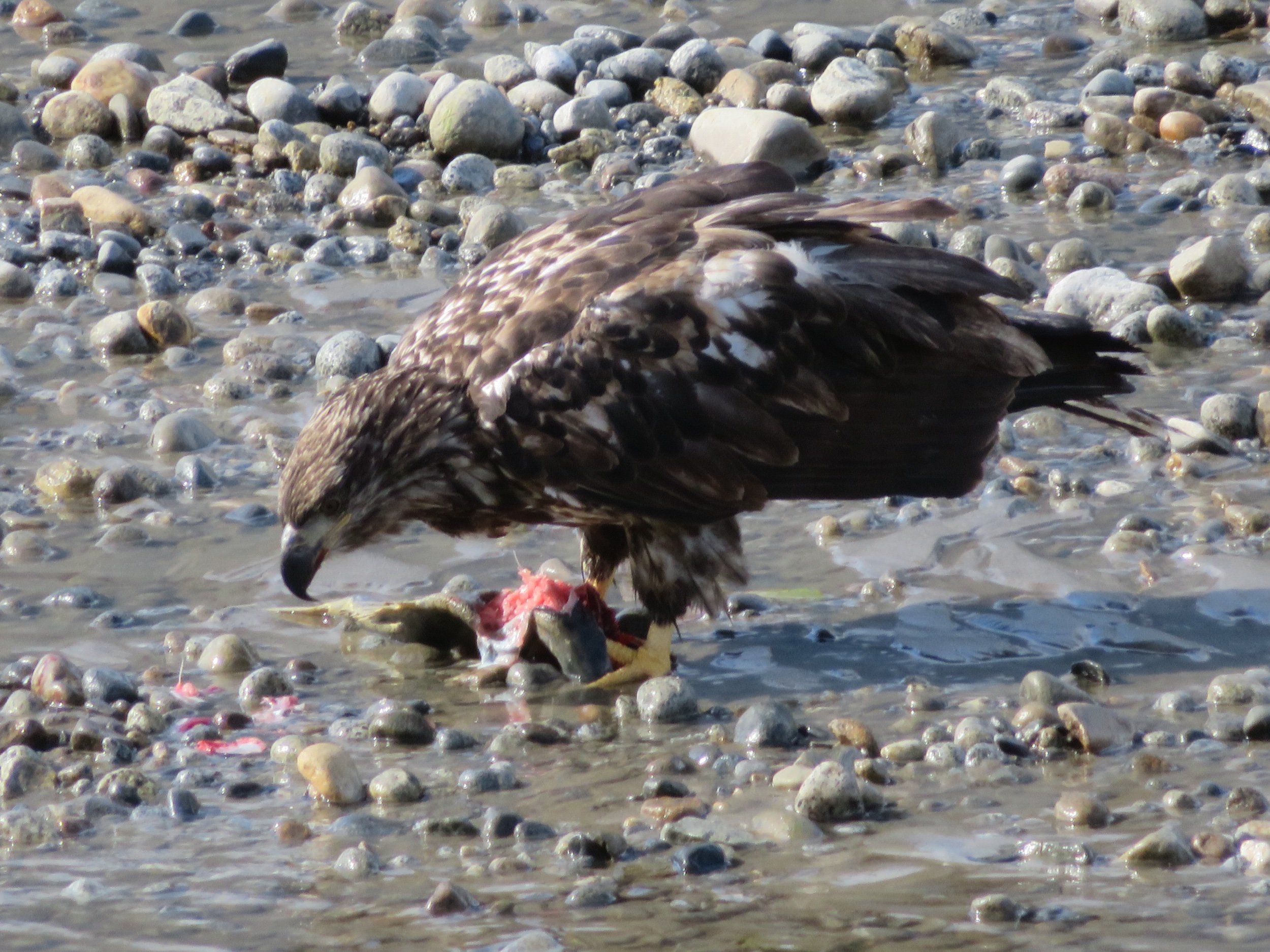
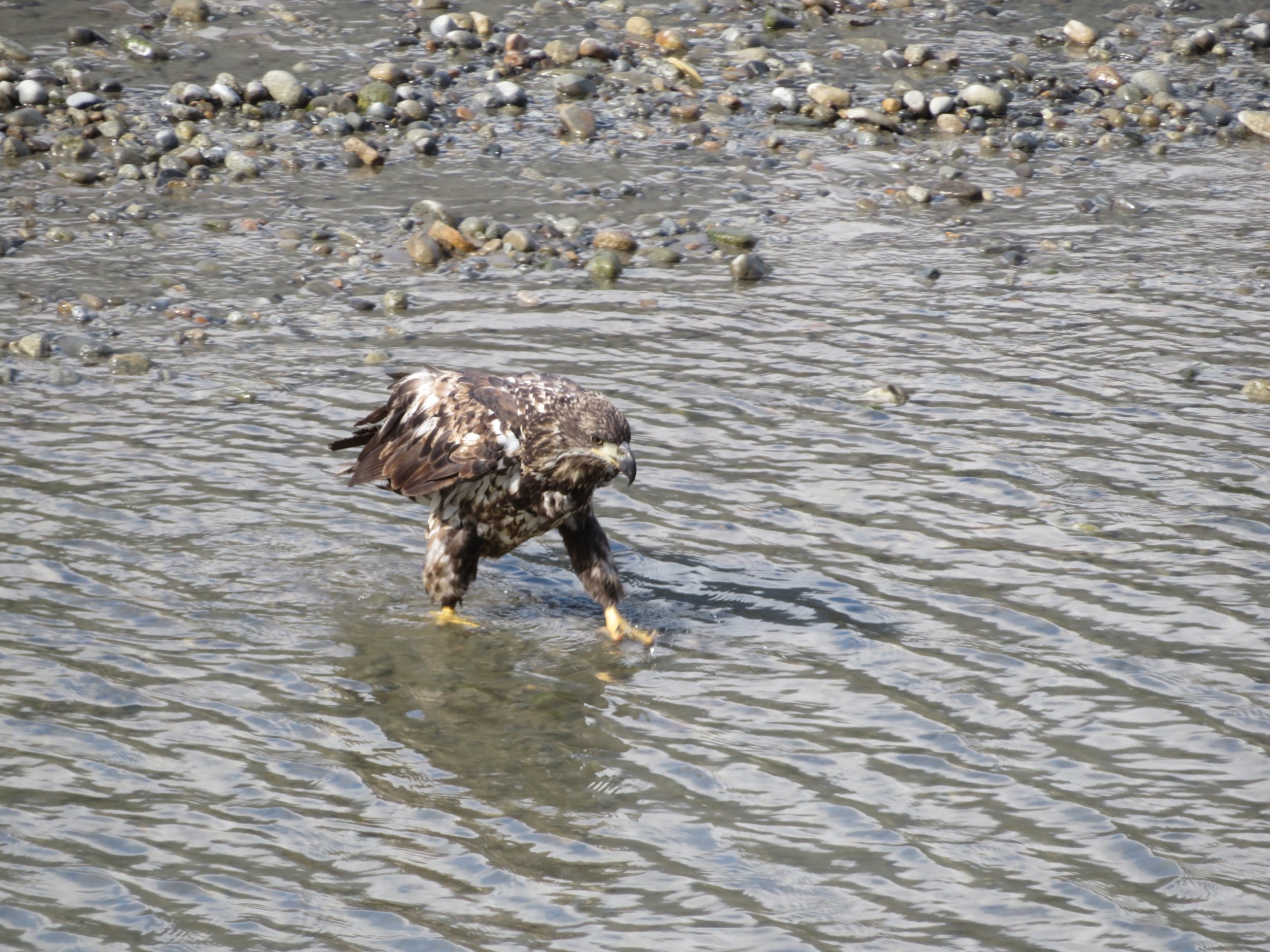
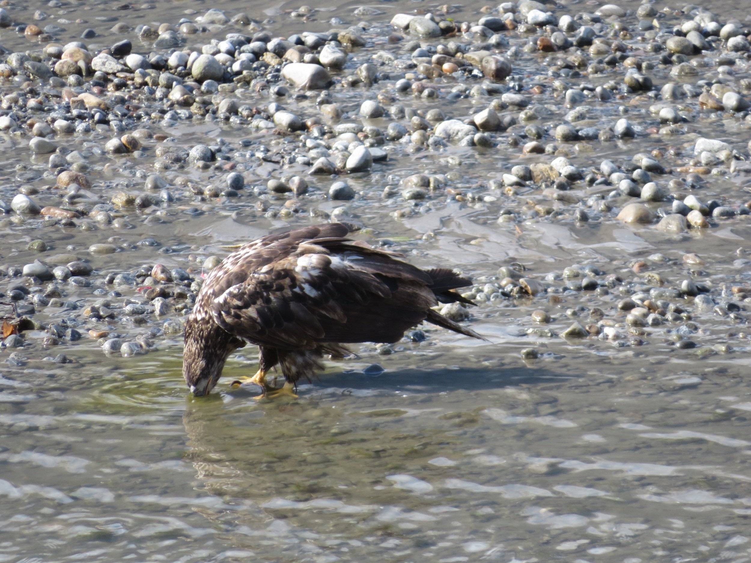
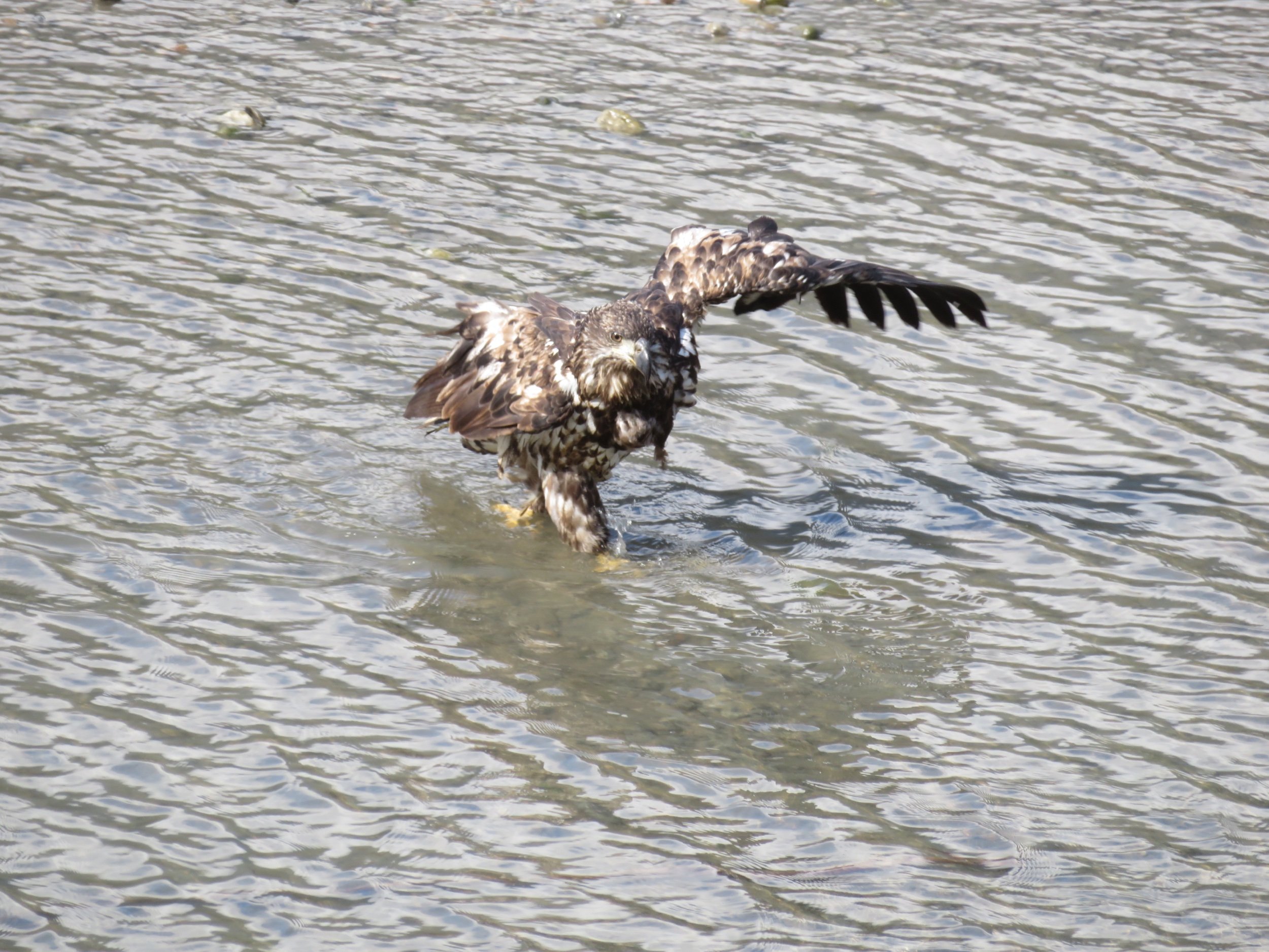
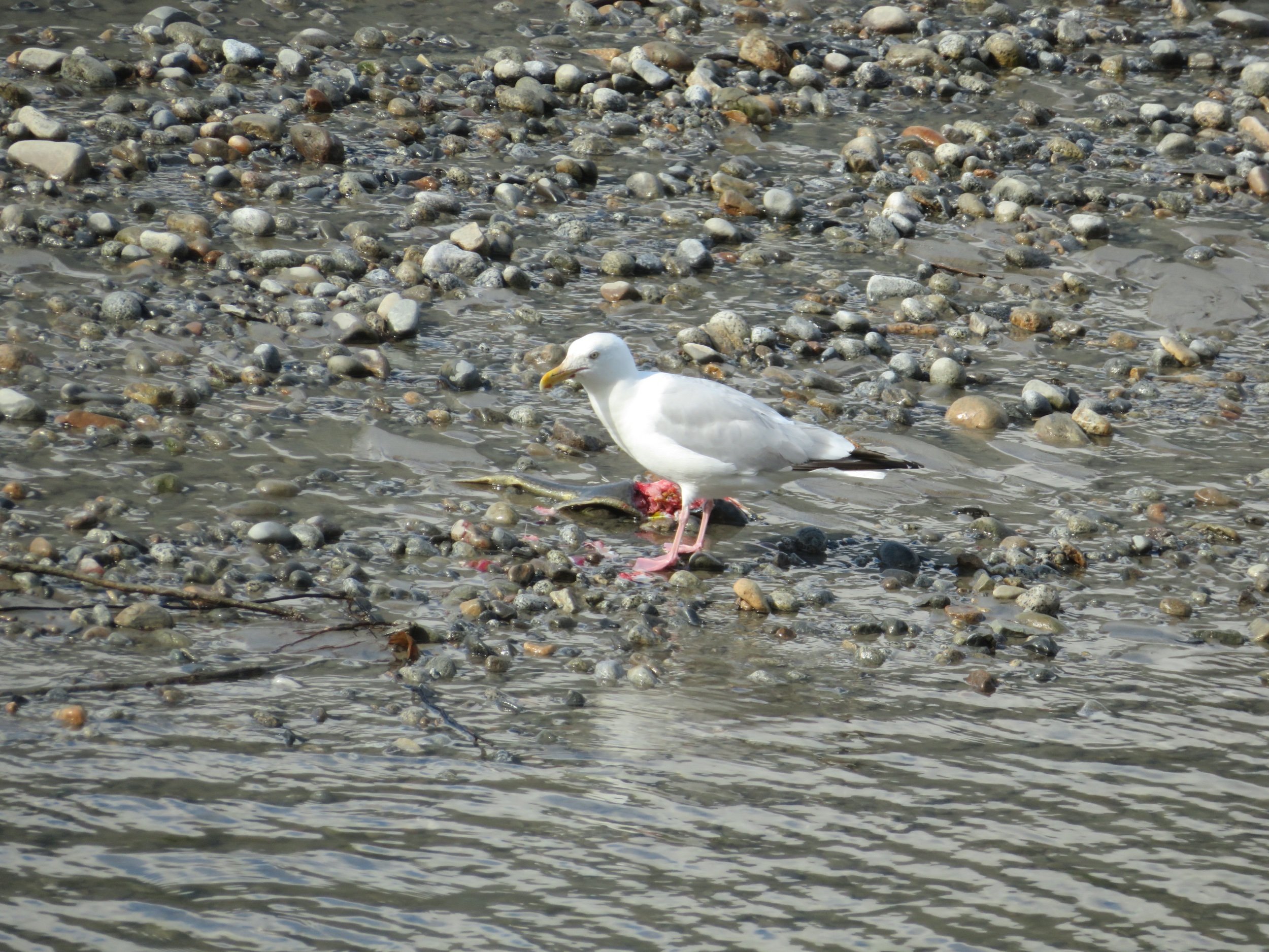
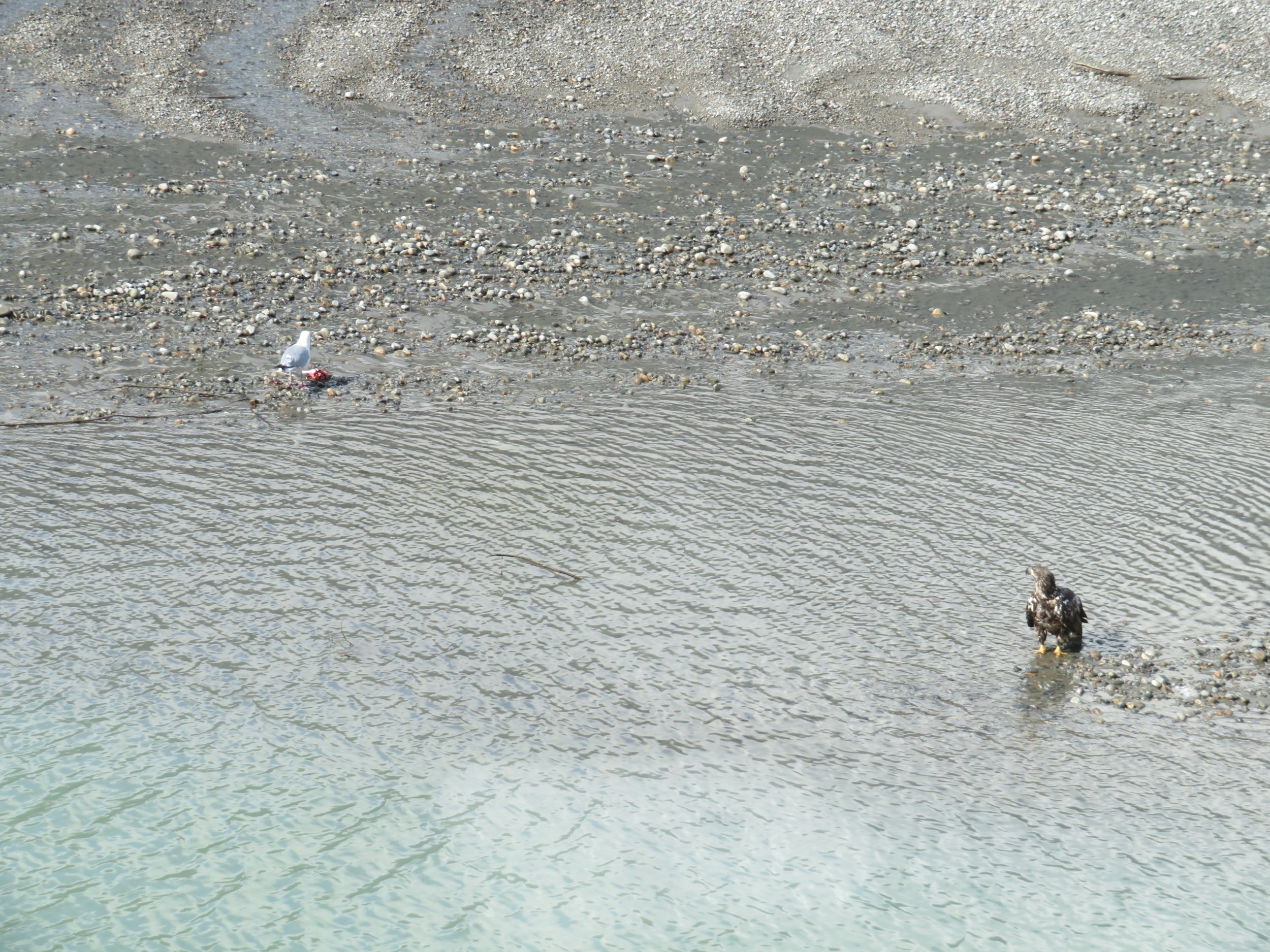
We watched a golden eagle on a sandbar eating a salmon. A hungry gull sat nearby watching and waiting. When the eagle had had his fill, he walked (it was more of a strut actually) into the river to drink and wash off. He spread his wings as the gull warily approached. The gull didn’t give up though. He slowly edged his way to the salmon and began noshing… always with one eye on the eagle. The eagle obviously decided he’d had his fill and was no longer interested in the salmon and allowed the gull the remains of the feast.
On our last morning passing by the ‘flats’, we spotted four golden eagles and two bald eagles. Not far away, we saw a black bear running across the road and into the woods. We could have stayed in this area for much longer, but the autumn clock is now ticking and there’s still lots to see and miles to travel.
Next time, we return to Mile 0 of the Alaska Highway, then head into Alberta, Canada… new territory and a whole new Canadian province. Join us!