

A Long Road and A Big Dam in Quebec
/We departed Quebec City early to beat the traffic and headed to Baie-Comeau. We were on a mission. Blanche was in need of an oil change and tire rotation before we began travel on the TransQuebec/TransLabrador Highways. David tried in vain to arrange an appointment near the city, but the wait was 2-3 weeks. The Dodge dealer in Baie-Comeau, about 280 miles northeast, promised to fit us in if we could arrive there no later than 2pm. We had to hustle since much of the route was a secondary highway and a ferry crossing was involved.
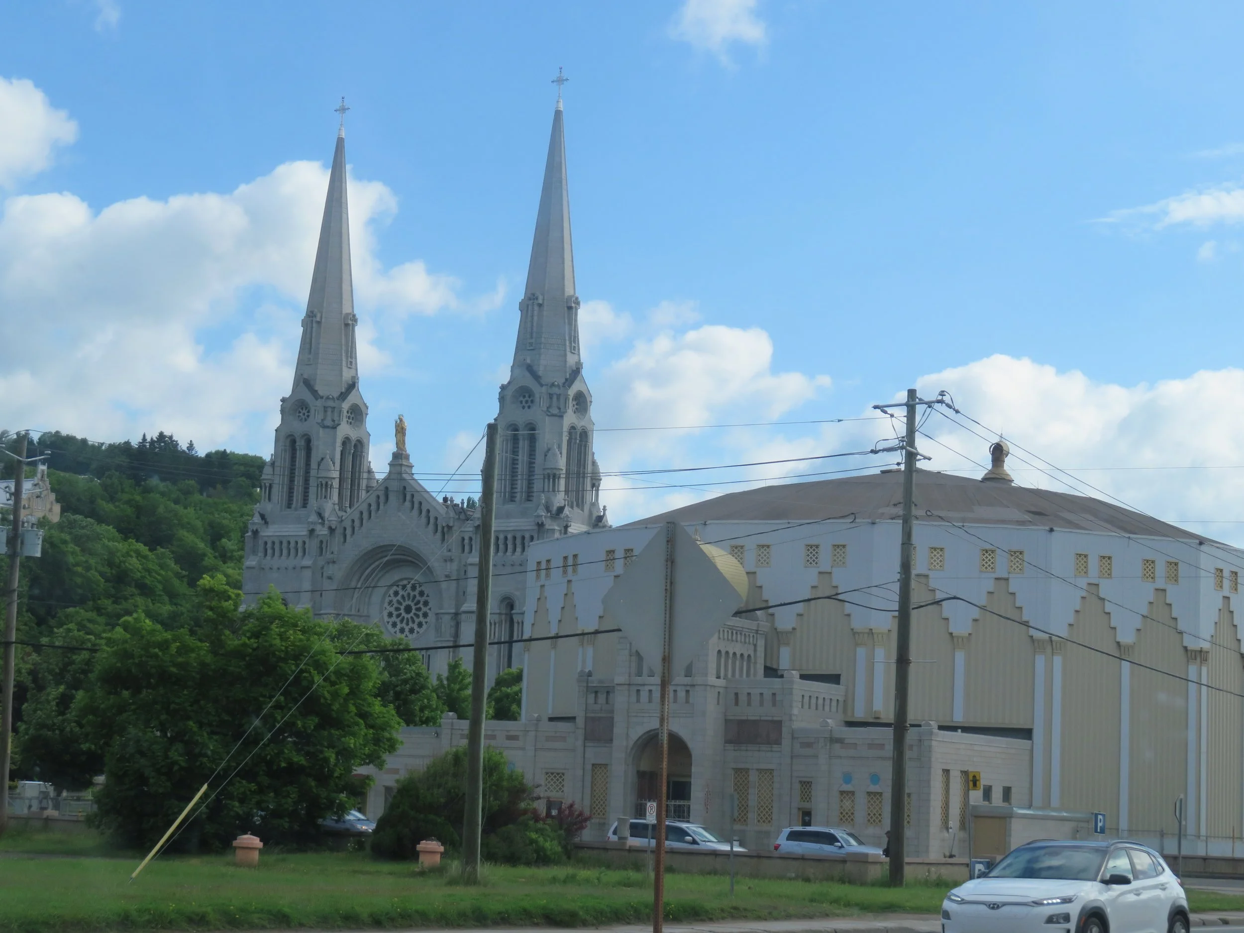
Route 138E is a busy route which took us along the St. Lawrence River (Le fleuve St. Laurent) past the scenic Montmorency Falls and the St. Anne de Beaupre Shrine. We wished we could have stopped at the Falls. St. Anne’s, however, appeared pretty commercial, though apparently very popular.


Low tide on the St. Lawrence as we drove up the highway.
We wended our way along the 2-lane highway slowly ascending through a myriad of little towns. Green, densely forested hills rose above the river to the east while lush valleys lay to the west. We stopped at a McD’s in Malbaie for a stretch, a loo and a coffee. Upon leaving we ascended high above the bay and noting all the sandbars in the bay quickly figured out why the name ‘malbaie’… bad bay.
The Tadoussac/Baie-St. Catherine-Ferry is a free, one-mlle ride across the Saguenay River. There are two ferries which operate on a load-and-go basis. We were fortunate that the queue wasn’t long and our wait was only about 20 minutes before boarding the M/V Alexandrina-Chalifoux for the quick passage across the river’s mouth.


We made it to Baie-Comeau with an hour to spare and true to his word, Michel, our contact, had us in and out in about an hour. Blanche was serviced and given a clean bill of health. We found a great free city camping spot next to the Jardin des Glacier in Baie-Comeau overlooking the mighty St. Lawrence. The sunset was gorgeous.

Sunset on the St. Lawrence River
We were anxious to be on our way up Route 389, the TransQuebec Highway. We’d learned through our research that the Manic 5 Dam, aka Daniel Johnson Dam, aka Barrage Daniel-Johnson et centrale Manic-5, had free dam tours with reservations made at least 24 hours in advance. We had booked in for a 3PM tour and wanted to be sure to be there on time. We filled up with gas and headed up the road. Destination: Manic-5 ~220 miles away.
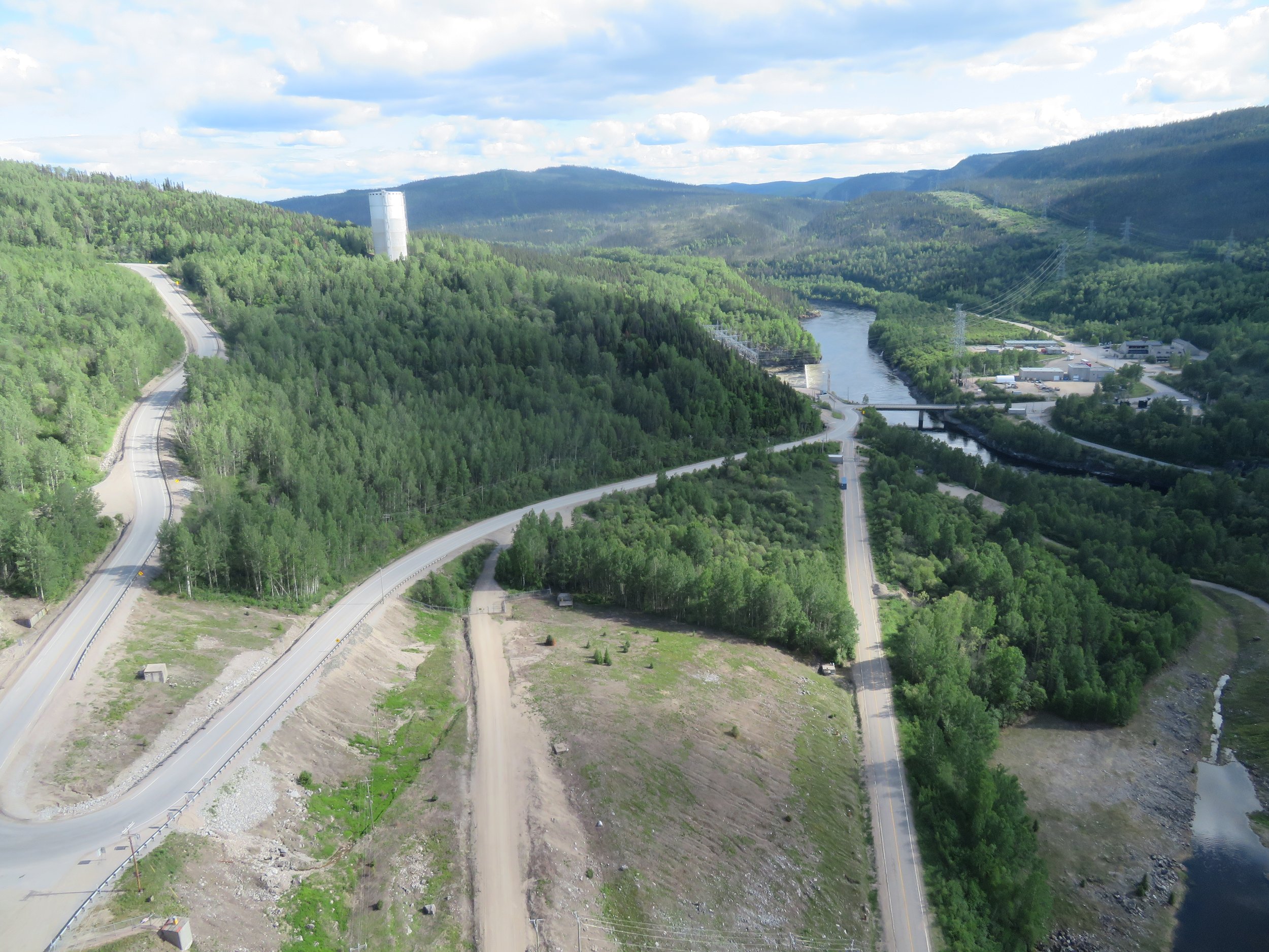
Quebec-389 is a ‘long and winding road’ with steep, steep hills, sharp curves and great views. Traffic was mostly semis and log trucks with a few passenger vehicles and motorcycles thrown in for good measure. The going was pretty good, but fairly slow.
We’d picked up a Cote-Nord brochure at one of the Visitor Centers along the way. It provided maps, mileages and services available on our route. Gas stations are few and far between, so when we reached the Motel de l’Energie just before the dam, we stopped to fill up. At $2.15CAD/liter ($6.10USD/gal), it was a bit of an ‘ouch’.
We made it to the Manic-5 Visitor Center with time to spare and checked out a camping spot that had been recommended, only to find that it unfortunately had been cordoned off and closed by HydroQuebec.
We checked in at the Visitor Center and wandered around a small exhibit area until the tour started. The tour was in French, but we were given headsets for English commentary along with our safety glasses and hard hats.

Manic-5 Visitor Center
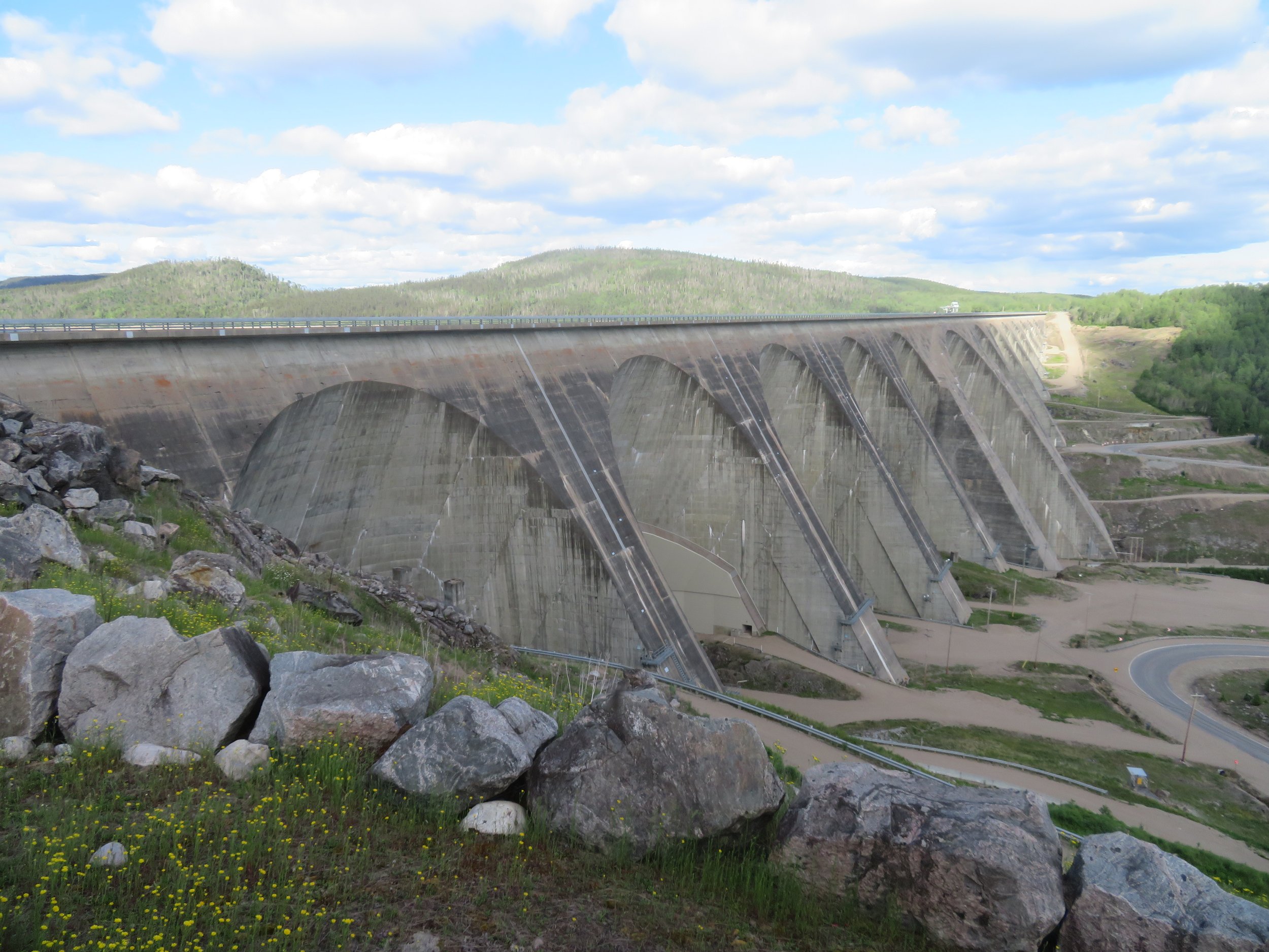
The two-hour tour was quite interesting although it didn’t differ much from dam tours we’d taken in the past. Manic-5 is a multiple-arch buttress dam on the Manicouagan River (hence the name Manic) forming the Manicouagan Reservoir. It’s comprised of 14 buttresses and 13 arches and was constructed between 1959 and 1970 to generate hydroelectric power. According to the dam statistics, it is 702 ft (214m) tall, 4311 ft (1,314 m) long and contains 2,900,000 cu yd (2,200,000 m3)of concrete, making it the largest dam of its type in the world.

A sense of proporation when compared to other tall world structures
We boarded a school bus to take us to the interior of the dam. For security purposes, no photos were allowed inside the dam. It was interesting, but I felt my claustrophobia kick in about 15 minutes into the tour and was quite pleased when we departed the inside and headed to the outside.


We were deposited under Arch 7A and standing below the arch gave us a sense of just how awesome this structure was. We moved on to inspect one of the buttresses. Just as impressive.

The buttresses were just as enormous and impressive as the arches.
Riding along and then walking on the top of the dam was even more breathtaking.
View from the top of the dam
On our way back down to the Visitor Center, the bus stopped at a scenic viewpoint for photo opps.
An overlook provided a great view
Leaving the dam and back on Route 389, we maneuvered hairpin turns and went up, up, up for great close-up views of the dam as we passed. Just a mile or two beyond the dam, we found a perfect gravel turnout for overnighting, large enough for the several campers that joined us.

We were up early enough, but lazy and got a late start. The day was sunny and bright. The road turned abruptly to gravel. Remembering our dust issues while traveling on the Dalton and Dempster Highways, we stopped and covered the bed with a tarp. In retrospect, it was unnecessary as the road was fairly hard-packed and there was minimal dust. The road became heavily forested on both sides. The trees were tall and spindly, mostly black spruce, and the area reminded us of Arctic terrain and scenery. We had crossed the 50th parallel and were indeed in the subarctic zone.
At the dam, we had learned about the ‘Eye of Quebec’ and now saw it on the GPS. It seems that an asteroid hit the Earth ~214 million years ago and created the immense crater that is now Manicouagan reservoir.
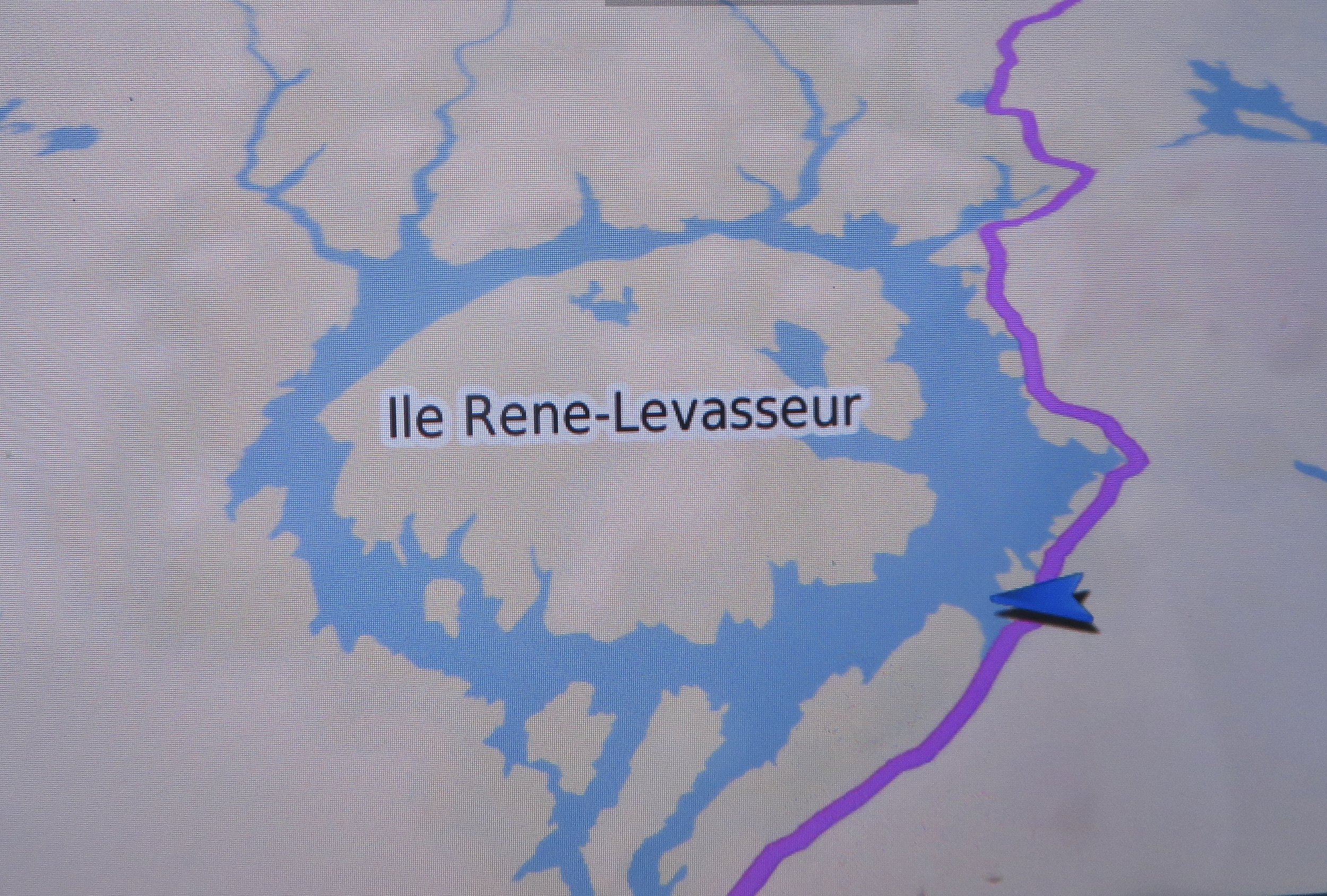
Eye of Quebec as viewed on the GPS
Around KM315, the road abruptly turned to pavement again. At Ville Gagnon, a deserted mining settlement, we noted some tourist info signs and drove into the pull-out to check them out. Bad idea! Blanche immediately sank into deep sand and was stuck. Luckily, David had a shovel and began to dig her out… tire by tire. We managed to move forward about two yards and she was stuck again. Out came the shovel once again to begin the dig out. We would have finally gotten out, but it would have taken us awhile if two Swiss fellows in a Toyota 4x4 hadn’t turned around when they saw our plight and graciously towed us out.


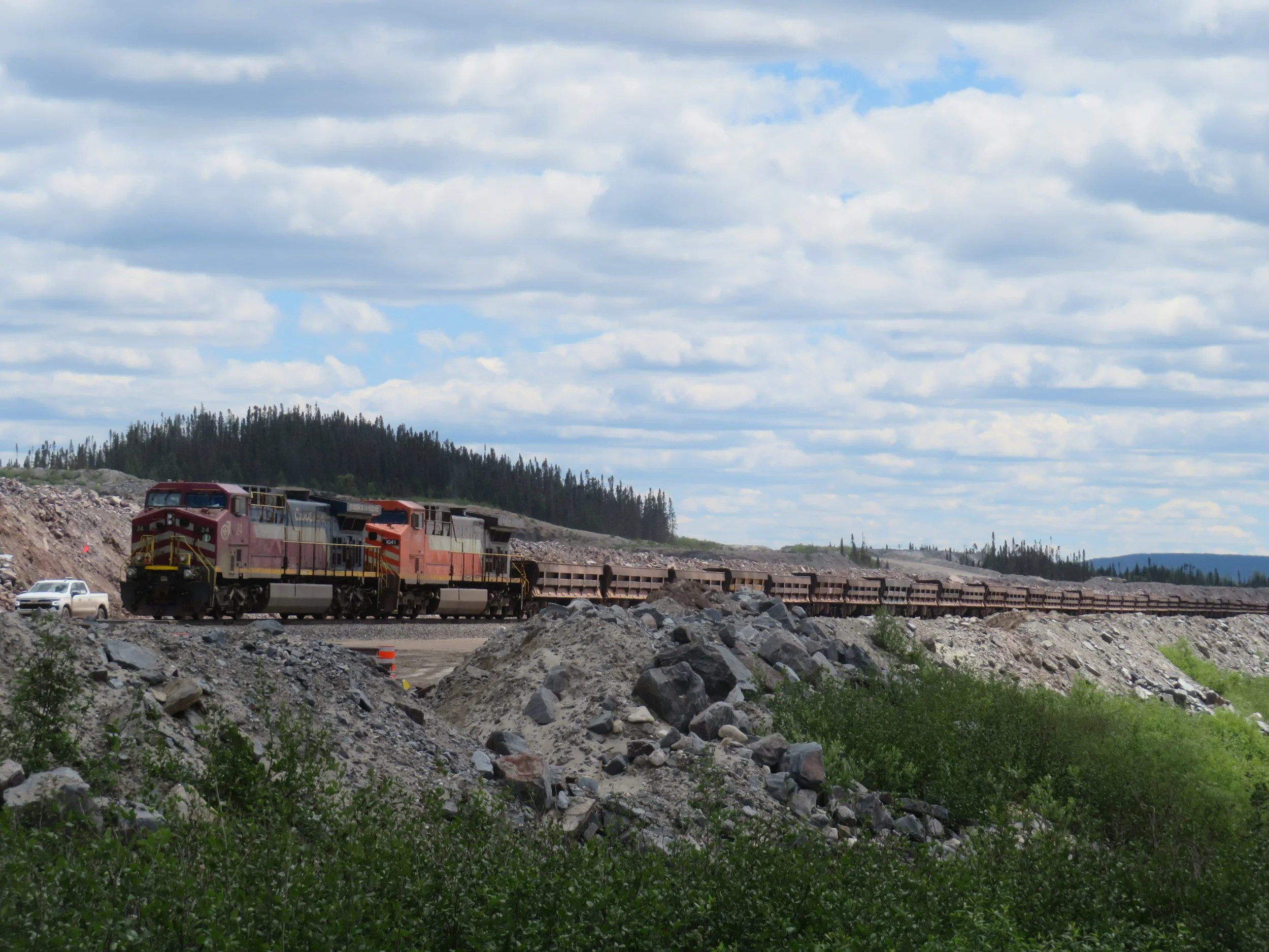
At Fire Lake, we were back on a gravel road. A huge iron mining operation was at work. Rail cars full of ore moved sluggishly along tracks and mountains of terraced tailings surrounded open pits.


The terrain changed. Instead of the steep inclines and valleys, the road climbed over rolling hills. About 10 miles outside of Fermont, the road was once again paved. We found a free city RV park in Fermont just off Rue Deschesneau with plenty of room for Blanche. It was pleasant enough for the night and the price was right. Unfortunately, it was too cold and windy for outside cooking, but we managed with sandwiches and chips for dinner.
In the morning, we did a bit of town touring. First, we visited Parc Jean Fortin at the Visitor Center for a photo opp of the huge mining truck.

That’s a big, big truck! I’d hate to get a flat.
Fermont is known for Le Mur-Écran. Literally, it translates to ‘wall screen’. In Fermont, however, it is multi-functional building built by the Quebec Cartier mining company in the early 1970s to provide mine workers and their families with a total indoor city to provide as much protection and comfort in the extreme subarctic climate. The building is 4,265’ long (1.3km) and 49 ft (15m) high… equivalent to 5-1/2 stories. Besides 500 apartments for the mining families, there is a supermarket, post office, medical care, salons, restaurants, shops, a school, a swimming pool, an arena, a hotel and even the City Hall… you name it. It’s an autonomous walled city. What a concept! We walked around inside for a few minutes. It’s pretty impressive.

A small section of the Mur-Écran
After a stroll through the Metro Co-op supermarket, we gassed up and headed back out on Route 389. I casually asked David, “Wanna go to Labrador for breakfast?”
“Sure”, he replied. And five miles down the road, we were there. We made it! Join us next time as we take on the infamous Trans-Labrador Highway!
Check out the map below to see our progress in blue and our planned itinerary in red.
