

St. John’s, Newfoundland’s Big Smoke
/Newfoundland is an island of rugged coastline and jutting peninsulas. We’d arrive on the Great Northern Peninsula and now we were heading from Fogo Island south-southeast to the Avalon Peninsula and the provincial capital, St. John’s. On Fraser’s advice, we took the shore road south, a little bit longer, but much more scenic. The 2-lane road was lined in orange and yellow hawkweed.

When we reached the eastern shore, purple, pink and white lupine put on a dazzling show.

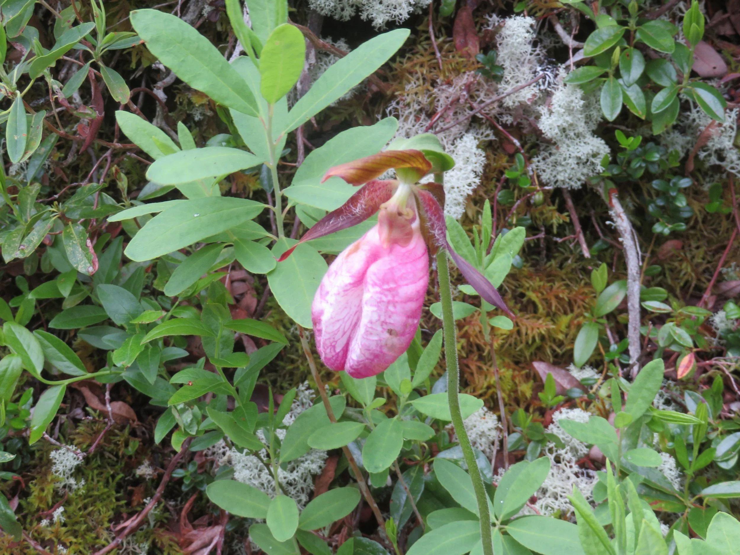
We boondocked for the night in a gravel turnout and continued on to Terra Nova National Park in the morning. We stopped at the Visitor Centre for a quick walk through, then spent a fraught half hour walking on the short, easy Heritage Trail swatting mosquitoes as we hurried down the path. Stopping to take flower photos led to some pretty pix and several itchy bites.


We made it to St. John’s by late afternoon and booked into quite a nice Fairfield Inn for the evening… another freebie. We’d only planned to visit St. John’s for a couple days and it poured for most of the first day. Luckily, we don’t melt in the rain and we found plenty to do.

As we headed downtown, we were in search of St. John’s Jellybean Row. We drove down the city’s oldest street, Water Street, along the harbor. After some reading, I had learned that Jellybean Row or the Jellybean Houses were not on a specific street, but rather were many of the houses on the downtown hillside. Duckworth Street was a good place to begin. The brightly candy-colored row houses weren’t hard to find. They were everywhere!

Jellybean Row houses
Why the bright colors.? There are a few different theories floating around, but my favorite is that the city is many times fog-bound and in order to identify their houses from a distance, sailors would paint their houses bright, distinctive colors that could be more easily seen in the mist.

What better thing to do on a rainy day, but visit a museum. We headed to The Rooms, St. John’s premiere museum and stewards of ‘the province’s most extensive collection of artifacts, art and historical records’.
Built in 2005, this modernistic building resplendent with sharp angles and a plentitude of glass sits on the site of the former Fort Townshend, one of the largest British fortifications in North America about 250 years ago. We had every intention of paying the modest admission fee ($6.50/seniors or $10/adults), but the museum was celebrating its 19th anniversary and admission on this rainy day was free.
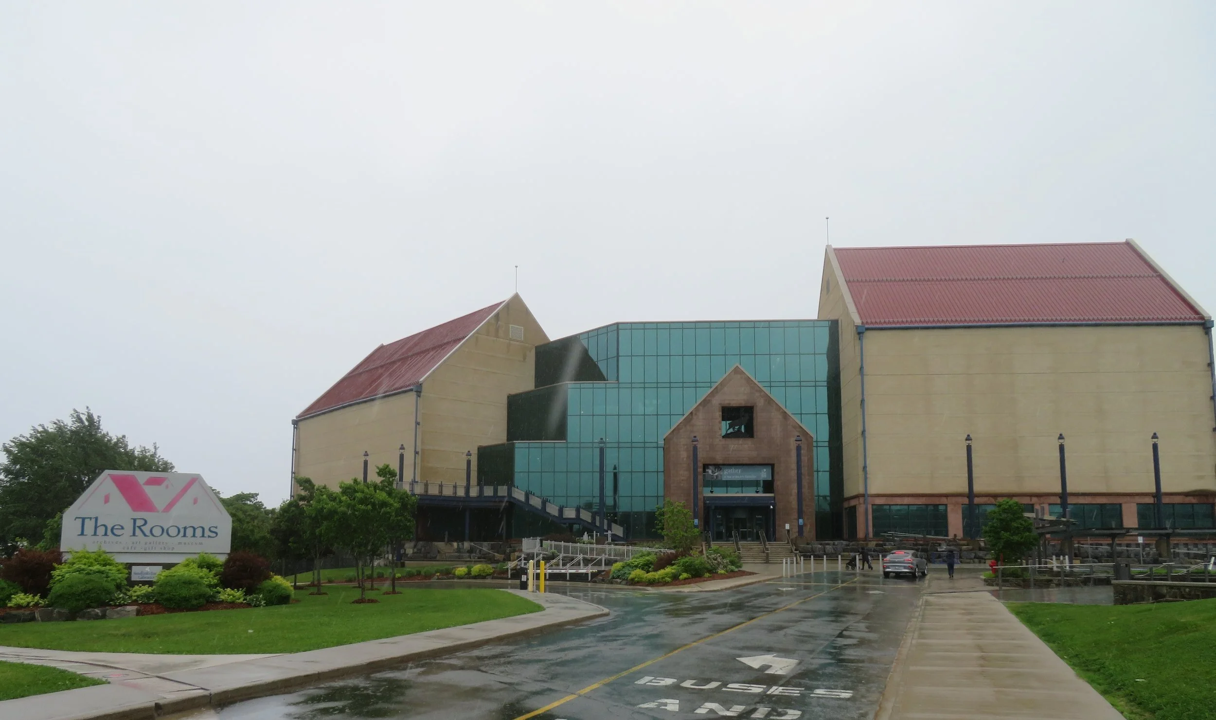
The Rooms on a very rainy day
Curious minds want to know… why is this museum called The Rooms? According to the museum’s website… “The building's name, as well as its architecture, is a reference to the simple gable-roofed sheds (called "fishing rooms") that were once so common at the waterline in Newfoundland fishing villages.”
Spacious and appealing, the museum and its galleries provide an insight into Newfoundland and Labrador’s history, culture and people. It’s a fascinating place. From a poignant WWI exhibit, to the province’s maritime history and fishing industry, from carnivorous pitcher plants and giant squid to ancient Paleo Dorset and Beothuk cultures and a gallery of local artwork… there was so much to see and absorb, in one day we could only manage a taste of all that was on offer.
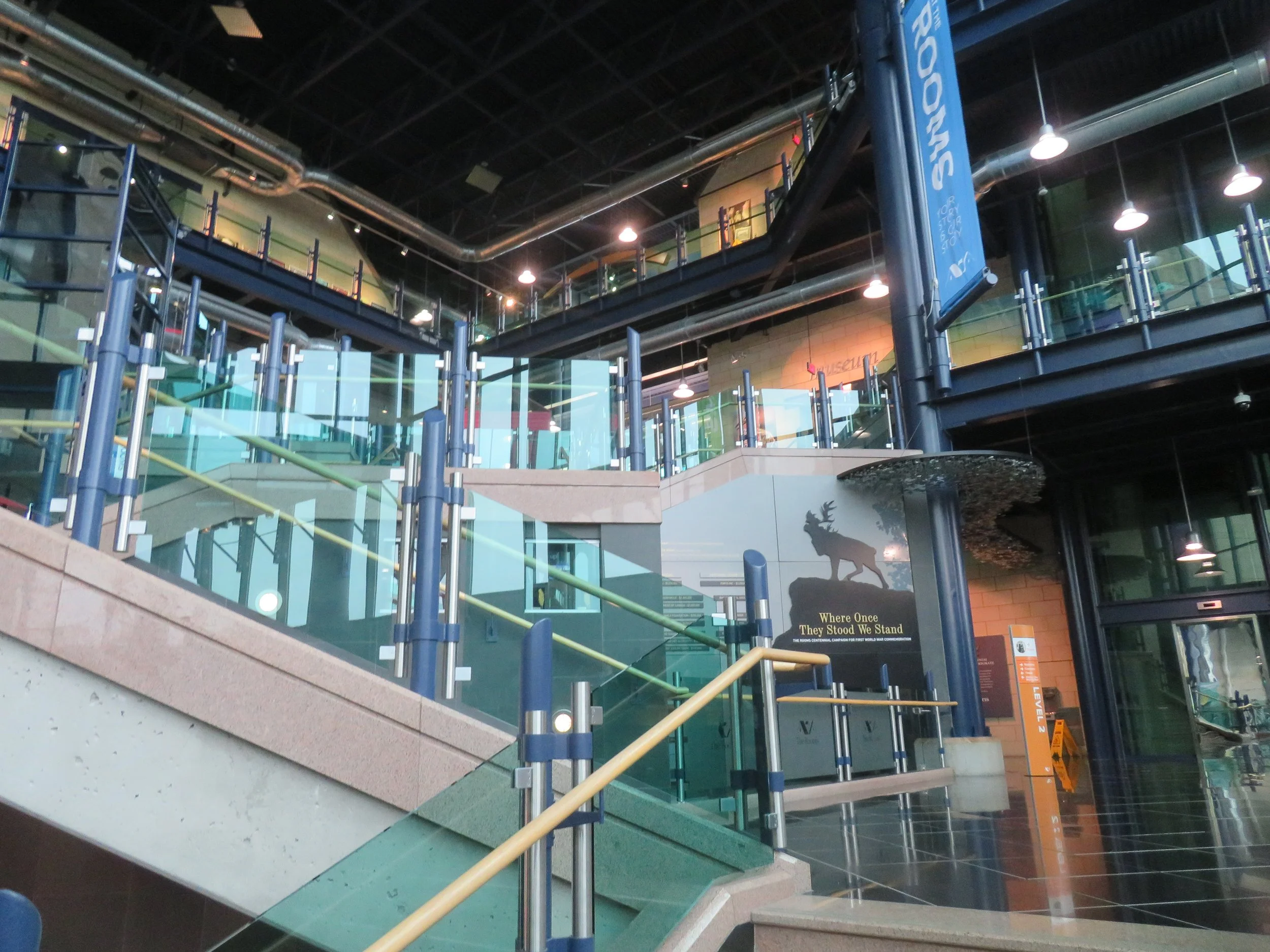
A spectacular 5-floors of eye candy
Take a look.


From the vast windows on the top floors of the museum, we had a good view of the harbor and set high above the harbor, we could see Signal Hill and the Cabot Tower, now a Canadian National Historic Site. We headed there next.

A view of St. John’s Harbour. perched atop Signal Hill is Cabot Tower.
Because of its strategic location overlooking the Narrows, the only entrance to St. John’s harbor, a lookout and fortifications were built by the British in the mid-17th century. In the 18th century, a fort was built and further fortified and in the final battle of the Seven Years War between England and France which was fought here, the British successfully defeated the French. From 1897-1900, construction of Cabot Tower commemorated Queen Victoria’s Diamond Jubilee and the 400th anniversary of John Cabot’s landing in Newfoundland.

Driving up the steep, winding road to the top provided great views. There were several trails we might have taken at the top except for the high winds and rain that prevailed during our visit.

Beyond its military importance, Signal Hill was important for another signal. It was here that Guglielmo Marconi first received the letter ‘S’ in Morse code… a trans-Atlantic wireless message sent on December 12, 1901 from Cornwall, England to St. John’s, Newfoundland, a distance of more than 2000 miles.
The first a trans-Atlantic wireless message was received here by Marconi in 1901.
.During a few brief periods of clearing, we were able to see views of the city below and Amherst Lighthouse.

City and Harbor view from the Top of Signal Hill

Amherst Light viewed from the top of Signal Hill

We watched as a fog bank chased this boat into the harbor.
We took this photo of the Cabot Tower one moment…

The next moment, the fog rolled in.

It was late afternoon when we headed to nearby Quidi Vidi, (kid-dee vid-dee) a picturesque little suburb of St. John’s. The little village is absolutely gorgeous, but our main intent was to visit the Quidi Vidi Brewing Company and purchase some Iceberg Beer, brewed with 20,000-year-old pure iceberg water.


The rain continued and, undaunted, we headed south to Witless Bay where we spent the night anticipating the next morning’s puffin tour and hoping for better weather.
Join us next time for PUFFINS!
Check out the map below to see our Newfoundland route thus far.
