

New Brunswick – Fundy National Park
/
Our Route to Fundy National Park
We were a bit more prepared for our stay at the Fundy National Park. Despite our aversion to reservations, we had booked two nights in advance at the national park campground. The temperature had cooled to the 70s (22 C). We drove along the famed Fundy Coastal Drive taking in the dramatic scenery.

Views from the Fundy Coastal Drive
The day dawned clear, bright and sunny. We were surprised when we came upon Sawmill Creek Covered Bridge. For some reason, we never considered that there were covered bridges in Canada, but how naive? In fact, at the end of the 19th century, there were over 1400 covered bridges in Canadian rural areas. Only 140 are still standing according to the Covered Bridges of Canada website, and 58 of the remaining covered bridges are in New Brunswick including the longest covered bridge in the world (uh, oh!). Like lighthouses, covered bridges provide a link to local heritage and a charming memento of past days... plus they’re a great opportunity to steal a kiss!

Sawmill Creek Covered Bridge
Extending across tiny Sawmill Creek, this single-span Howe truss bridge was built in 1907 and is no longer in service. It provided a quick morning walk to inspect it more closely and grab a quick kiss. A good way to start the morning.


At the advice of a Visitor Center agent, we took a detour to visit Cape Enrage Light, the first lighthouse in the Upper Bay of Fundy, started in 1838 and completed in 1840. As we neared the cape, the sunny day morphed into pea soup fog. When we arrived, we were disappointed to learn there was $9/pp admission fee just to park in the area or even eat at the restaurant. The lighthouse view was hazy at best and weighing value vs. dollars, we turned around and headed towards the national park.

Cape Enrage Lighthouse in pea soup fog hardly seemed worth an $18 dollar entrance fee.
The fog cleared as we departed the cape, but the day grew chilly and windy as we neared Alma. A cute little coastal town just east of the national park entrance, Alma offers lots of shops, restaurants and a brewery. We stopped at the Alma Lobster Shop & Restaurant for a bowl of chowder and, despite the chill, an ice cream cone. (They had maple walnut… how could I pass it up?) We picked up a lobster for dinner at the Collins Lobster Shop, then proceeded to check into our campsite.

After a quick stop at the Visitor Center, our route took us along Point Wolfe Road for a few miles and through the Point Wolfe Covered Bridge. Spanning the Wolfe River and maintained by the national park, this bridge was rebuilt in 1992 to replace the original 1909 bridge.

Point Wolfe Covered Bridge
The campground was crowded, but pleasant enough edged with musk mallow and goldenrod (achoo). We had a visitor each morning… a chubby, furry groundhog who seemed undisturbed by our presence as long as we didn’t venture too close.

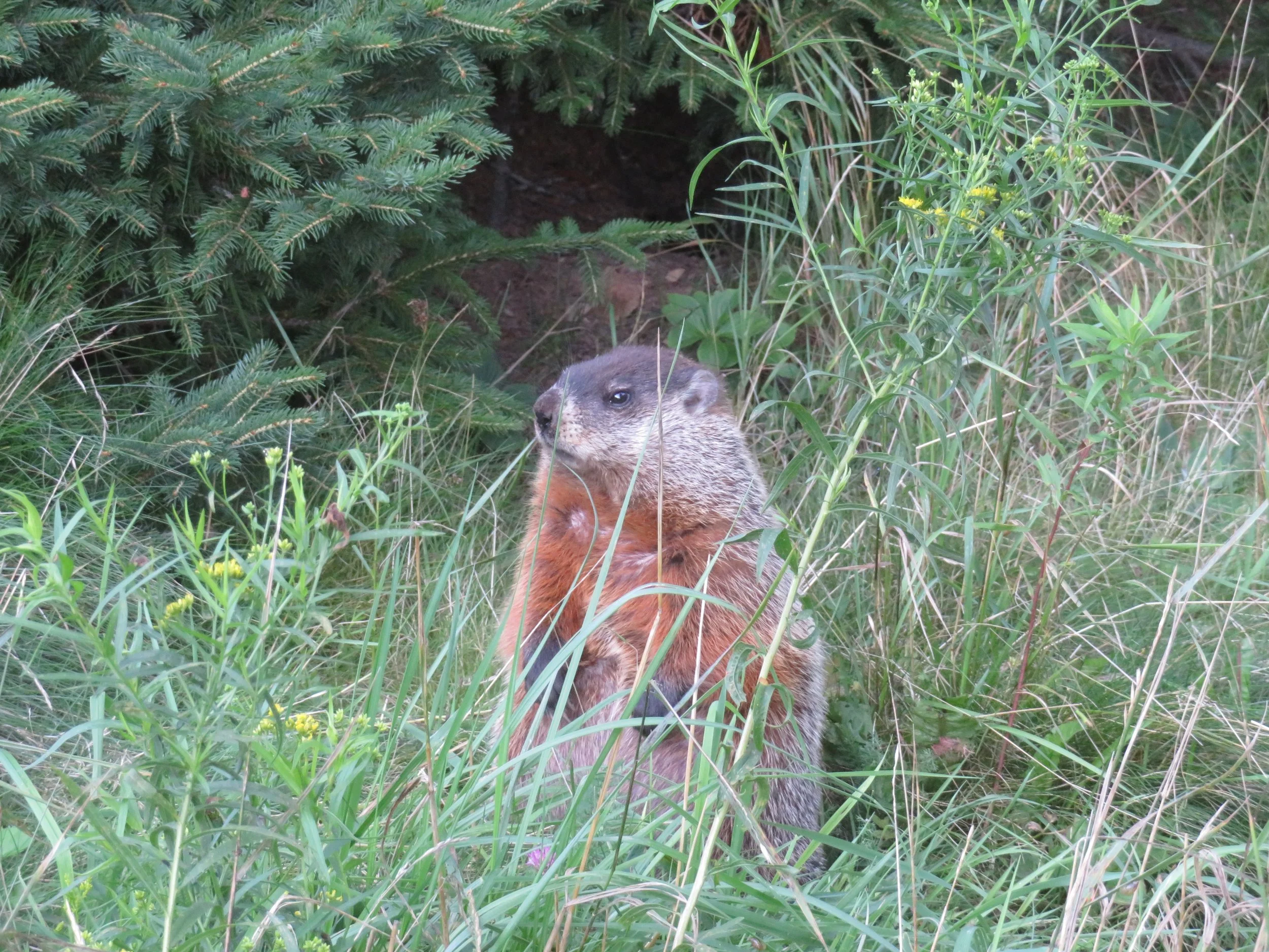
I got to thinking… How much wood would a woodchuck chuck if a woodchuck could chuck wood? Not much I learned. Groundhogs, aka woodchucks in Great Britain, don’t eat nor chuck wood.

Fat and furry groundhog... but woodchucks do not chuck
We’d had our lobster steamed at the pound and David set about cracking it open and extracting the meat. Interestingly, when we first met, this Colorado boy had no idea how to crack and clean a lobster. Now, after 40 years of excellent tutelage by a New England girl, he’s a pro.

Lobster for dinner!
We managed two short hikes the next morning after a lazy start. The Point Wolfe Beach Trail is an easy, 1/2 mile (.8 km) RT along a a wooded trail ending at the beach. The wooded area provided the habitat for some wildflowers with which we were unfamiliar… purple foxglove, a poisonous plant and the source of digitalis drugs and broad-leafed helleborine, a tiny orchid.


We arrived at low tide and took a walk on the ocean floor which was, as expected, muddy and rocky with underwhelming views.

The walk was rocky and muddy and the view was underwhelming at low tide
We retraced our steps to the intersection with the Shiphaven Trail, another easy 1.5 mile RT path through the forest that climbed for great views of the bay below.

Intersection of the Point Wolfe and the Shiphaven Trails

The views from the Shiphaven Trail were beautiful.
As we descended the wooden steps on the opposite end of the trail, we arrived at the Point Wolfe Covered Bridge again and got a much closer look… and a requisite kiss, of course. For a century, ships sailed up this tiny cove during high tide to load freshly-milled lumber provided by the local logging and sawmill company. Three small schooners were also built here as part of the shipbuilding industry which grew up along the Fundy coast.

Descending the wooden steps from the trail, we gave the covered bridge a closer look
Peeking through the bridge windows into the cove, we could imagine sailing ships of old plying their way up the cove at high tide to load their cargo.


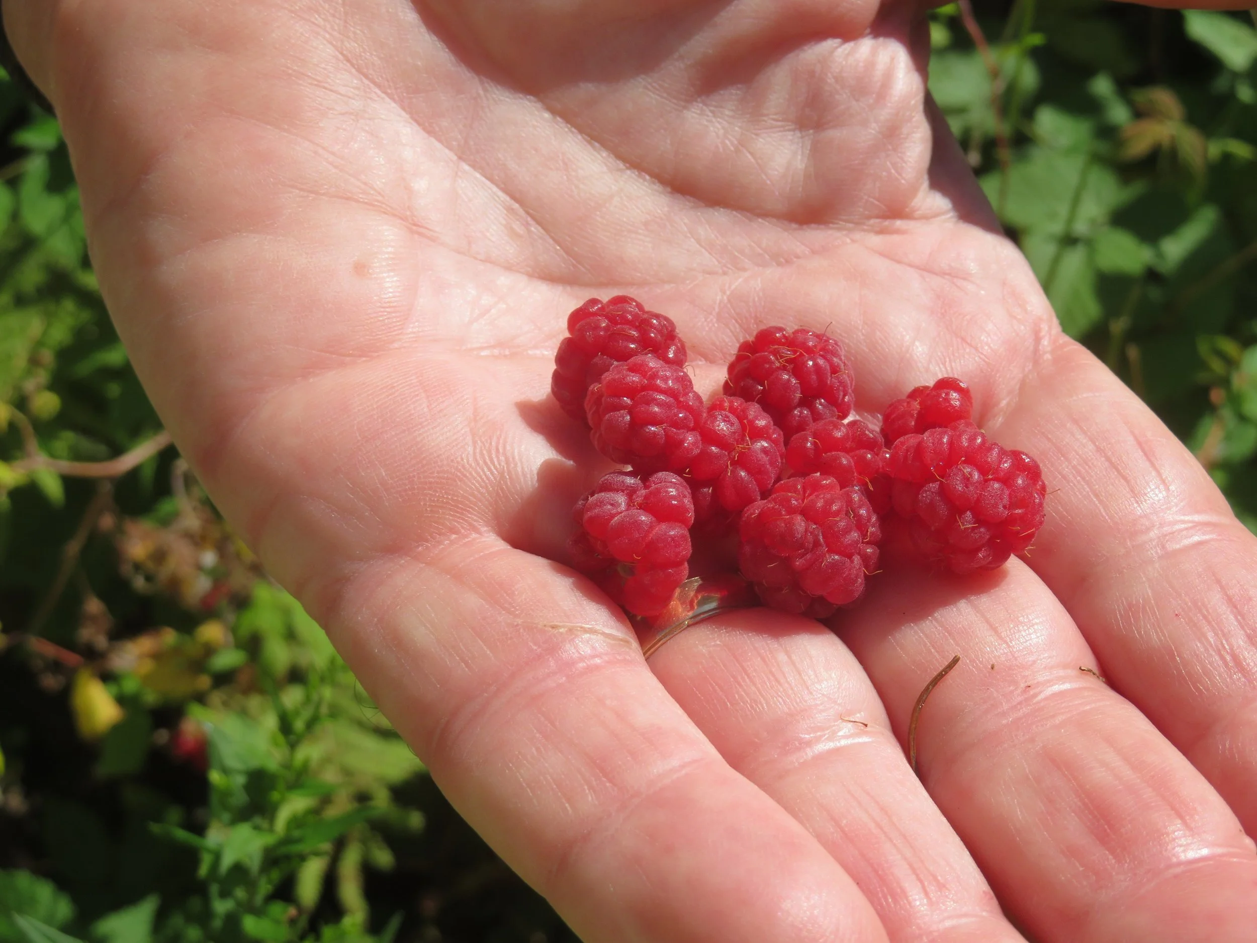
We followed another meadow path lined with tansy that led pretty much nowhere, but we did find several wild raspberry bushes. We noshed our way along with no complaints, then retraced our steps.


Returning to the campground, we enjoyed a quiet evening before breaking camp for a planned early departure the next morning.
Next time? Drive with us along the Fundy Trail Parkway through Fundy Provincial Park, hugging the Bay of Fundy coast all the way. Then we’ll head to St. John.