

US 6 - Part 2 – Into Utah and Over the Rockies to Denver
/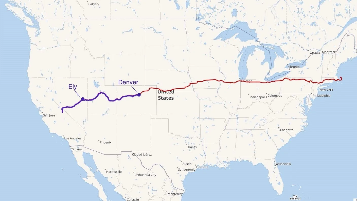
We’ve gotten as far as Denver, Colorado on US-6, but there’s a lotta miles to go to Provincetown, RI.
After a restless, cold, windy night, we left Ely just after dawn. As the sun rose, the sky turned a hazy blue with wispy cirrus clouds high above. We noted the weather forecast was calling for snow. We hoped to keep ahead of it.
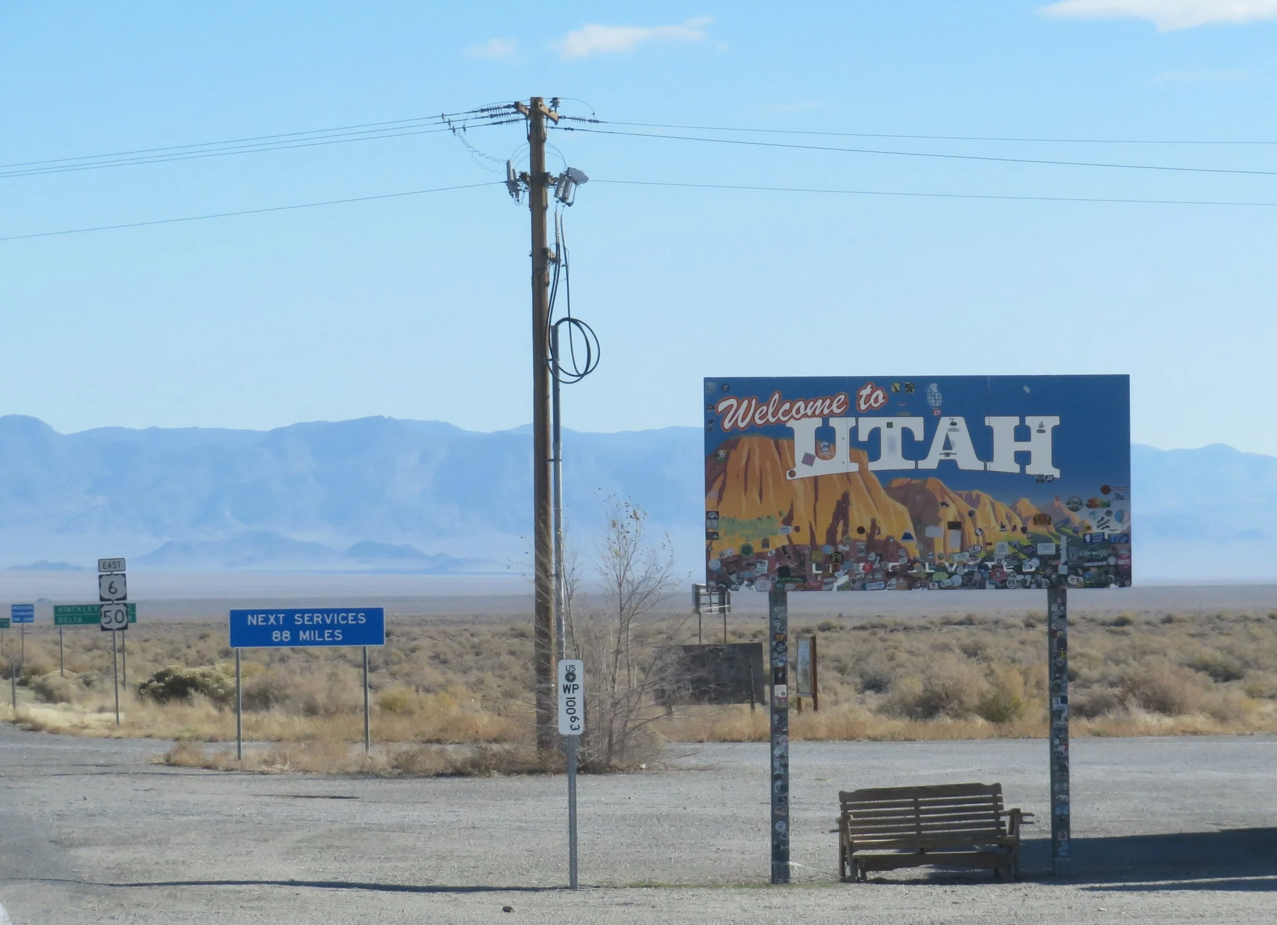
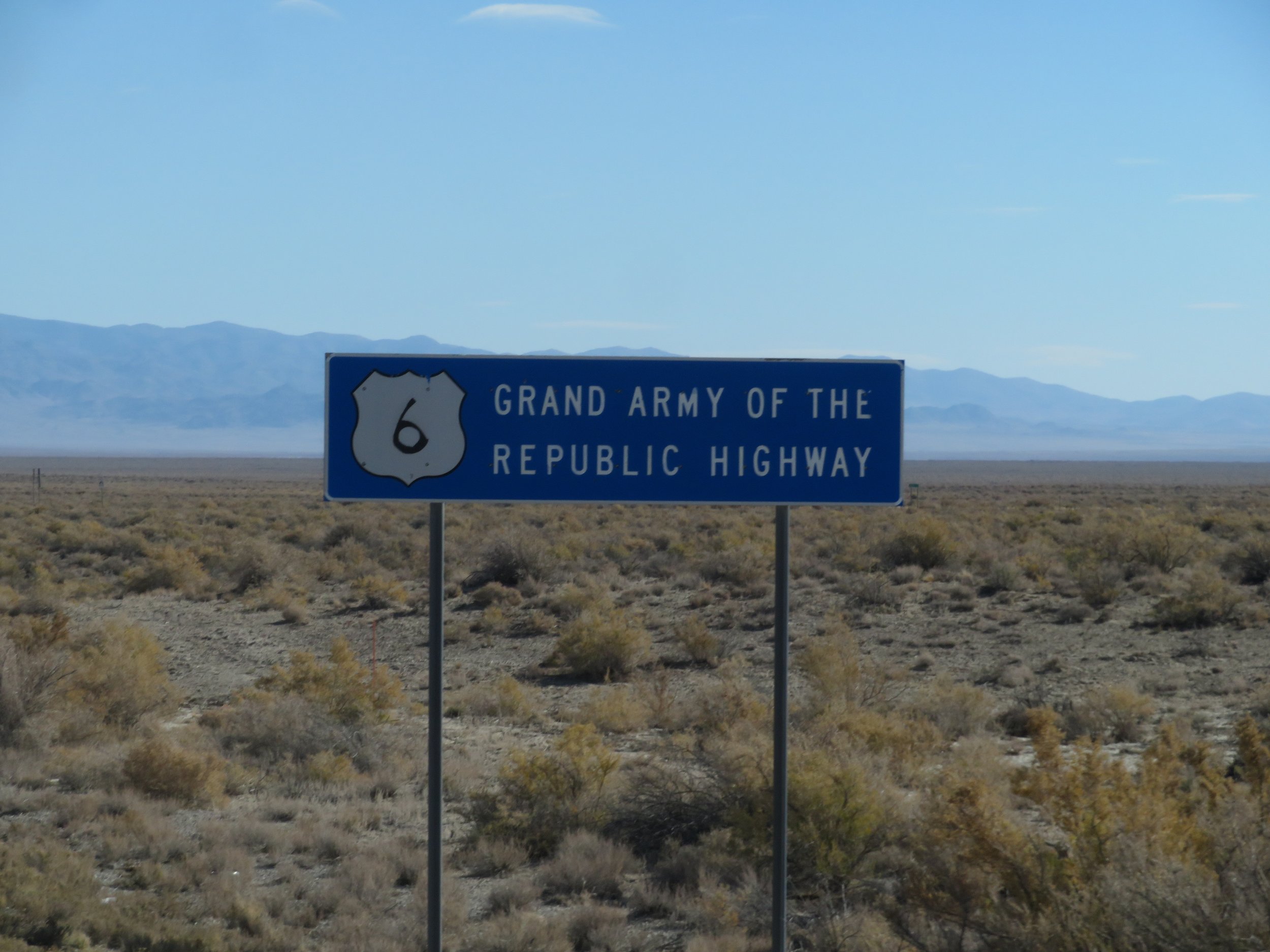
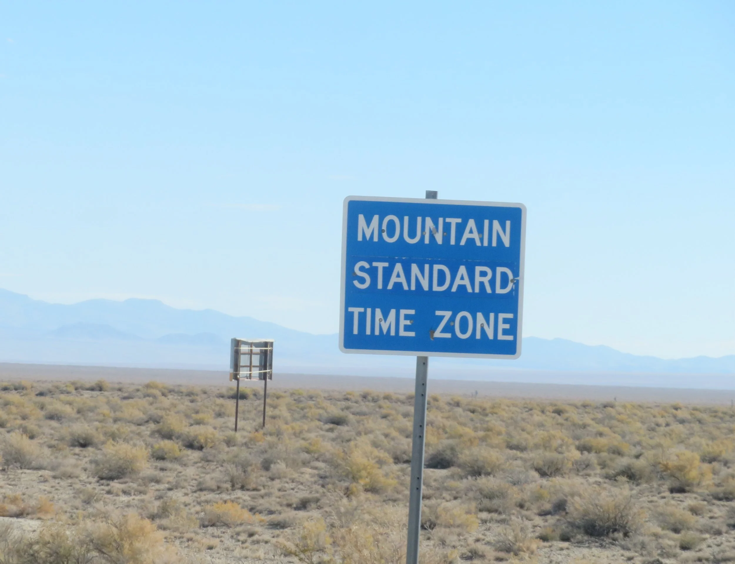
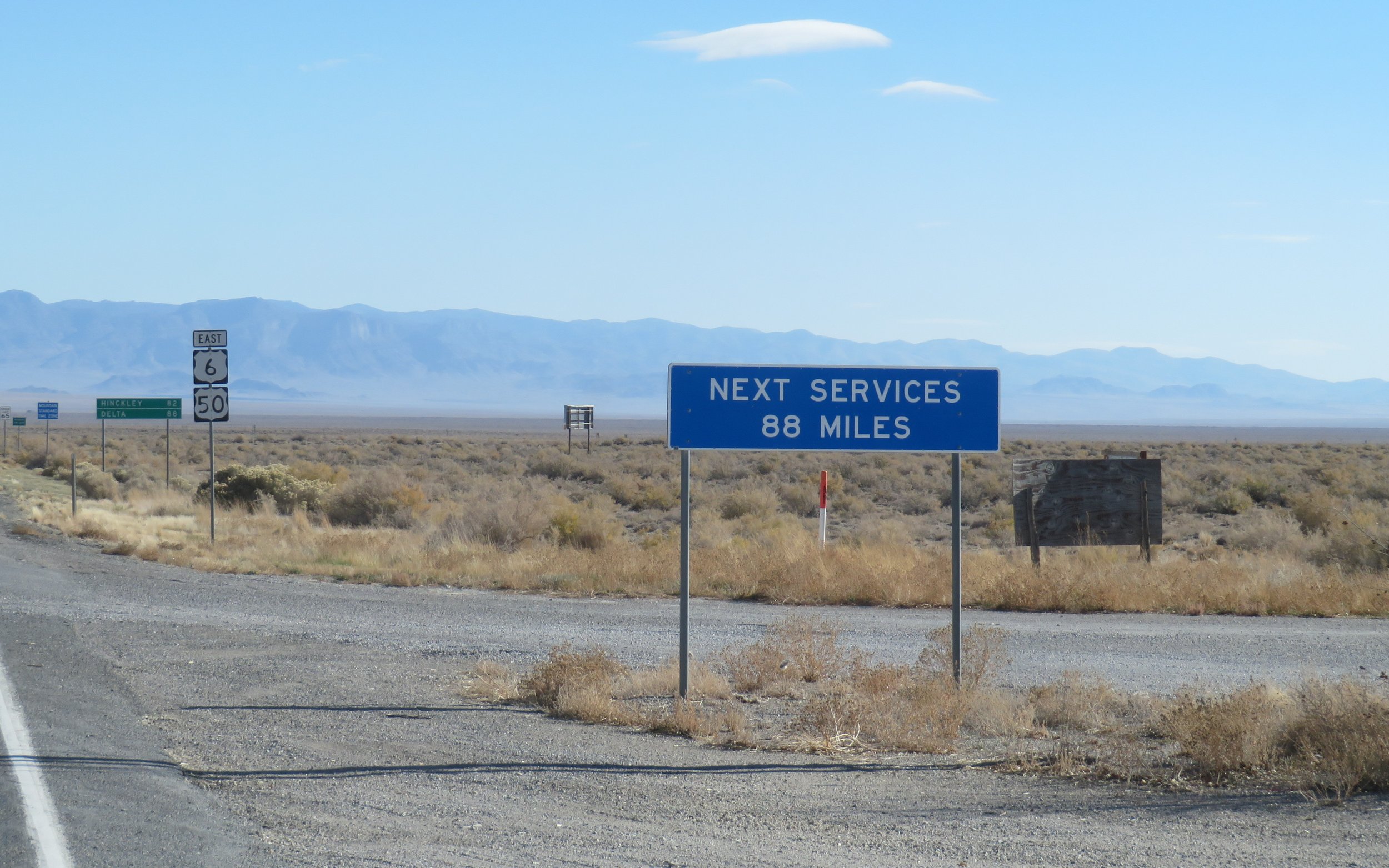
It is only 62 miles from Ely to the Utah state line. We were welcomed to Utah by a group of signs first reassuring us that we were still on US-6 (The Grand Army of the Republic Highway), another that we'd lost an hour as we entered the Mountain Time Zone, and last, but certainly not least, there would be no services for the next 88 miles.
We stopped between MM 18/19 at a large, pea-graveled rest area well off the road. The eastbound turnout had no services, but afforded a good place to have breakfast and stretch our legs. Across the street we noted a similar turnoff with a trash bin and when we crossed the highway to make a deposit, we found an entrance through the fence. A well-worn dirt road extended well beyond the ½ mile that we walked. There were several places others had obviously stopped in the past that would have made a great area for boondocking.
Back on the road we passed by Sevier Lake which caught our attention because it looked like a huge salt pan. This lake is an intermittent (sometimes it dries completely, like it is currently; other times it has water) and endorheic lake, i.e. its water stays in the basin and doesn't drain to an ocean as most rivers and lakes do. It's a remnant of Lake Bonneville from the Pleistocene Ice Age.
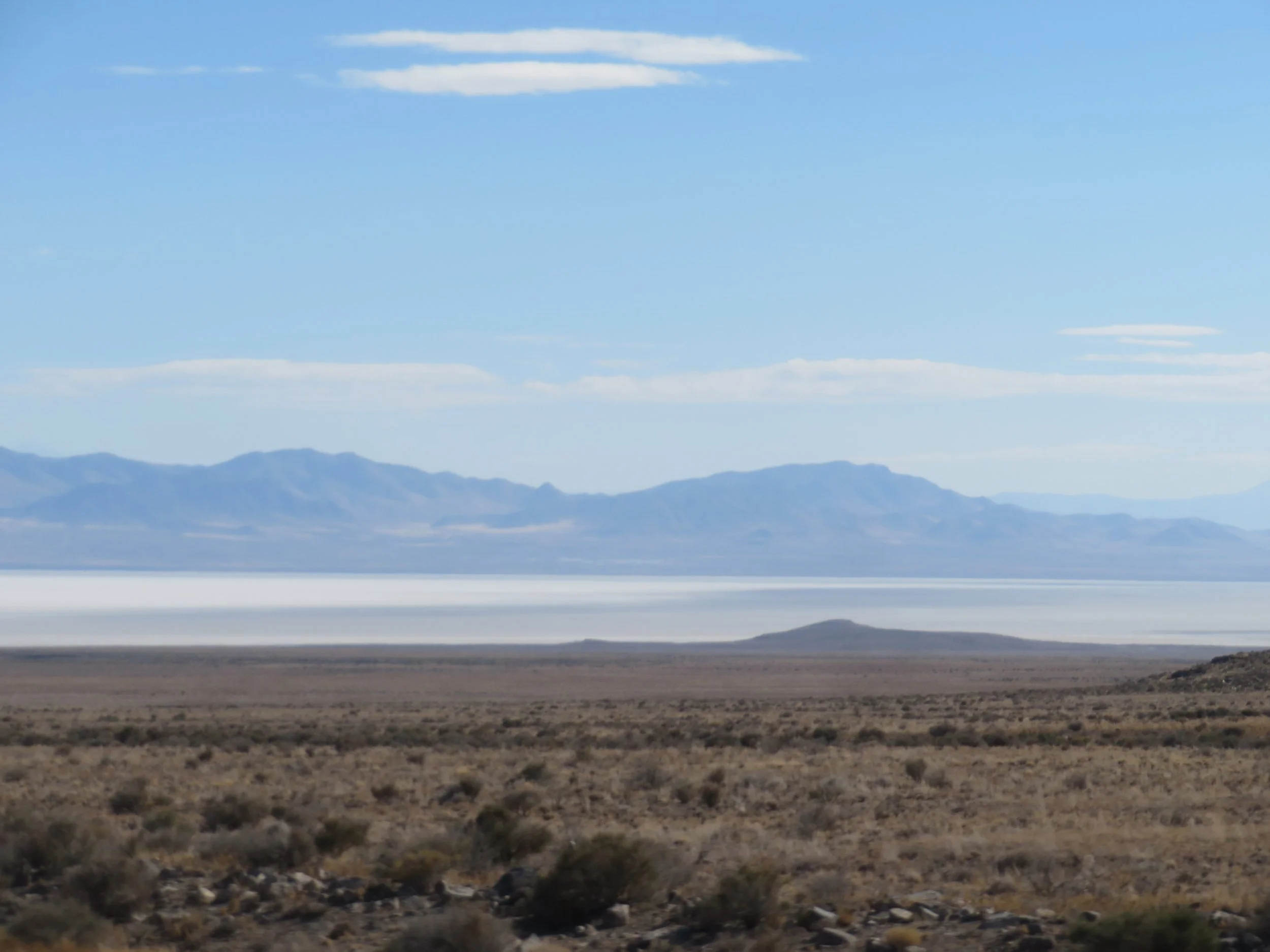
Sevier Lake
Finally, a town... 83 miles from the state line was tiny Hinckley (no services), but in another 4 miles we were in Delta... civilization once again. Delta, population ~3,751, was settled in 1906. It is most famous as the site of the Topaz Relocation Camp about 16 miles northwest of the town. Topaz was a WWII era internment camp for Japanese Americans. This surprisingly excellent museum sits right on US-6 (Main Street, Delta). We stopped to learn more. David will give you the lowdown in his next blog. Admission is by donation. It is definitely worth the stop. Next door was the Great Basin Museum which was closed when we were there.
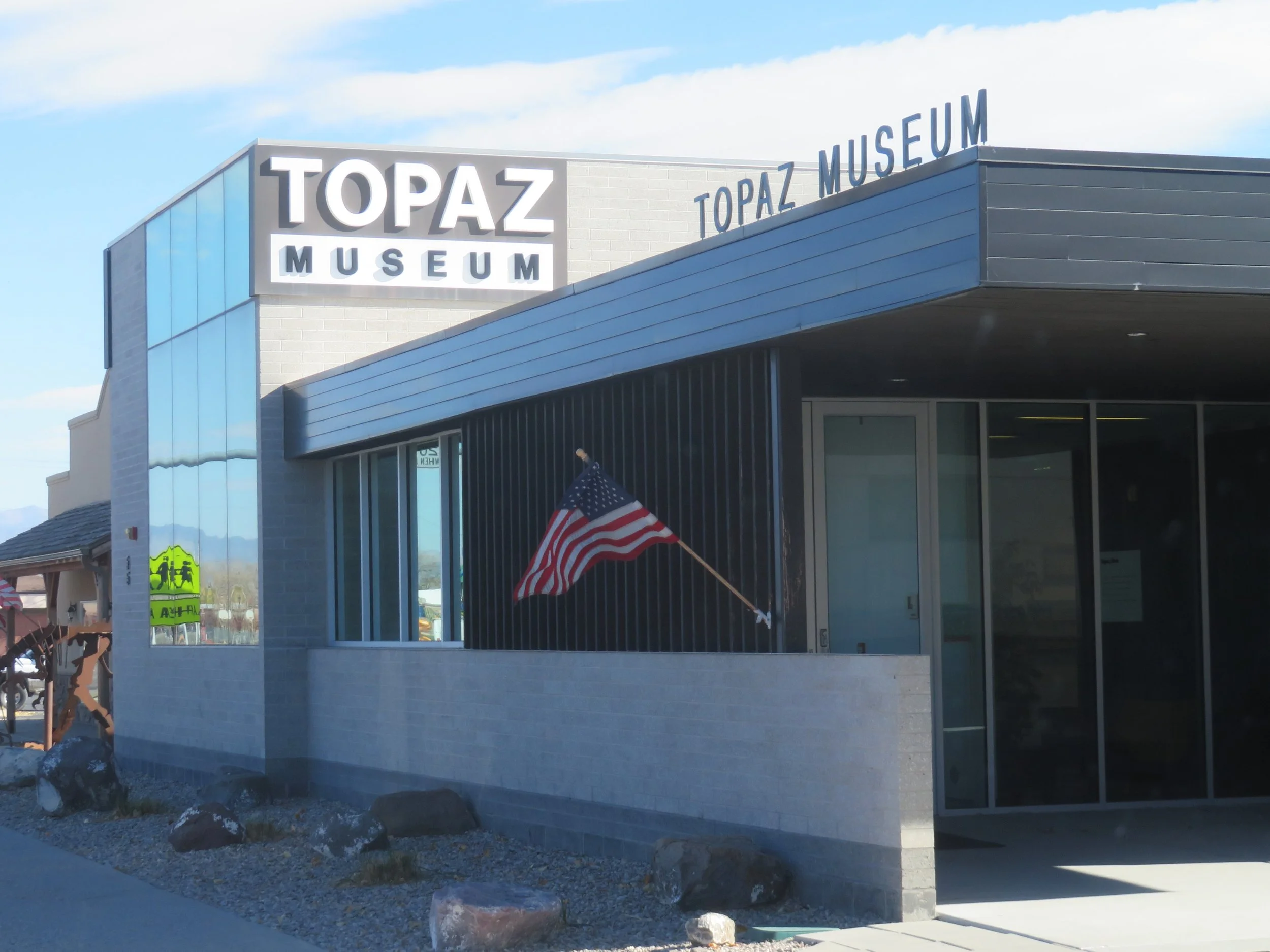
The Topaz Museum was excellent and recounted the history of the Japanese Internment Camp in Delta.
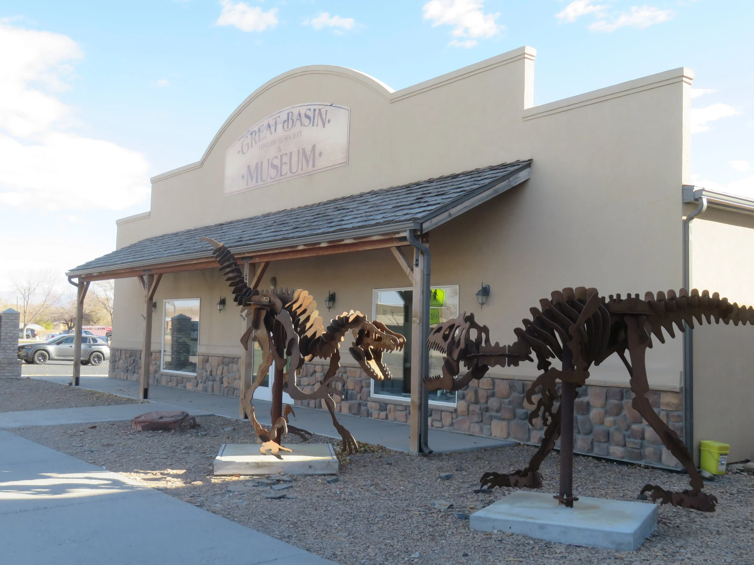
The Great Basin Museum was next door, but was closed when we were there.
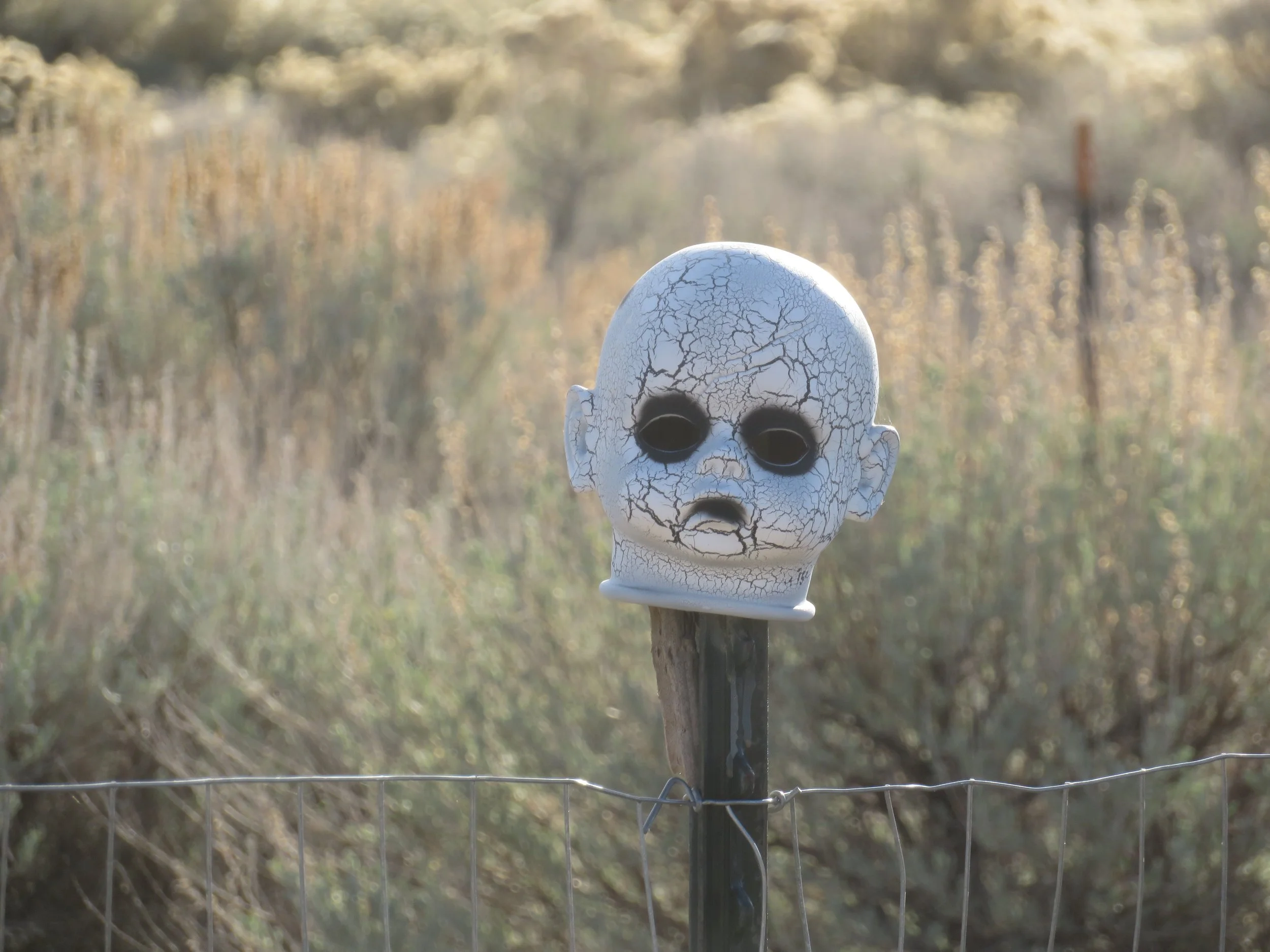
I’d read a little blurb about Silver City, a mining ghost town and though there was a sign on the highway, we were unable to locate it. We did, however, see a spooky doll head stuck on a fence post.

We passed through the tired little town of Eureka. Listed as a “semi-ghost town”, I had to look up the definition of that terminology. “... a place with a small, but present, population, where most structures are vacant or in disrepair, and the overall population is a fraction of its peak.” That definition was spot on for Eureka. Eureka was once the major mining center and financial hub of the Tintic Mining District back in 1899. Mining ended in the 1950s and so did Eureka for the most part.
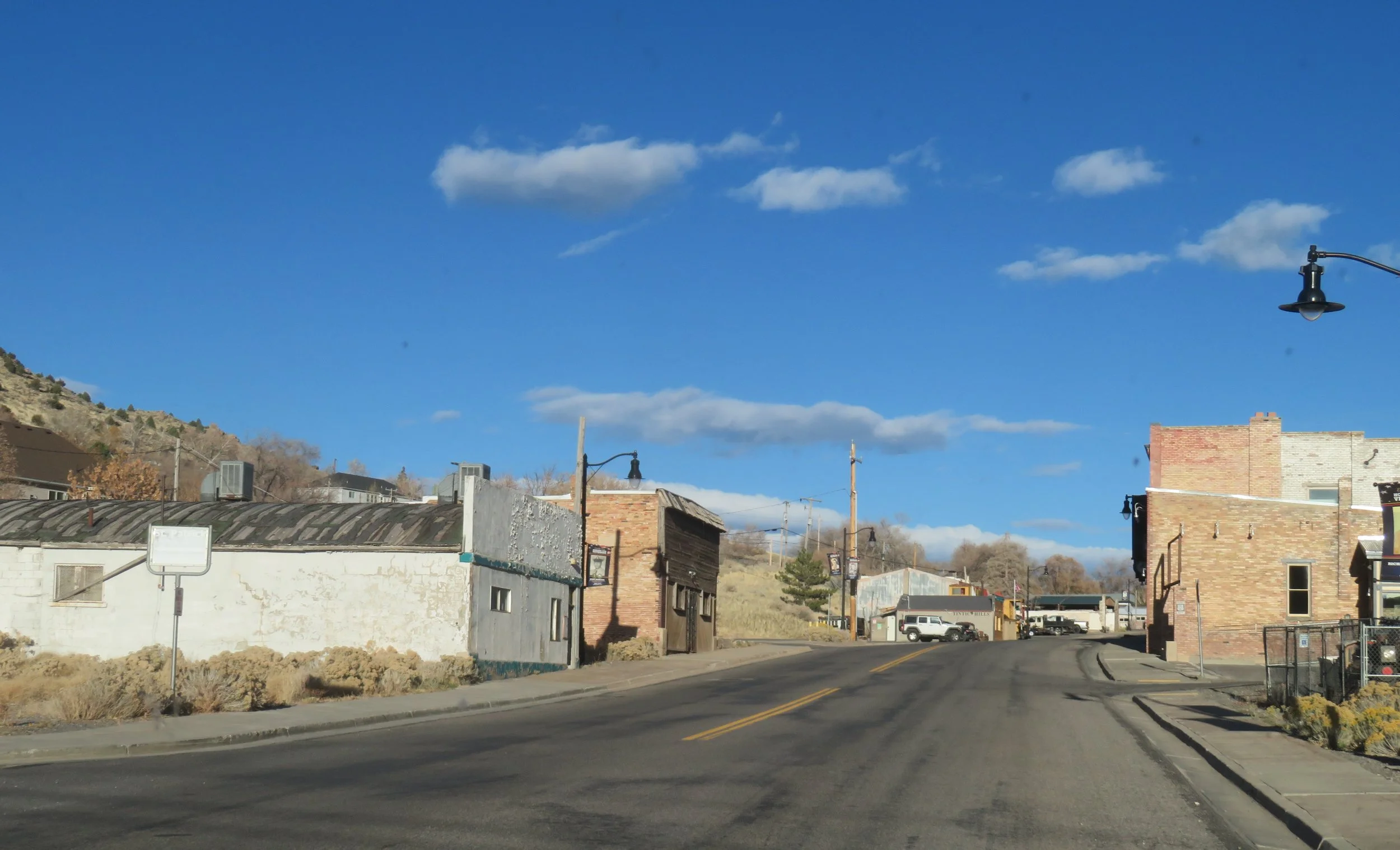
Eureka, a semi-ghost town, once the thriving financial hub of the Tintic Mining District.
Along the highway in tiny Elberta, I spotted an old Sinclair gas station which was a perfect photo opp. David obligingly turned around so I could snap a pic or two. Note Sasquatch in the background.
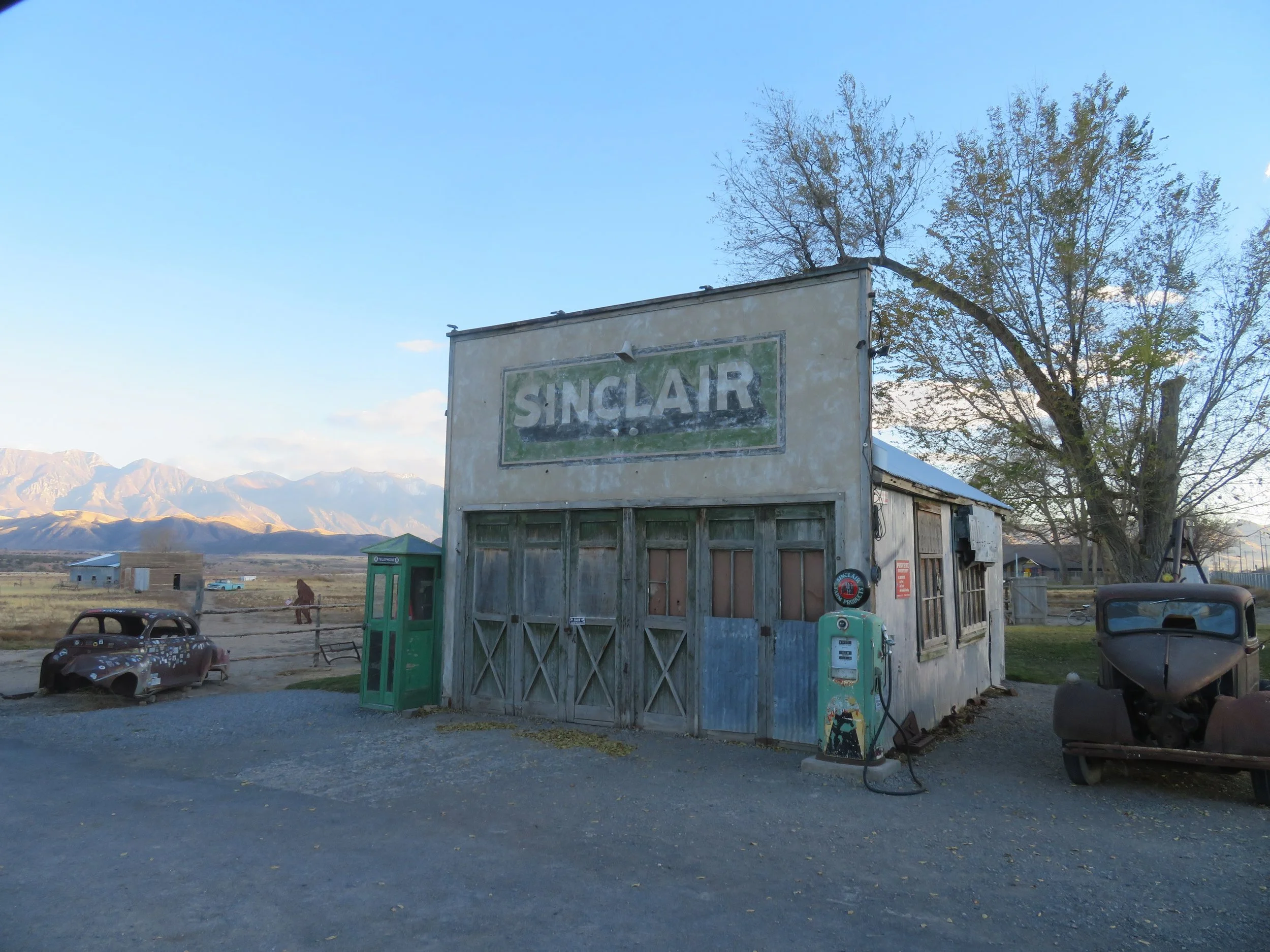
Elberta, Utah
We passed through pleasant Santoquin, stopped briefly for supplies at the Walmart in Spanish Fork, then continued on to the Tie Fork Rest Area. It was dark when we arrived. According to Jacob Barlow’s blog, “The structure was named the Tie Fork Rest Area after the side canyon where it was located. The replacement rest area was designed to mimic an early 1900s era train depot to honor the town, including a replica roundhouse and non-functional steam locomotive…”
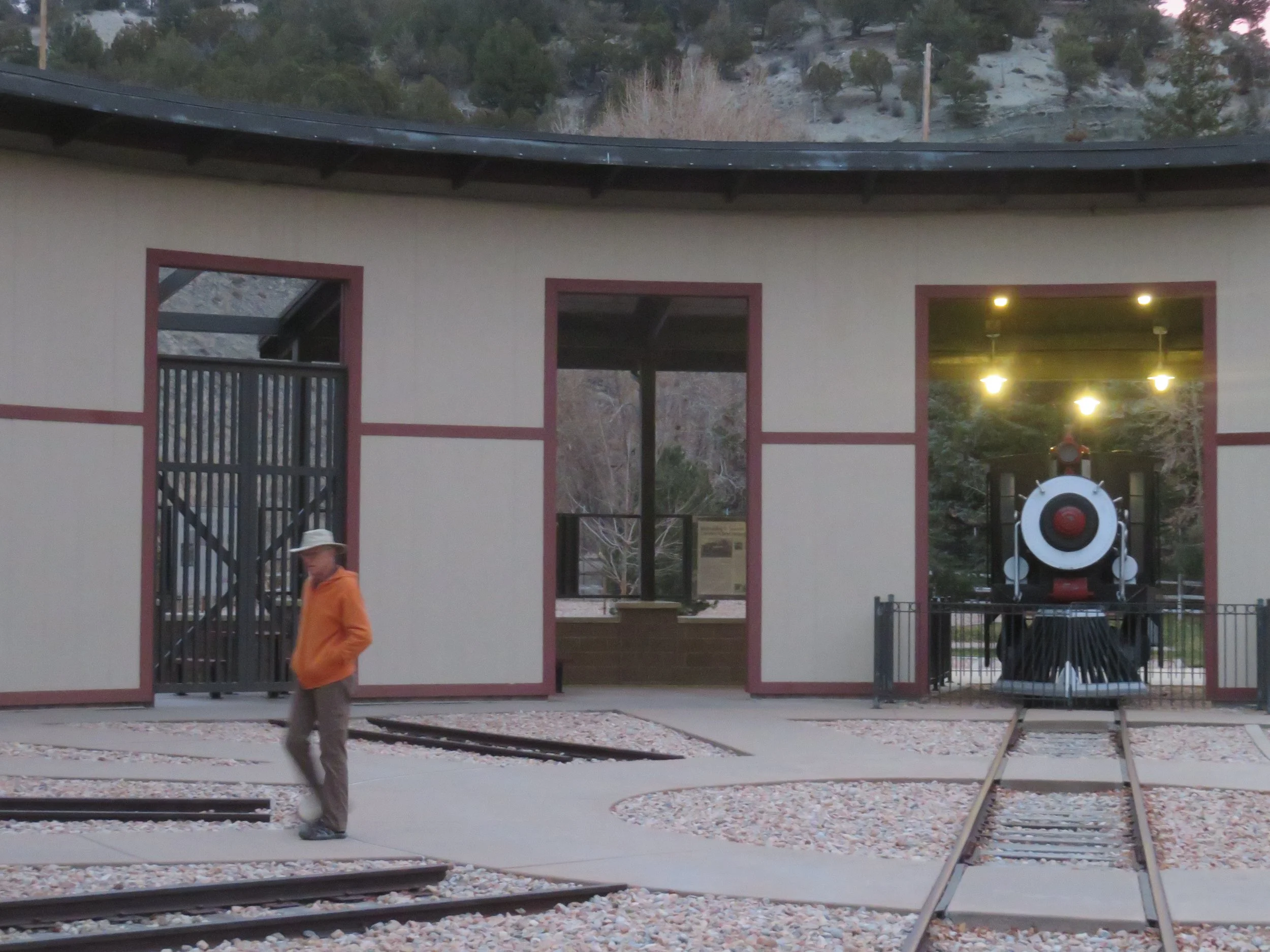
This rest area has received lots of great reviews. It was, indeed, a reasonable and safe place to overnight with Blanche. Restrooms are clean and open 24x7 which is great. However, its proximity to busy US-6 along with the significant number of semis with engines running all night and the train whistles loud enough to rattle Blanche’s windows, made for a restless night and not much sleep. Also, there was no cell reception… a bit inconvenient. That said, it was free, so I’ll stop bellyaching. FYI… there are four EV chargers on site.
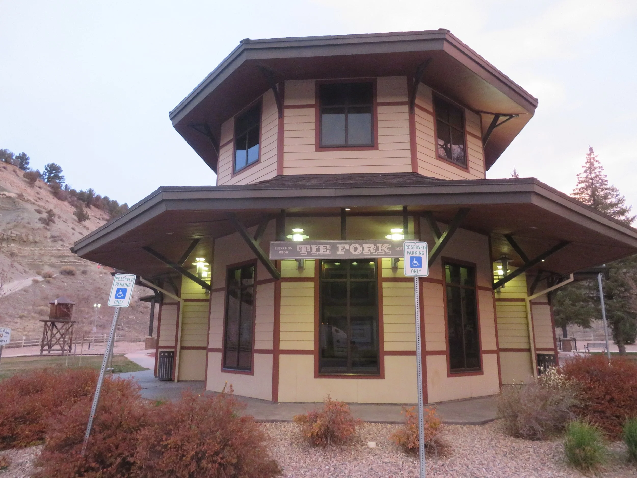
Tie Fork Rest Area building looks like an old train station.
We were both awake way too early… 0300. It was cold and breezy outside (33F/1C), but the diesel heater kept us cozy enough. By 0330, we gave up trying to sleep, brewed some coffee, chatted, planned, looked at maps, and planned some more. No sense in driving a blue highway in the dark… there’s stuff to see!
Finally, ~0700, it was light enough to see our surroundings and we explored a bit. The ‘train depot’ building housed the toilets and vending. The replica roundhouse and engine were interesting and authentic-looking and quite appropriate to the local environment.
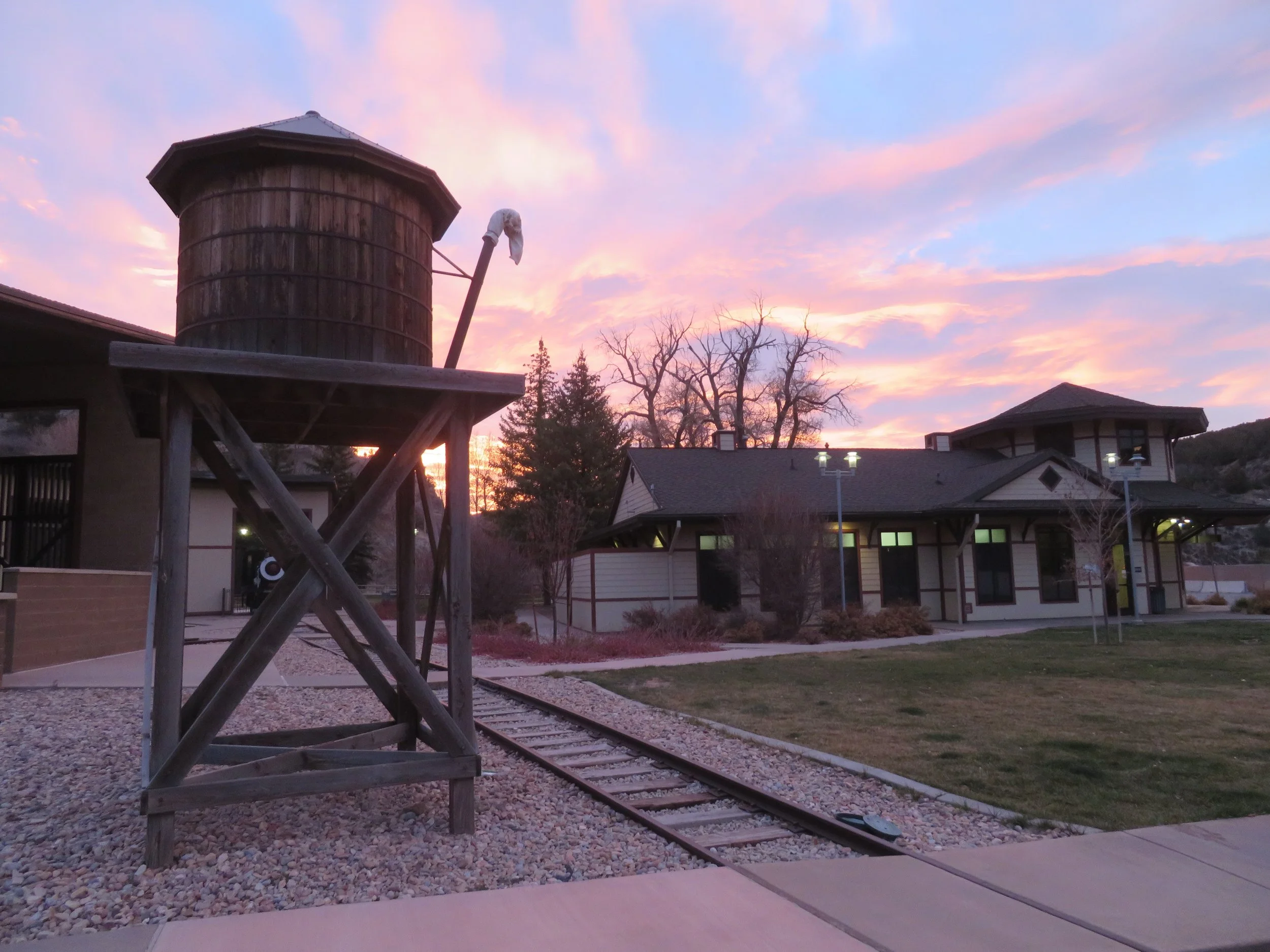
Tie Fork Rest Area at dawn.
Without our morning newspaper to read, it didn’t take long to get back on the road. We didn’t drive far before we came to a turnout celebrating Carbon County and Utah’s coal industry.
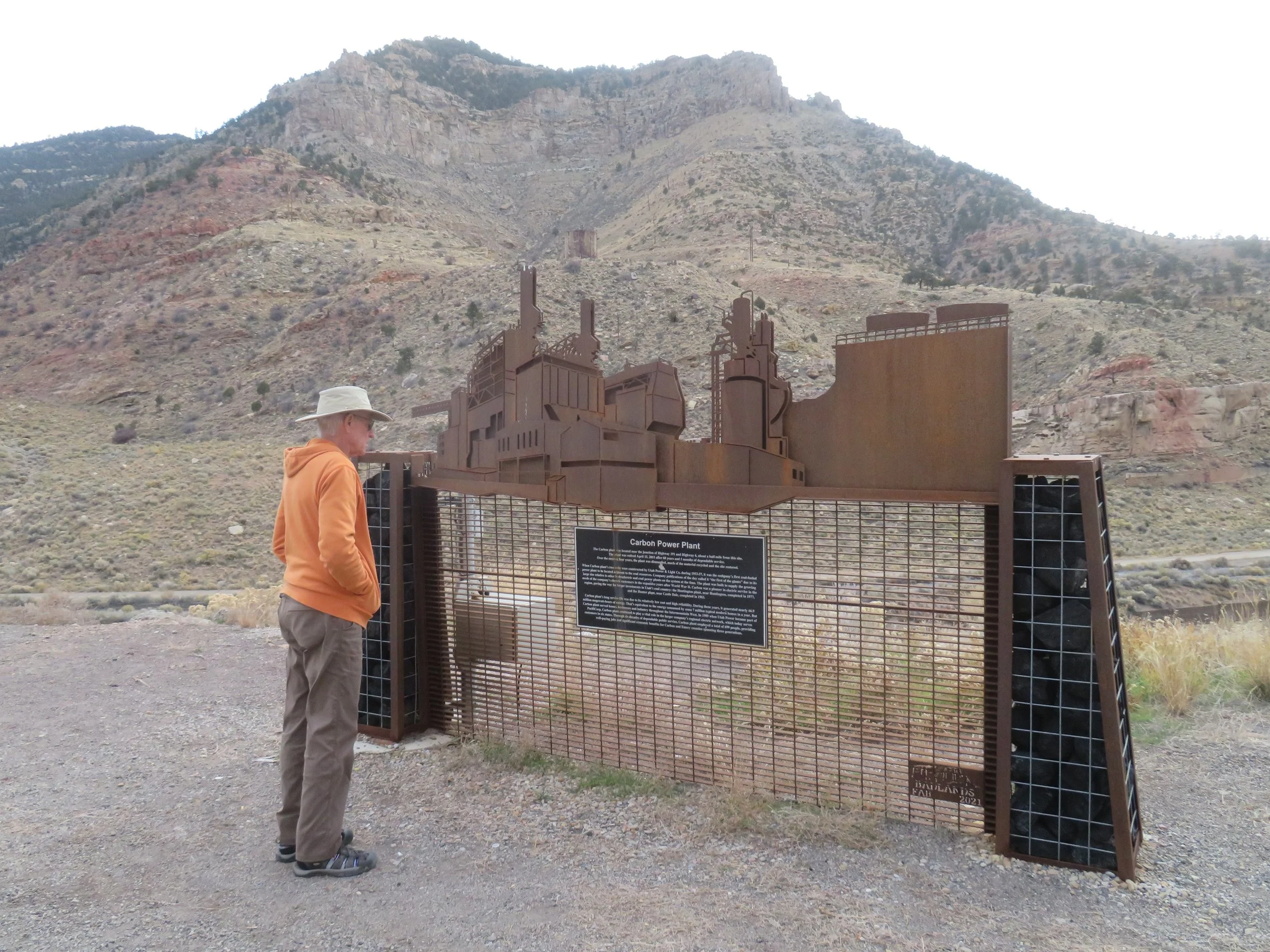
Carbon Plant Monument
A bit further up the road, we stopped in the town of Helper, Utah. The town got its name for the ‘helper’ auxiliary engines that were once stationed there to help the trains get up over the summit.
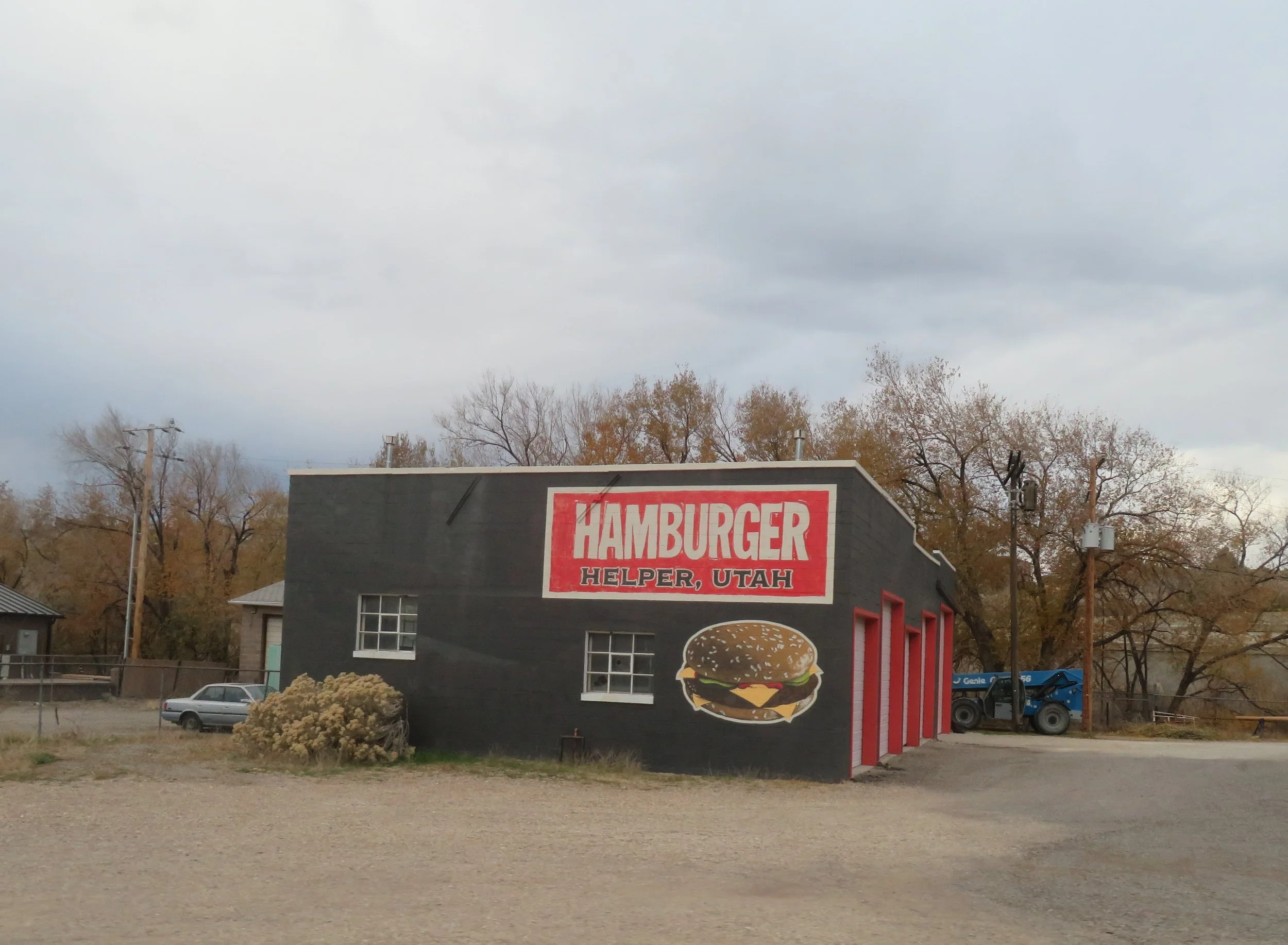
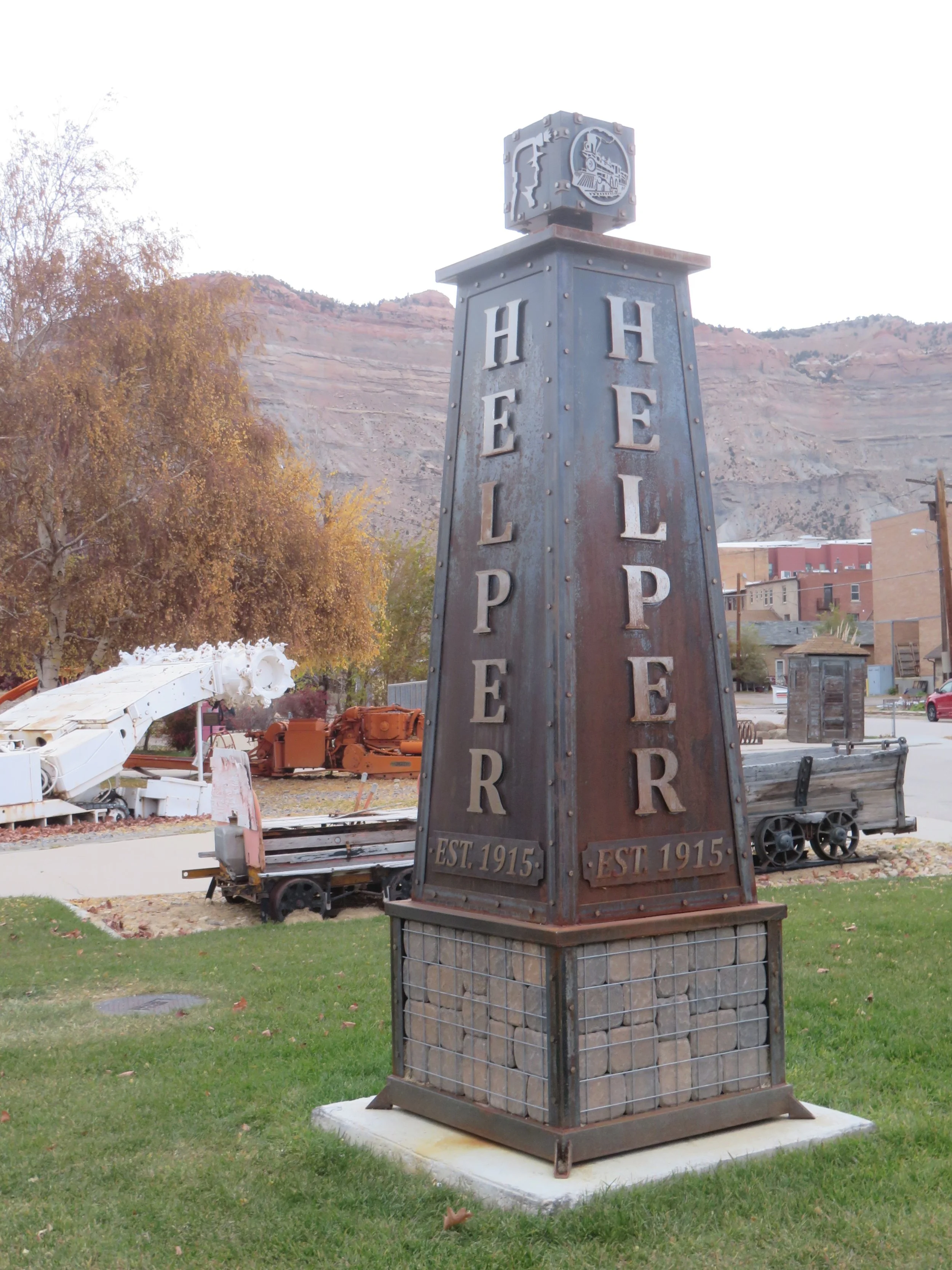

It’s an interesting little town, proud of its heritage. “Big John”, the coal miner stands in front of the city offices.
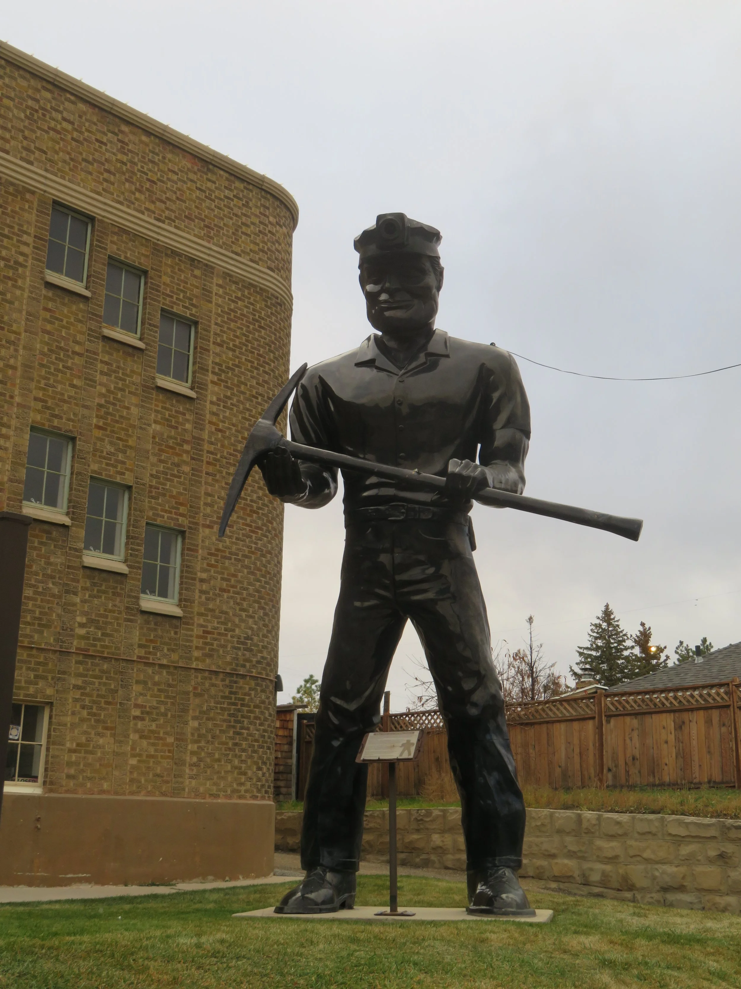
Helper’s biggest resident, Big John.
We stopped for breakfast at Farlaino’s, a pleasant little cafe in Price, then proceeded on to Green River. The John Wesley Powell River History Museum was open and we stopped to check it out. According to its website, visitors can ”learn about the expeditions of John Wesley Powell, explore regional paleontology and geology, view historic watercraft, and take a walk through the River Runners Hall of Fame to learn about the history of river running on the Green and Colorado Rivers.”
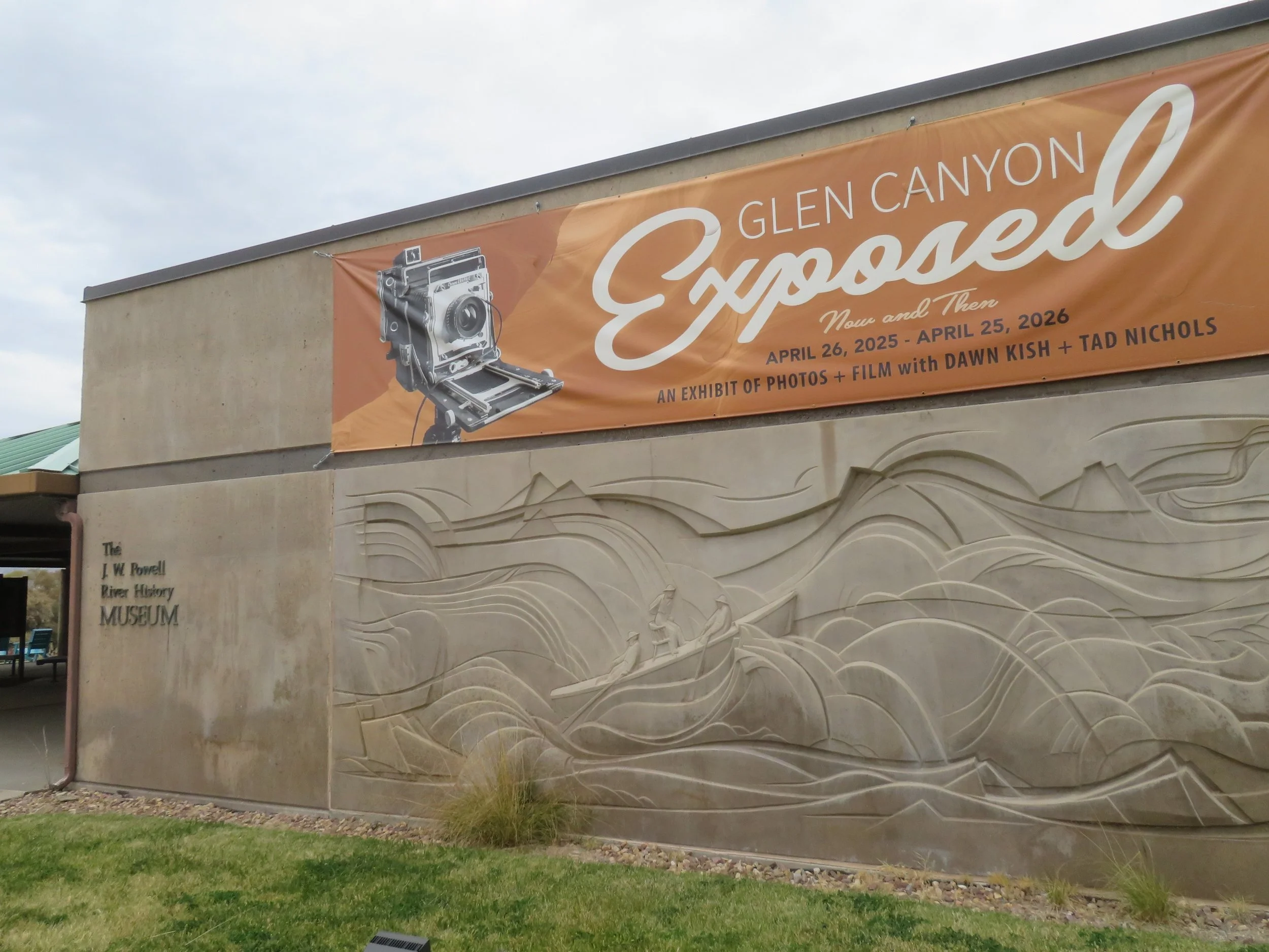
John Wesley Powell River History Museum
I found it mildly interesting, especially a current black and white photographic exhibition entitled “Glen Canyon Exposed”. David was most interested in the river running section. Admission: $8 adults/ $6 seniors and kids. David went as a senior; I went as a kid.
US-6 merges with I-70 at Green River. We’ve driven this route between Green River and Grand Junction dozens of times. It’s a long stretch between services (62 miles), but with a speed limit of 80 mph, we made good time. At Exit 2, the Rabbit Valley Trail is a 1.5 mile loop that highlights the geological features of the area. Administered by the BLM, it’s free and easy walking and a good leg stretch through a working fossil quarry. No samples allowed!
Crossing the Colorado state line had no effect on the landscape. Mack is the first town in Colorado on US-6/I-70, but has no official population count and no services, so it was a non-event.
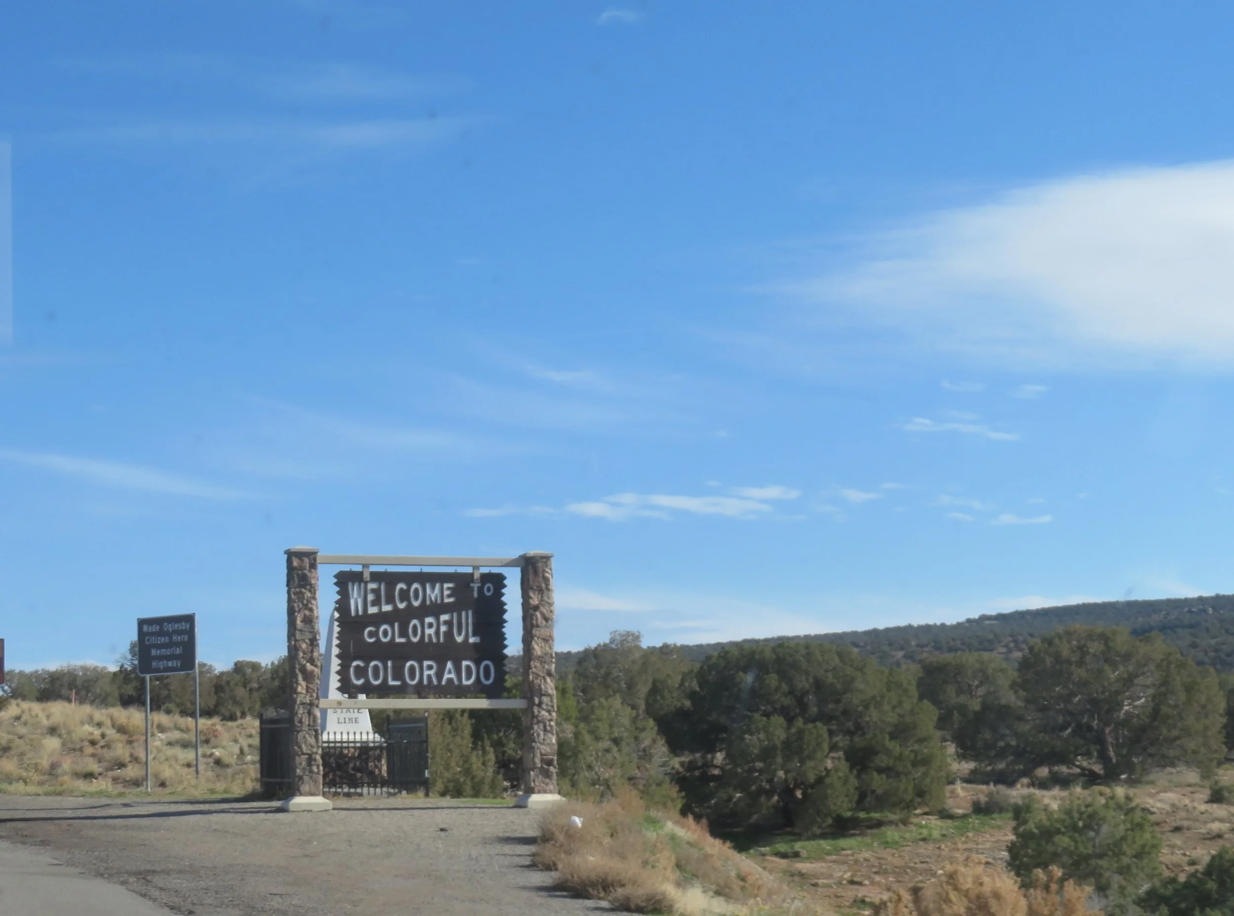
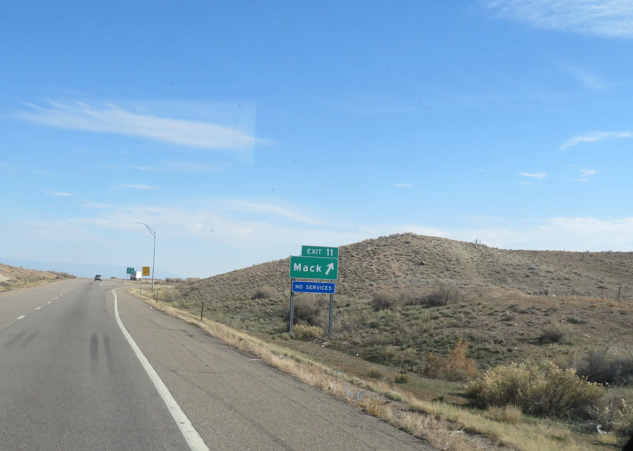
Mack, the first town in Colorado, has no official population
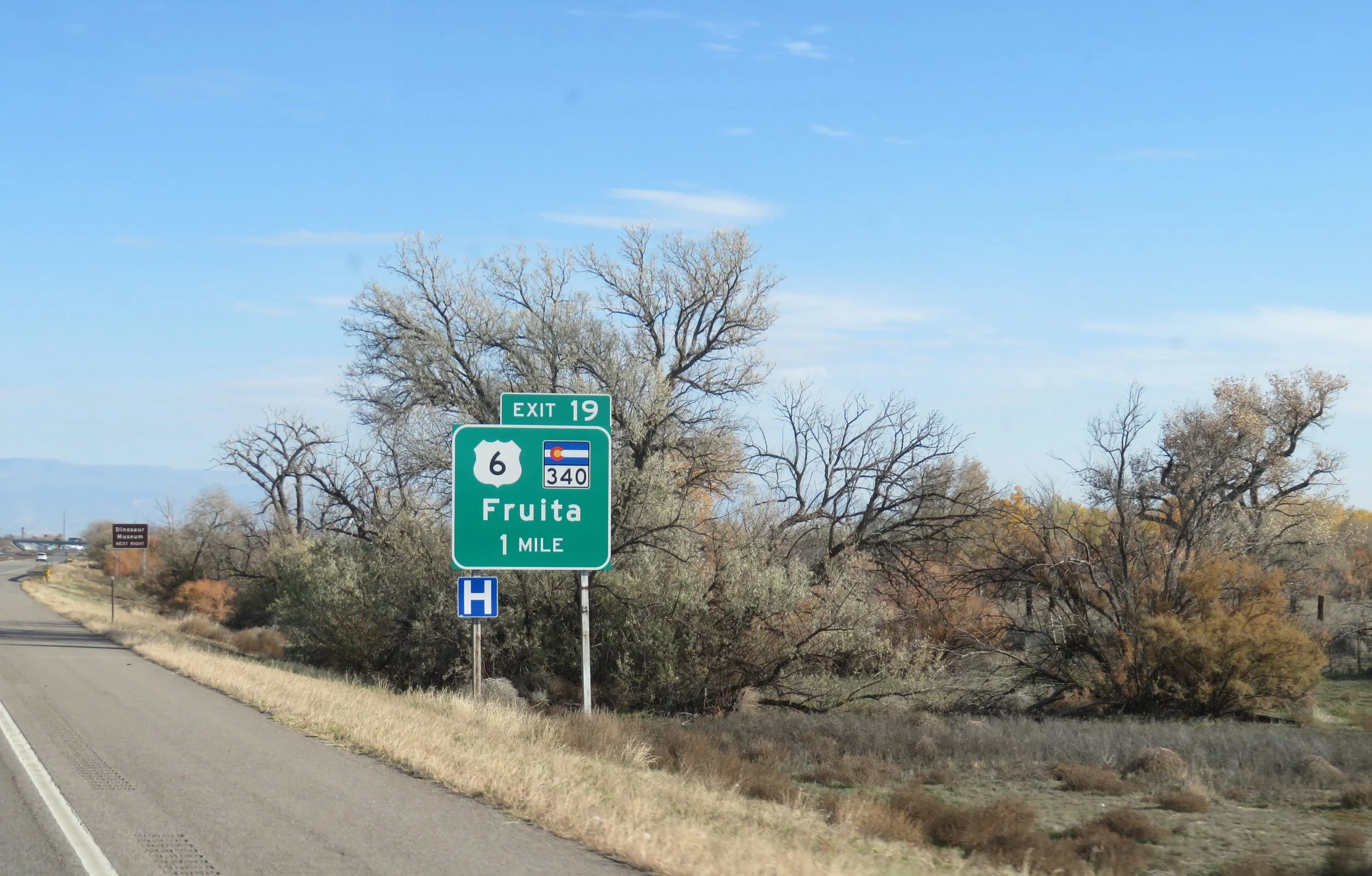
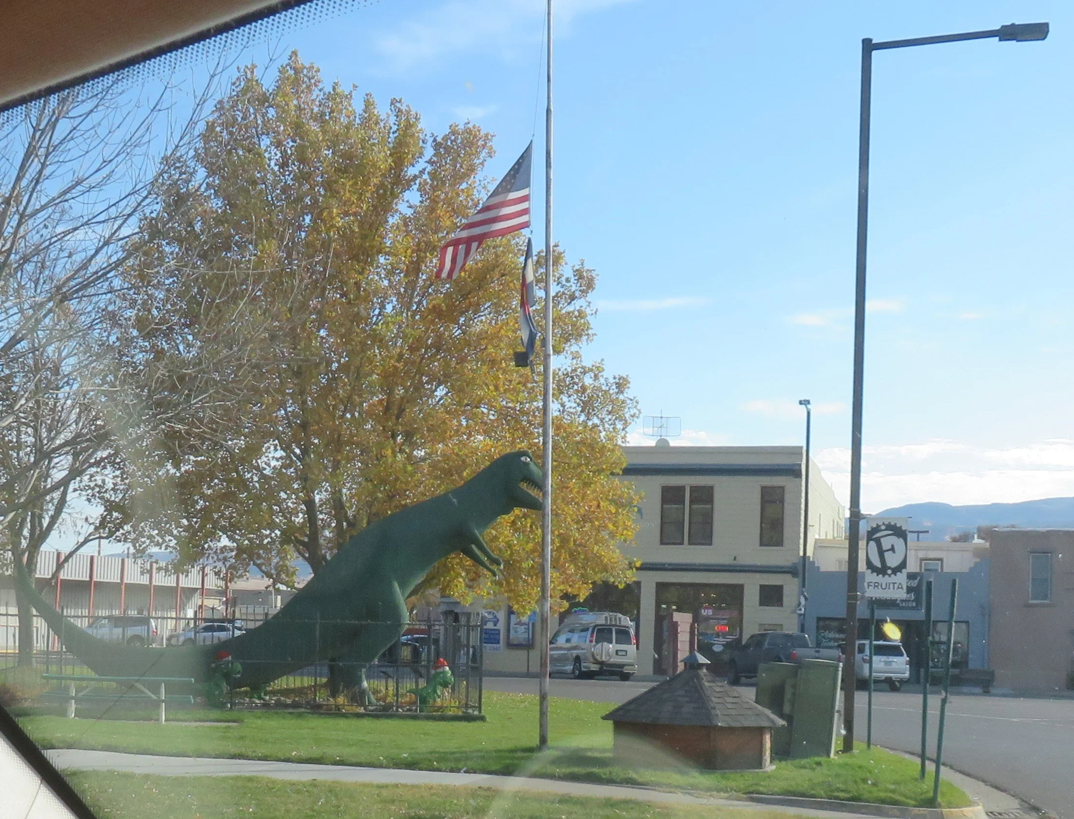
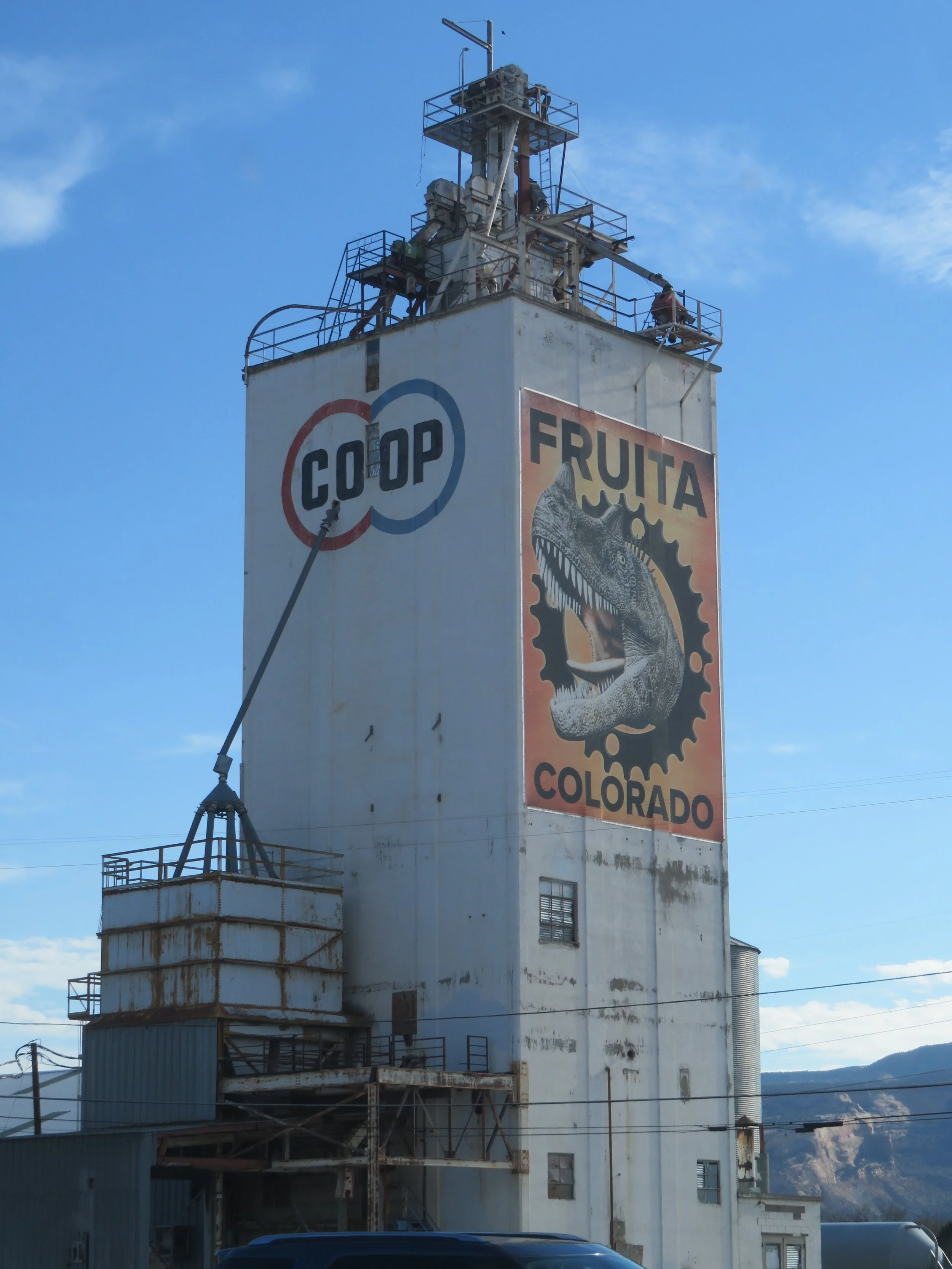
US-6 splits with I-70 at Fruita and attempting to follow our designated blue highway through this area was frustrating. Signage was poor. It merged with 70BL and US-50 sometimes and sometimes not. It meandered and lost itself (or at least us) a half dozen times. This area, by the way, is noted for its dinosaur fossils and they celebrate it with museums, statues and murals. We finally made it to Grand Junction and spent the night there, ready to tackle the US-6 again in the morning
As expected, the sign elves had not worked during the night and the signage did not improve. We picked up US-6 East and headed through Clifton and Palisades, an area known for wineries and fruit-growing, especially peaches. We rejoined I-70 for great views of the Bookcliffs (cliffs that look like books) above us and the Colorado River running alongside us.
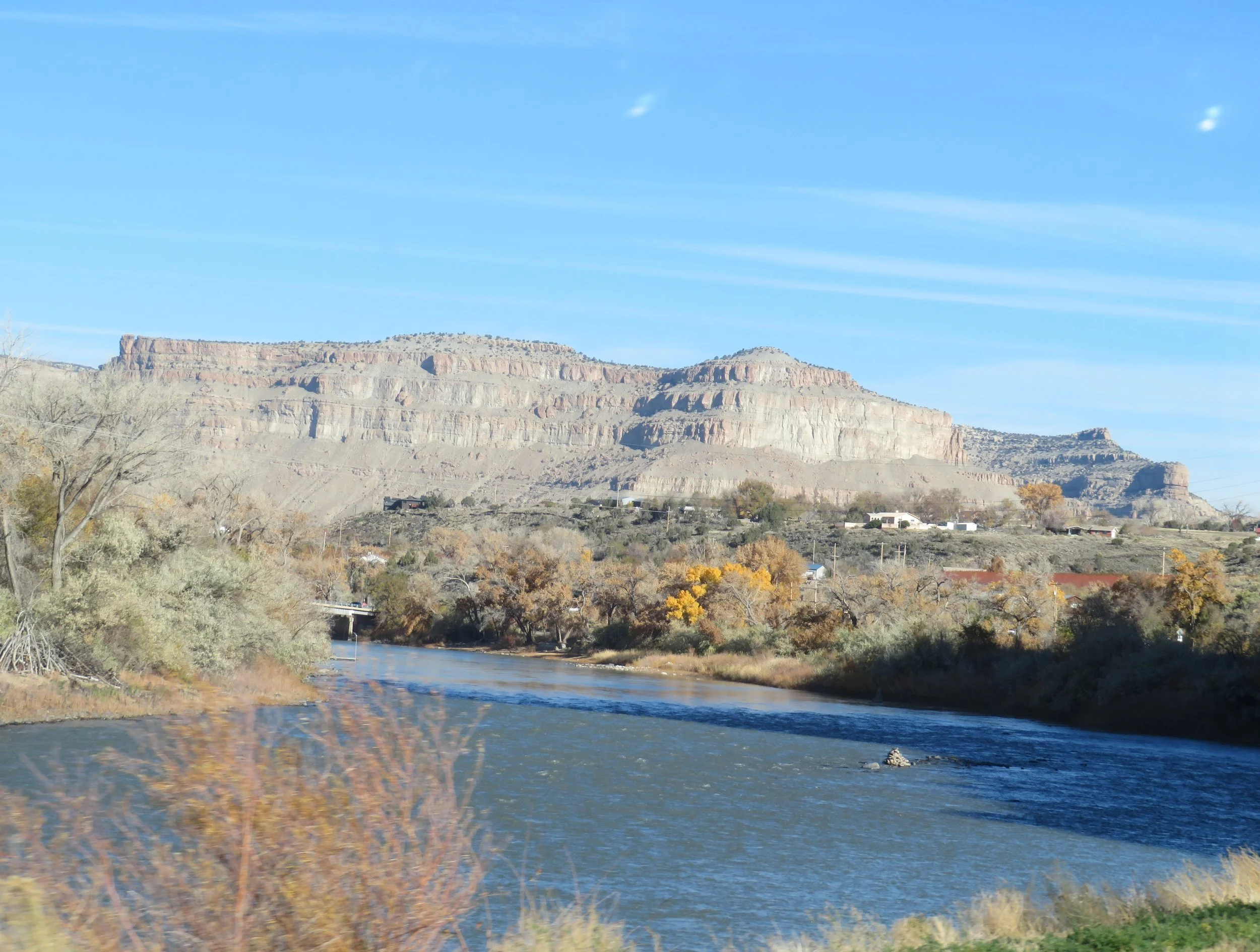
Bookcliffs overlooking the Colorado River
We sped along the highway through dark tunnels emerging to bright sun and the last of the golden aspens along the riverside. We perused the map to see where US-6 deviated from I-70 and exited at Exit 72, Parachute. To our dismay, we found that US-6 also went west! What? With nary a sign, nor a hint on our GPS, we had to backtrack 10 miles to DeBeque to cover the mileage we’d missed. Grrr! We played this hide and seek game off and on I-70 to Newcastle and then to Canyon Creek where US-6 came to an abrupt end. We turned around and got back on I-70 once again to Glenwood Springs. This time US-6 was on our GPS, but not on our Colorado DOT road map.
Though a pretty town, Glenwood Springs is very touristy and congested. The hot springs are easily accessible at several locations. You can also visit the cemetery where Doc Holliday is buried. We’ve done this before and gave it a pass this time.
On the other side of Glenwood Canyon, we played the ‘find-US-6’ game once again through the little towns of Gypsum, Eagle, Walcott, Edwards, Avon, and on to Minturn. Oops! Without warning or signage, we missed the turn back onto I-70 just before Minturn and had to turn around about 5 miles down the road when we finally figured out we were on US-24, not US-6.
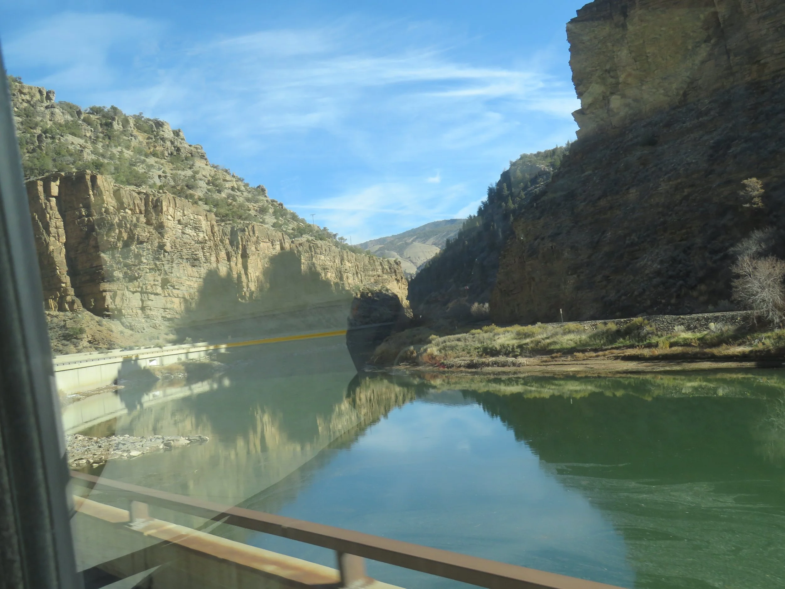
Driving through Glenwood Canyon alongside the Colorado river
Back on I-70/US-6, we were over Vail Pass (10,666’/3251m) with views of the snow-covered ski slopes and exited I-70 at Dillon. Instead of going through the Eisenhower Tunnel on I-70, US-6 heads up over Loveland Pass. At 11,992’ (3655m), it is the high point of US-6.
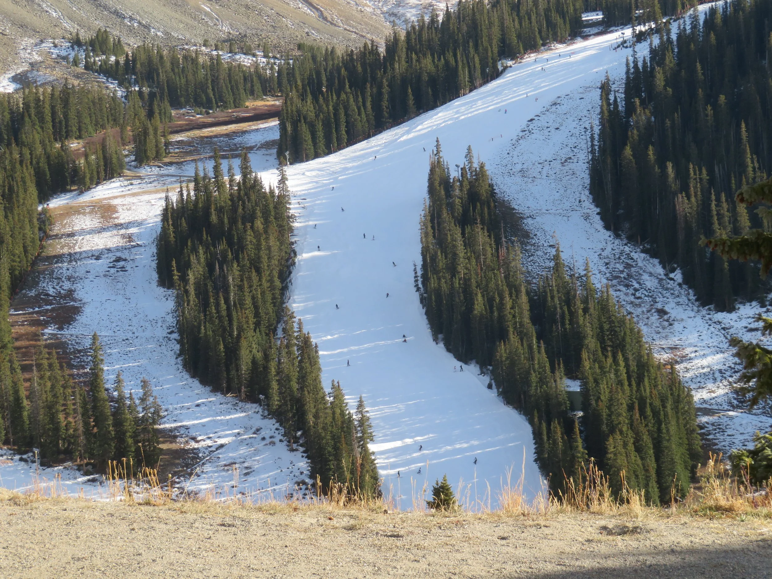
Early season skiers at A-Basin
We noted the early season skiers at Keystone and A-Basin (manufactured snow) as we climbed up, up, up and over the pass. There were lots of people at the summit and we waited our turn for a photo opp. A young Russian fellow obliged us and took our picture. Interestingly, there was absolutely no snow at the top of the pass. The ground was brown and bare, surprising for this time of year at this altitude.
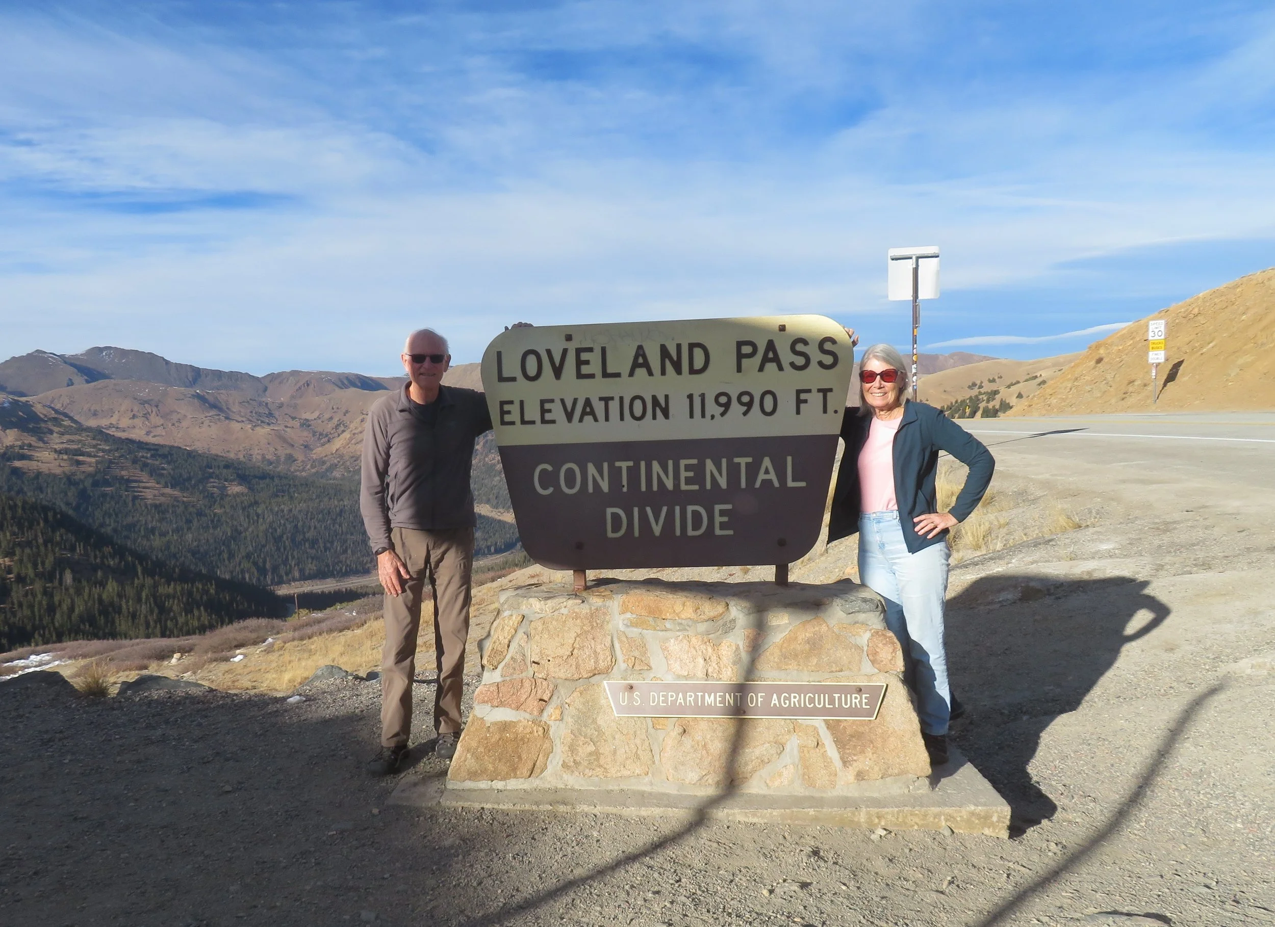
Loveland Pass, the high point of US-6
Down, down, down we descended to Blackhawk and Golden, through scenic Clear Creek Canyon. The Peaks to Plains Trail is a new addition to the area and looks to be an excellent hiking/walking opportunity. It was fairly crowded despite being late in the afternoon.
A glimpse of the Peaks to Plains TRAIL IN Clear Creek Canyon
Finally, we arrived in Denver. We decided to complete the Denver portion of US-6 through the city so we could join US-6 on the east side when we were ready to depart the city.
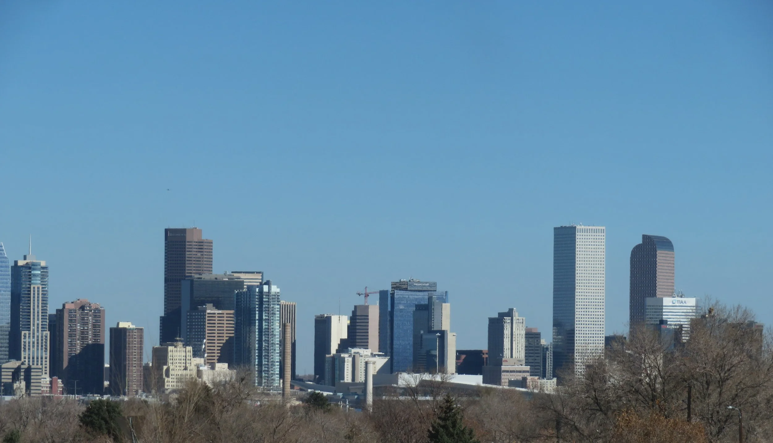
Cityscape of Downtown Denver
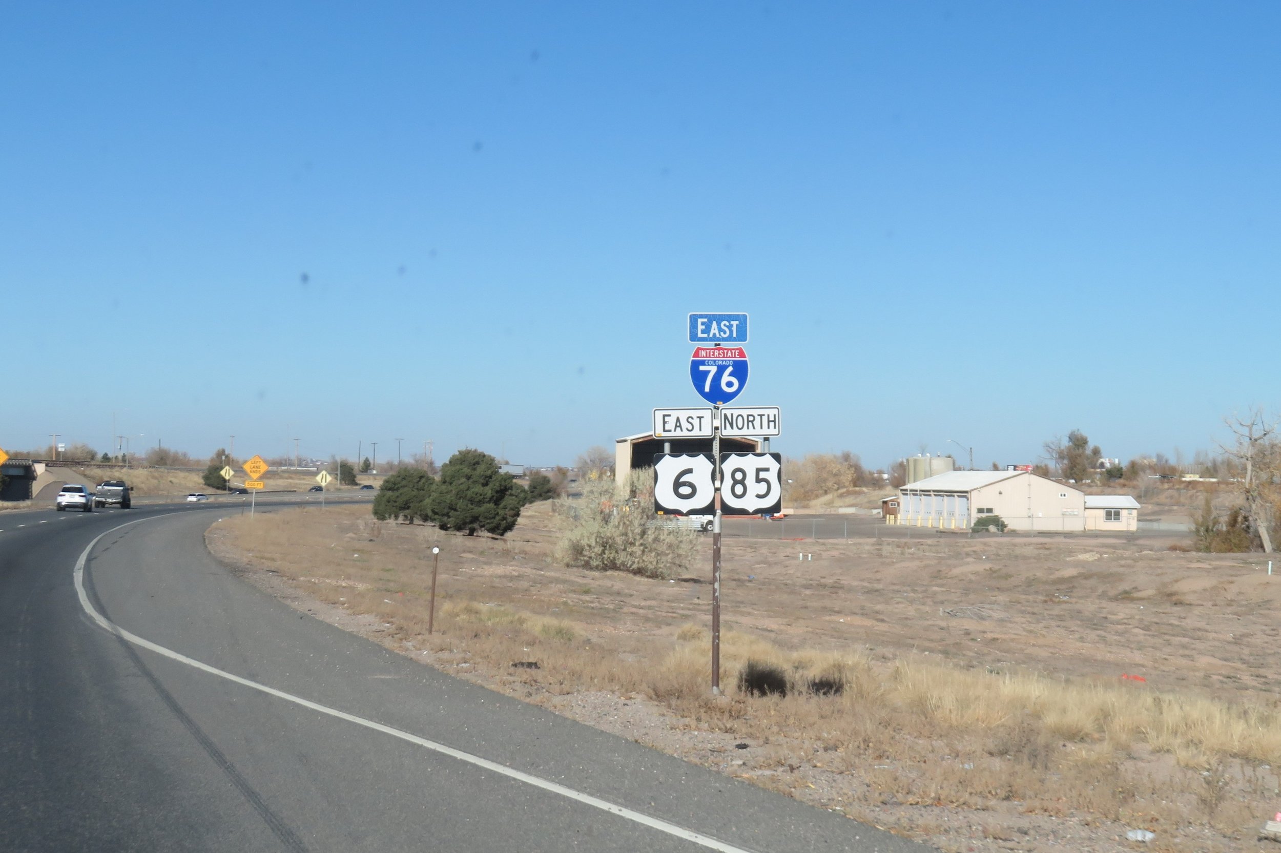
Once again, it was a challenge. The GPS and two maps differed in their representation of the route. We finally called our personal geographer, Brennan, who provided a Wiki street-by-street, turn-by-turn link through the city. The route led us from US-6 in Golden to the 6th Avenue Freeway to I-25 to I-70 to Vasquez Boulevard to I-76. Whew! Another frustration-wrought section completed.
At last, through Denver!
We’ll be in Denver for five days before heading back out on I-76/US-6 and heading east. Join us for the next segment of the trip from Denver to Des Moines and all that country in between. Click here US-6 Part 3.