

Hiking the Barber Peak Loop Trail
/
We arrived late afternoon at the Hole-in-the-Wall Campground in Mojave National Preserve. We’d so enjoyed our stay here a couple of weeks ago, we were anxious to return for another quick getaway camping trip. We’d reserved campsite #2, the same site as last time.
After a cool, quiet night, we were up early, but lazed over coffee and reading the New York Times. Yes, we had cell coverage here… not overly strong (1-2 bars), but with the aid of our cell antenna, it was sufficient to get emails and download the morning paper. Hence, we got a late start at 0830 on our planned hiking trail.
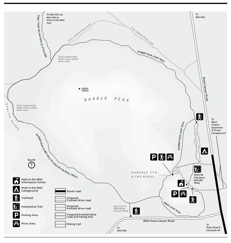
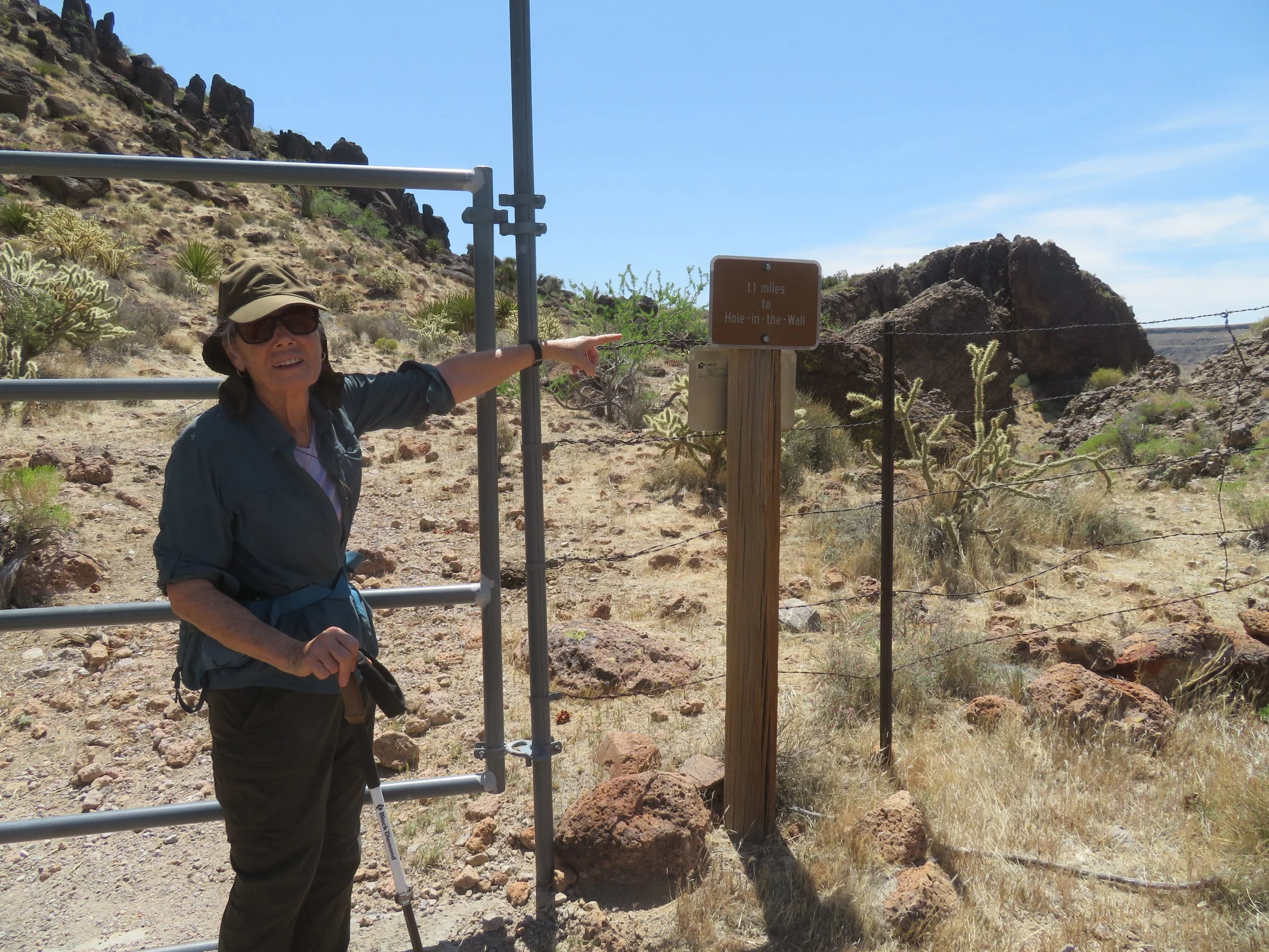
One of the trailheads for the 6-mile Barber Peak Loop Trail begins at the north end of the campground. A posted sign provides a map and relevant information about the trail.
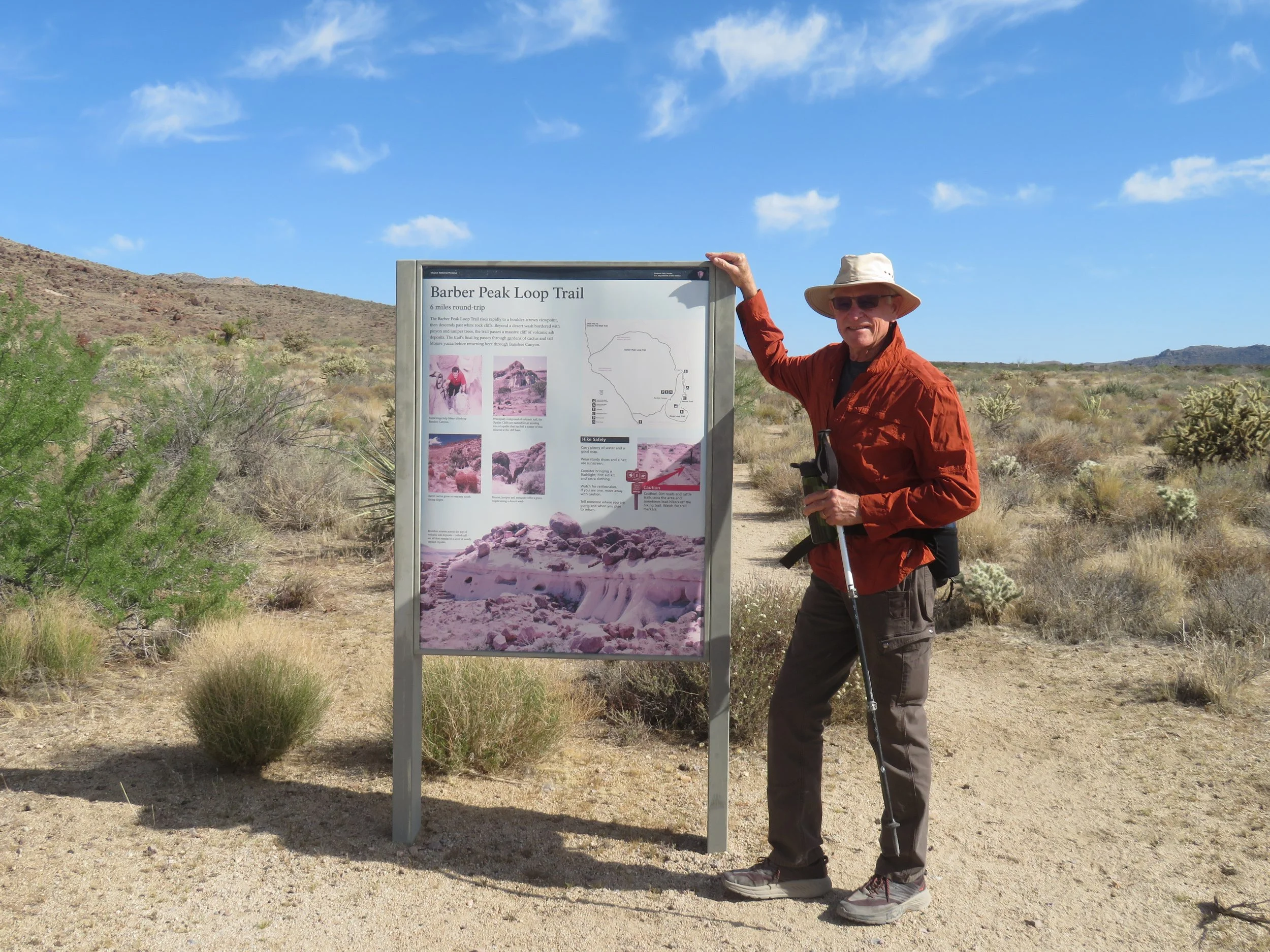
Trailhead for the Barber Peak Loop Trail was at the north end of the campground
We’d gone less than a mile when David yelped… a sharp pain in his right foot. He hobbled over to a rock, sat, and removed his shoe. Nothing seemed amiss. He rubbed the bottom of his foot, the inside of the shoe… nothing there. It appeared that whatever caused the problem was gone. Shoe back on, he took about 10 steps, and OUCH, the stabbing pain returned. Back to the rock, shoe off, sock off… we inspected the foot, the sock, ran our hands inside the shoe… nothing. We found the culprit on the outside of his shoe… an inch-long cactus spine had penetrated the sole, and whenever David put weight on it, the spine pierced his foot. Spine removed, all was well, and we resumed the hike.
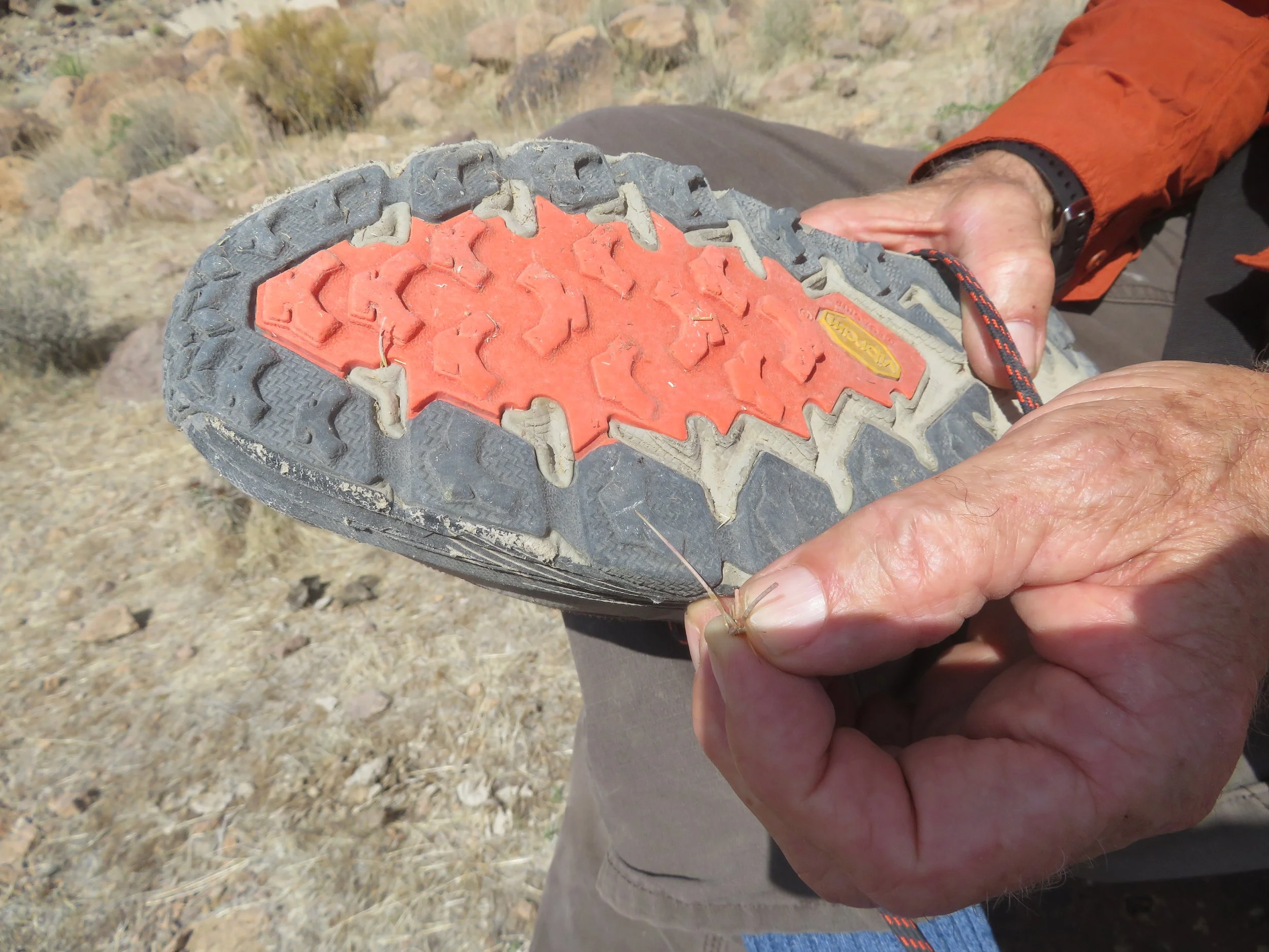
OUCH!
A short distance later, we passed through a gate in a barbed wire fence and entered open range land. We weren’t alone. Here and throughout the hike, we would encounter several head of cattle sharing our path. Some were curious and eyed us suspiciously, but all of them were timid and scattered when we approached. We were glad they were steers and cows. Bulls might have had a different attitude toward intruders.
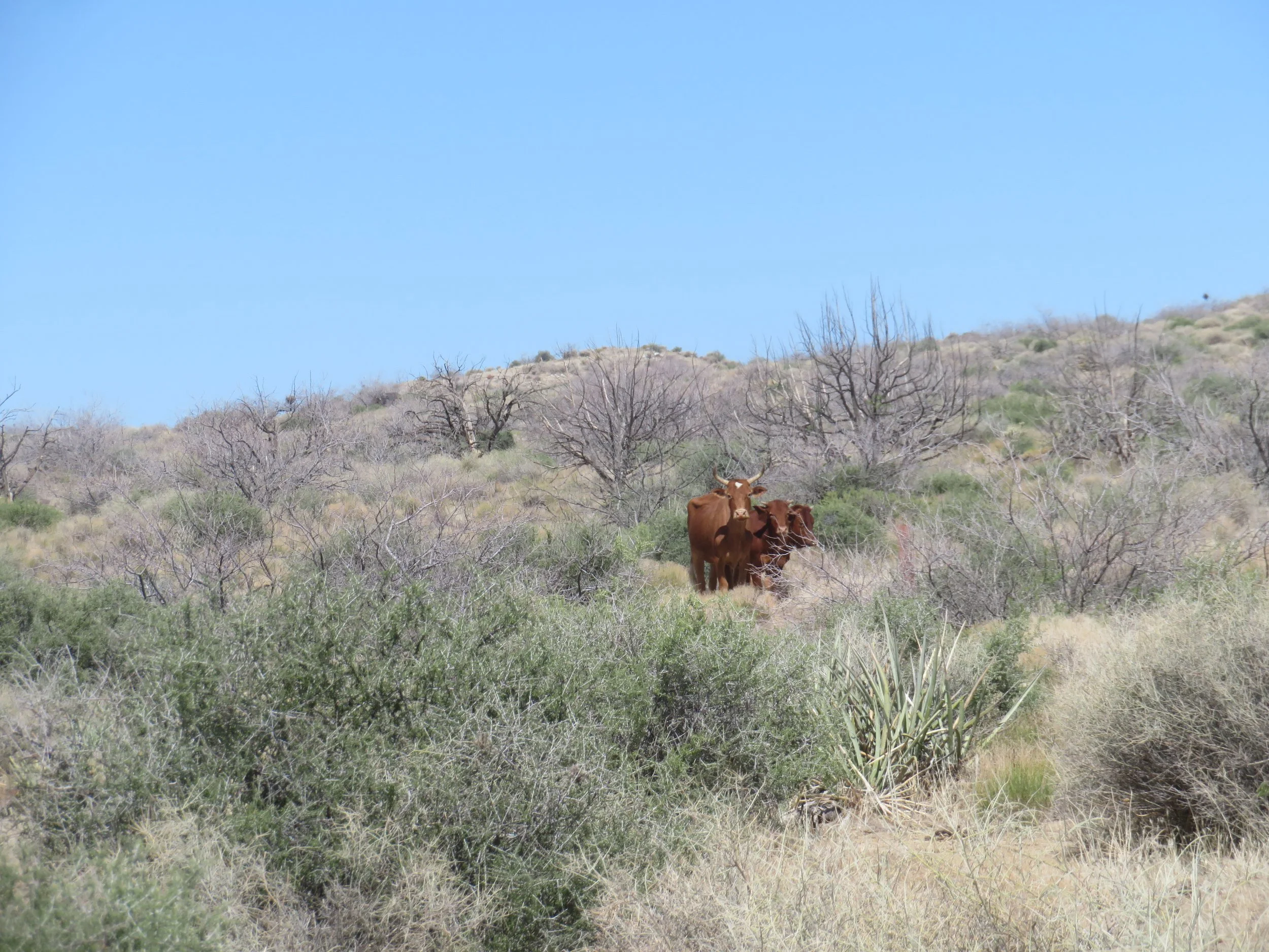
We weren’t the only ones on the trail!
Bright red, spined California barrel cactus dotted the landscape.
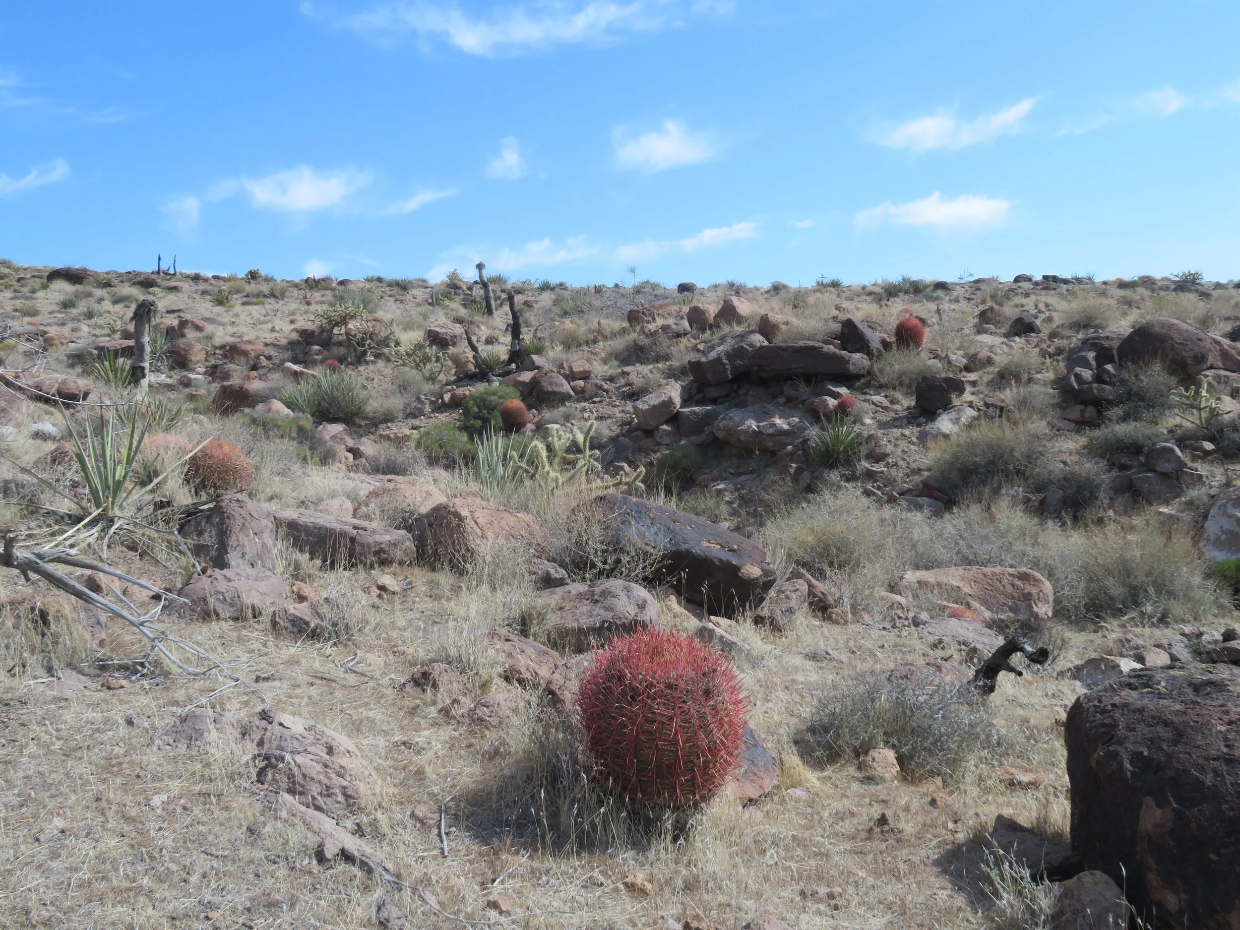
California barrel cactus… bright red with very, very long spines
A rocky ascent along a serpentine path led to the top of the white Opalite Cliffs. According to the USGS site, “The opalite cliffs of the Mojave Desert formed during the Mesozoic Era (roughly 252 to 66 million years ago). The opalite itself is often associated with hot water emissions from late-stage volcanic events.” From the park brochure description of the trail: “A stone staircase skirts volcanic ash deposits known as tuff, while the Opalite Cliffs glisten like diamonds among the rocks”. We maneuvered our way around the cliffs and inspected the caverns and columns below.
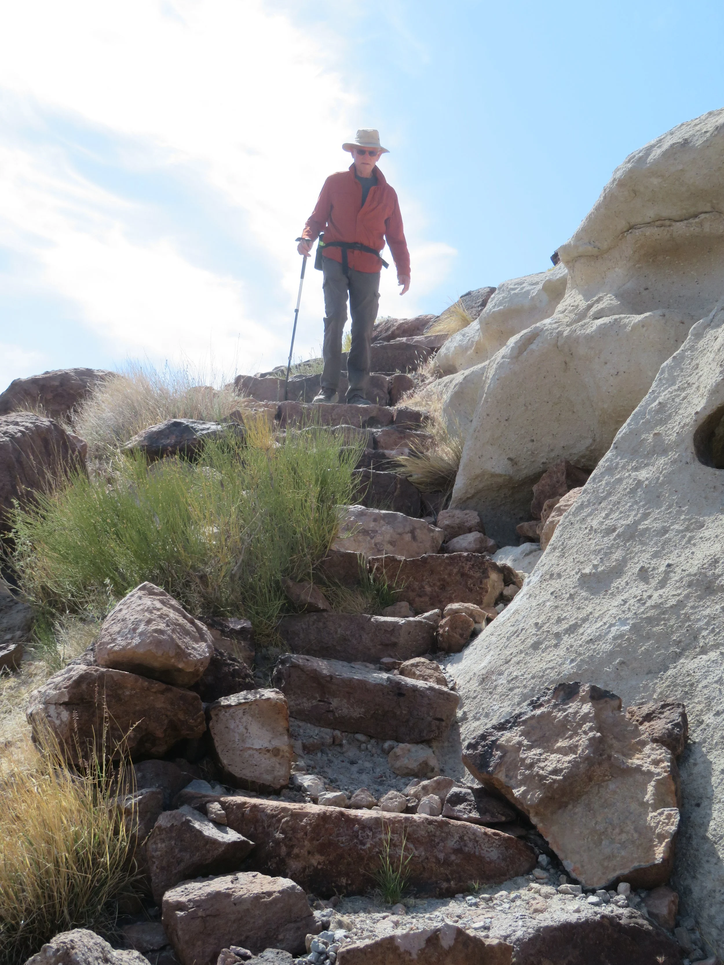
Descending the stone staircase
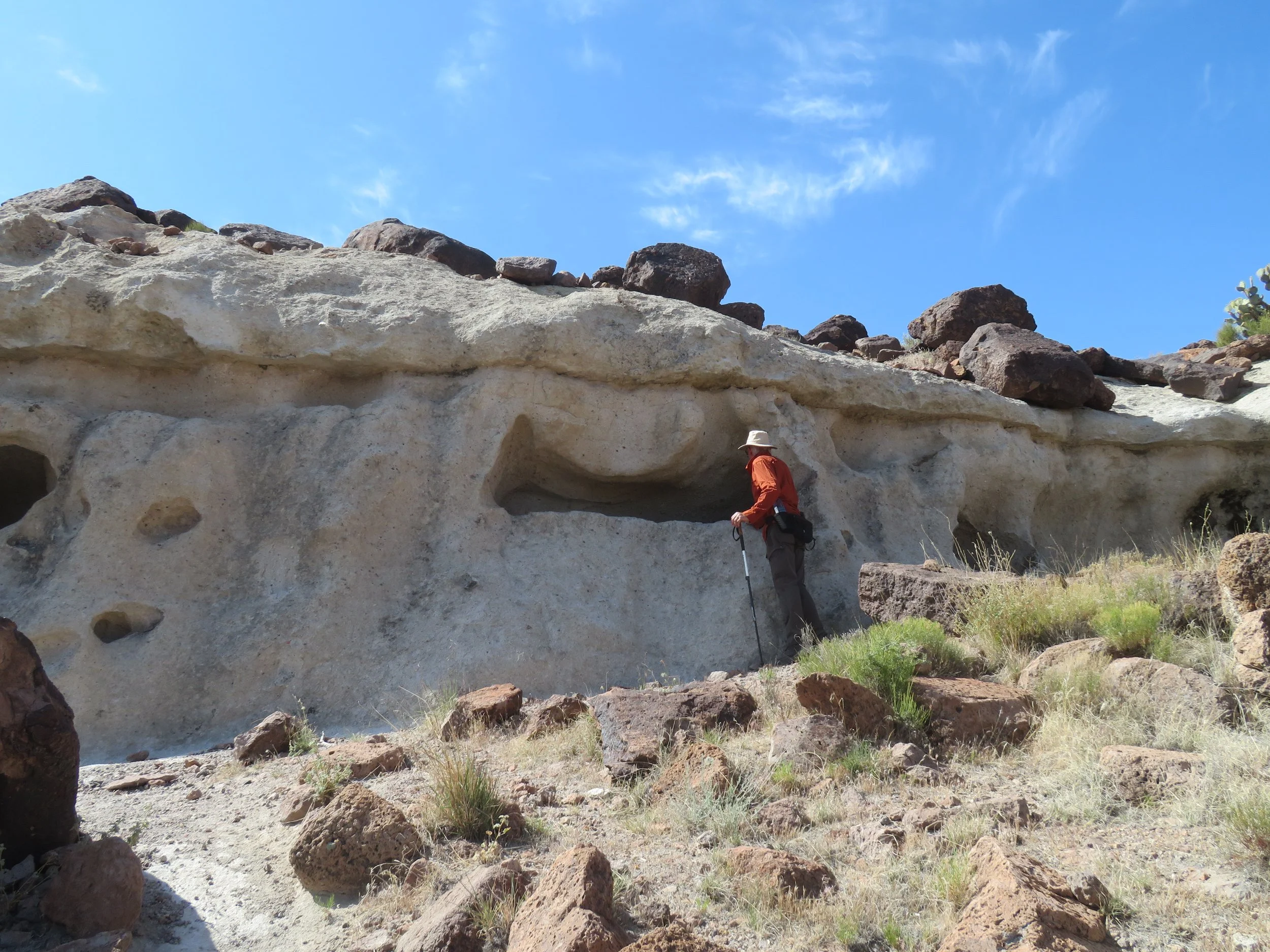
Anybody home?
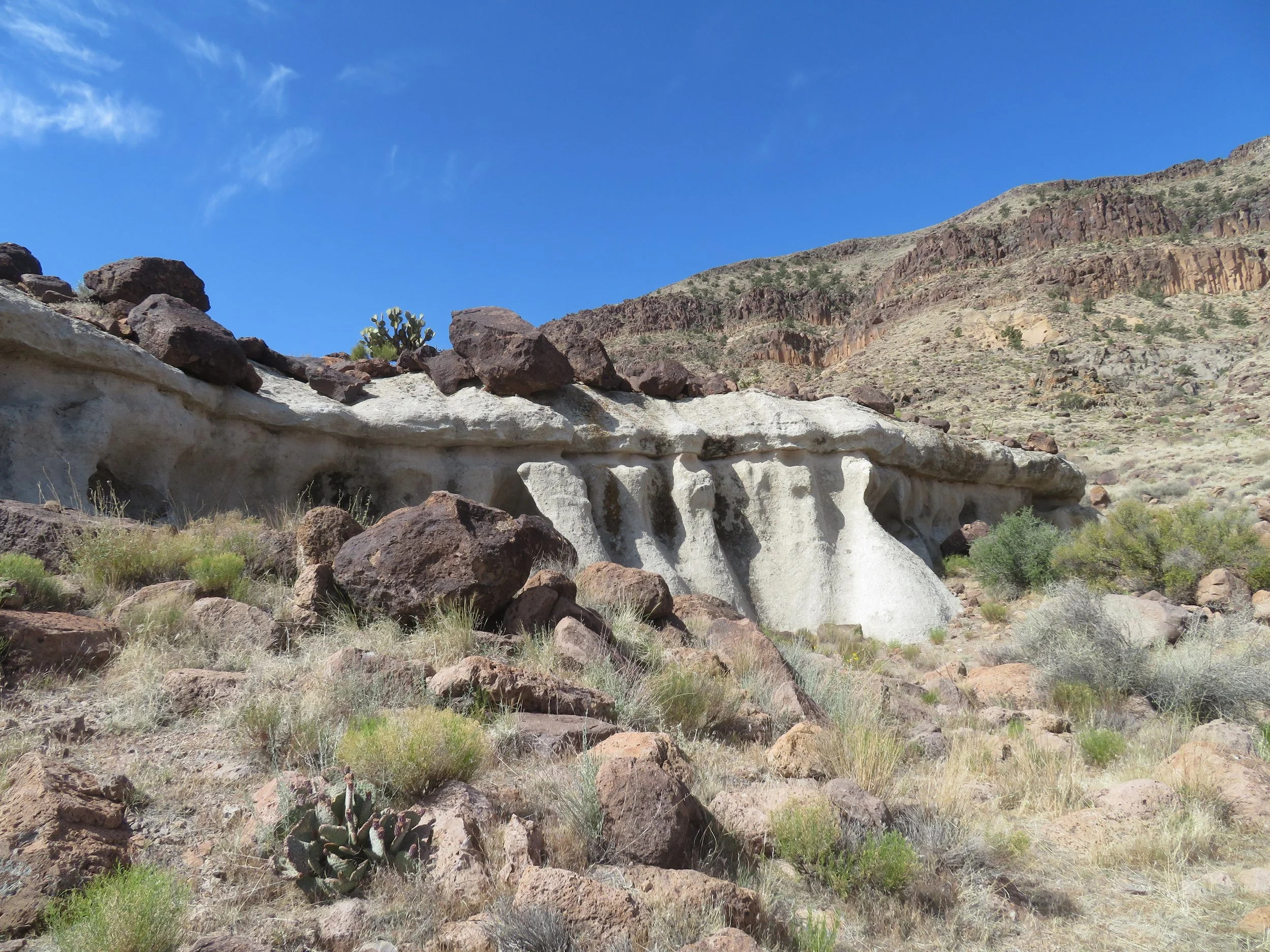
The Opalite Cliffs
The trail meandered up and down, sometimes sandy, sometimes rocky, sometimes along old cart roads. Most of the time we could spot trail markers in the distance. On occasion, the markers were either gone or were in ‘stealth’ mode… leaning over or entwined in yucca or a tree stump.
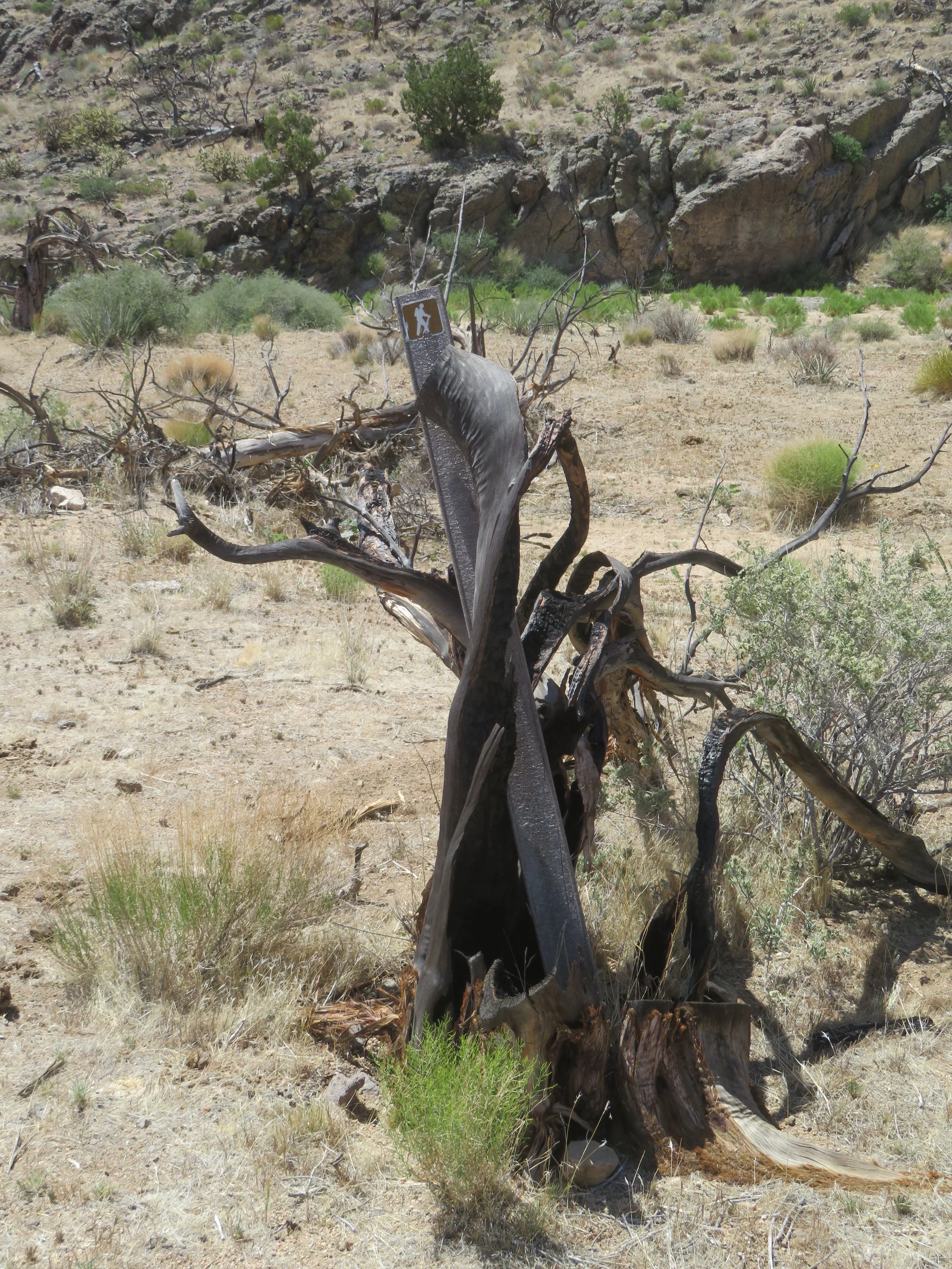
Some trail markers were a bit hard to spot
Mojave yucca, by the way, provided some interesting natural artwork as we walked. One old, desiccated yucca looked like a deer from a distance. Another time, we weren’t sure if we were seeing an old yucca stump or if a displaced sea serpent had landed in the desert.


We knew the path would eventually have to traverse a pass, but couldn’t see exactly where. We came to a fork… one path climbed a rocky incline with a fence gate at the very top. Another path looked like it might lead around the incline through a slot canyon. We followed the path of least resistance only to find it ended abruptly at a 10’ (3m) drop-off. Hmmm… back to the fork and a scramble up the steep rocky incline to the highest point on the trail, 4700’(1433m). Then we were through the gate and making a steep descent down to the desert floor.
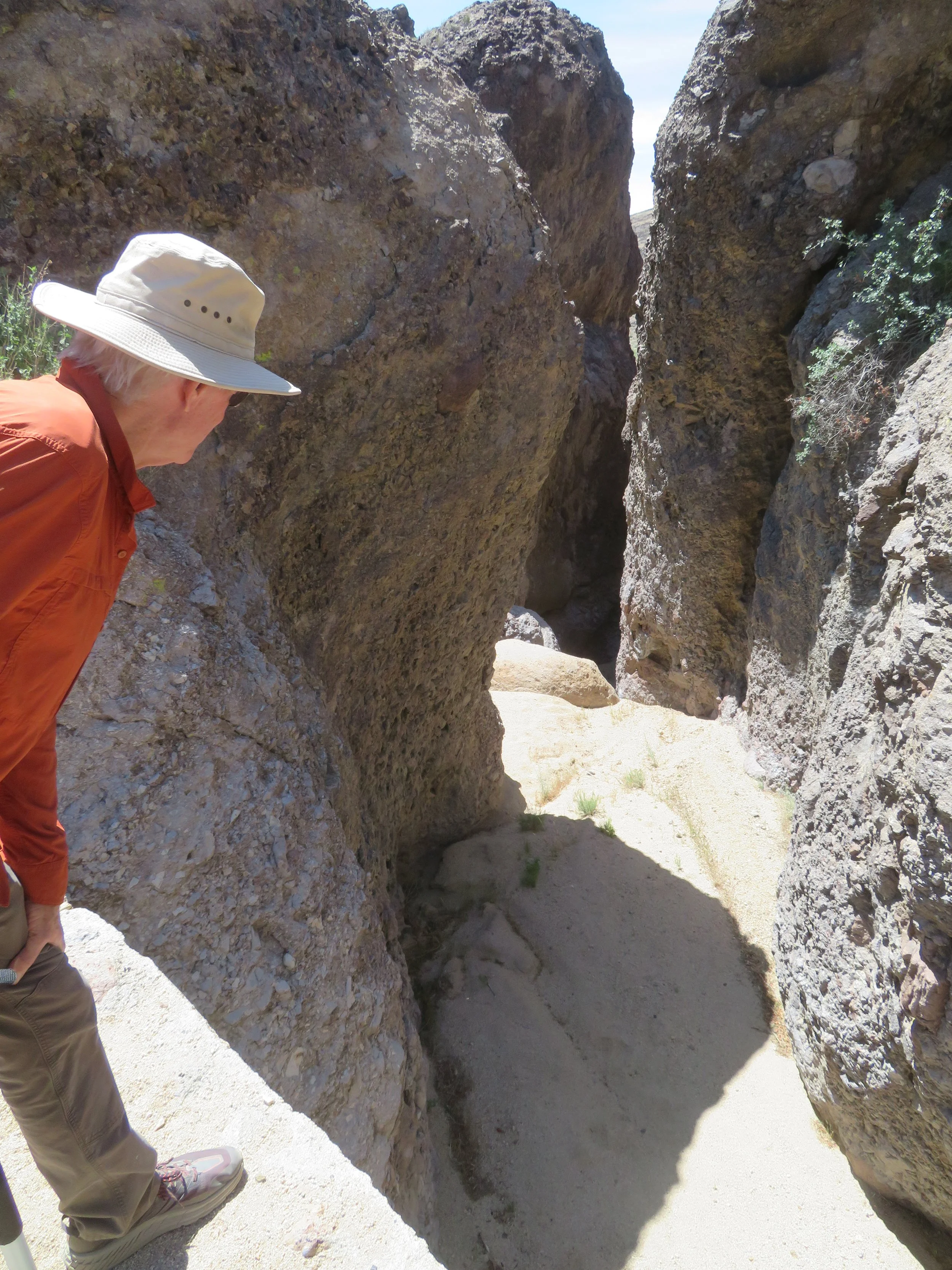
Oops! Not this way
A short, but arduous scramble and we were up and over the pass, through the gate and on our way down to the desert floor.
The trail passed through a cactus forest of sorts. Cholla, barrel cactus and pricklypear were thick in this area and grew close to the trail side, apparently attempting to reclaim it. We had to maneuver carefully to avoid being ‘bitten’ as we passed.
The cactus can ‘bite’ if you venture too closely, but they’re also quite beautiful.


Finally, we came to the fork which led back to the Visitor Center and campground. Another mile along a dry, sandy trail with little shade to be found. We were parched. We’d each gone through a full liter of water and shared an extra liter David had in his pack. When we finally spotted the Visitor Center, we headed directly to a covered picnic table and got some cool water from the pump. It felt great to sit for a spell.
Total distance walked ended up at 8.1 miles. Cold beers and salty chips were a welcome treat once we returned to Blanche.
Though the nights are cool and the mornings and evenings are lovely, the midday sun is scorching. The campsite affords no shade from about 1230-1630. This is probably the last camping trip to Mojave National Preserve until fall.
Best campsites at Hole-in-the-Wall?
#2 & #37 - A bit smallish, 1-2 bars cell coverage; close to the Visitor Center path and vault toilet. Good views
#13, 15, 17, 18, 23 - All good size, level, close to vault toilets. 13, 15, and 23 have big pull-throughs. No cell coverage.
Notes:
Some vault toilets were closed while we were there because they were full. Others were open, but stinky and near full. The vault toilet closest to #2 was clean, smell-free, and well-stocked.
Some fresh water from the pumps at the campsite, but the best water is from the pump at the Visitor Center.
Limited Wi-Fi is available at the Visitor Center along with information, brochures, maps, books, and souvenirs.
Visitor Center has limited hours. Friday through Monday, 10 AM-4 PM
Next time, we head to the Midhills Campground, ~1200’ (336m) higher in altitude. Join us.