

Lunar Crater National Natural Landmark
/
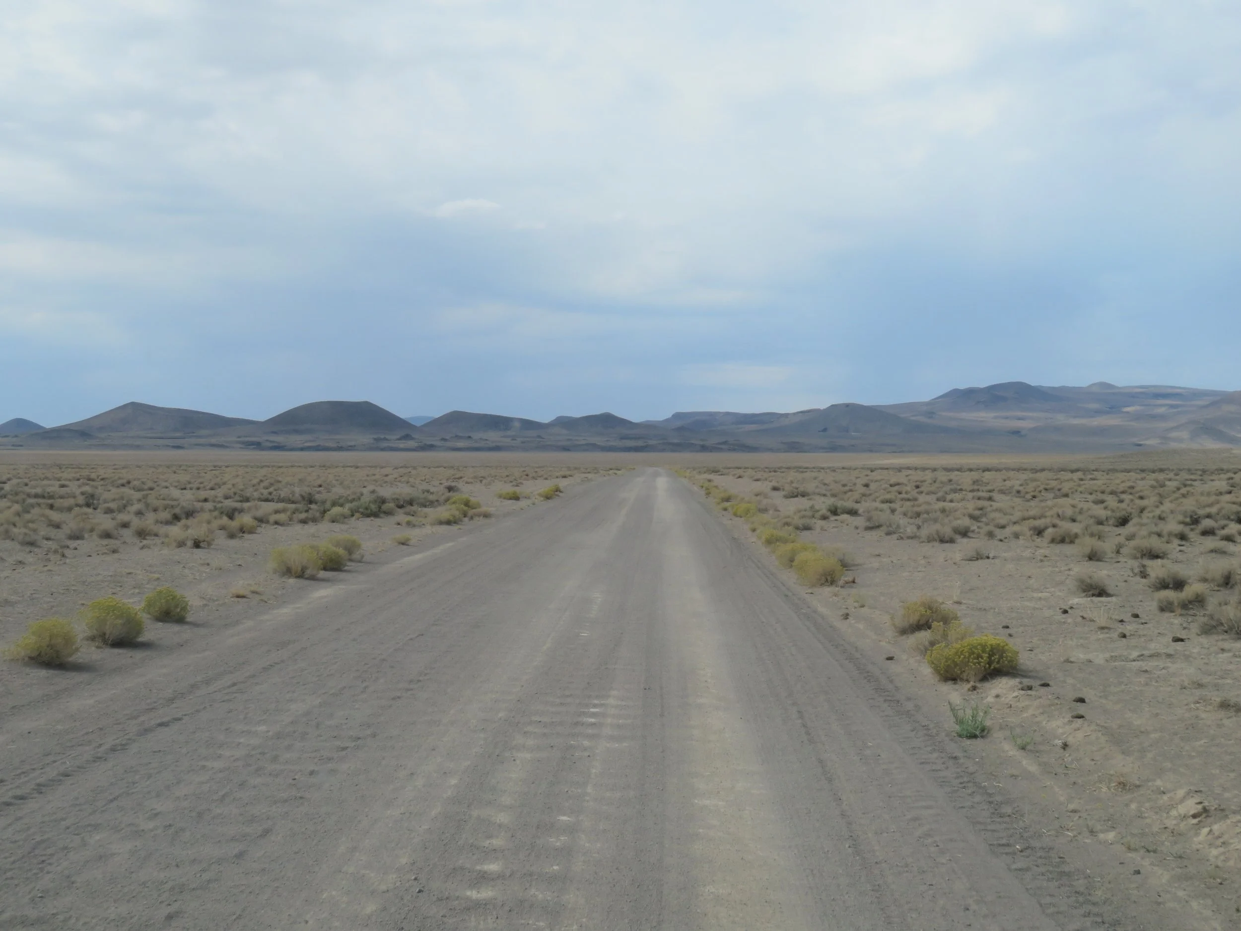
We continued along US-6 heading east out of Tonopah traversing this flat, desolate, parched land through the heart of the Great Basin. Sage, juniper, scrub and brown hills in the distance were all we could see… endless shades of dusty green and brown for miles and miles. Once again, we climbed to summit passes and then descended into valleys.

US-6 is a desolate, lonely road
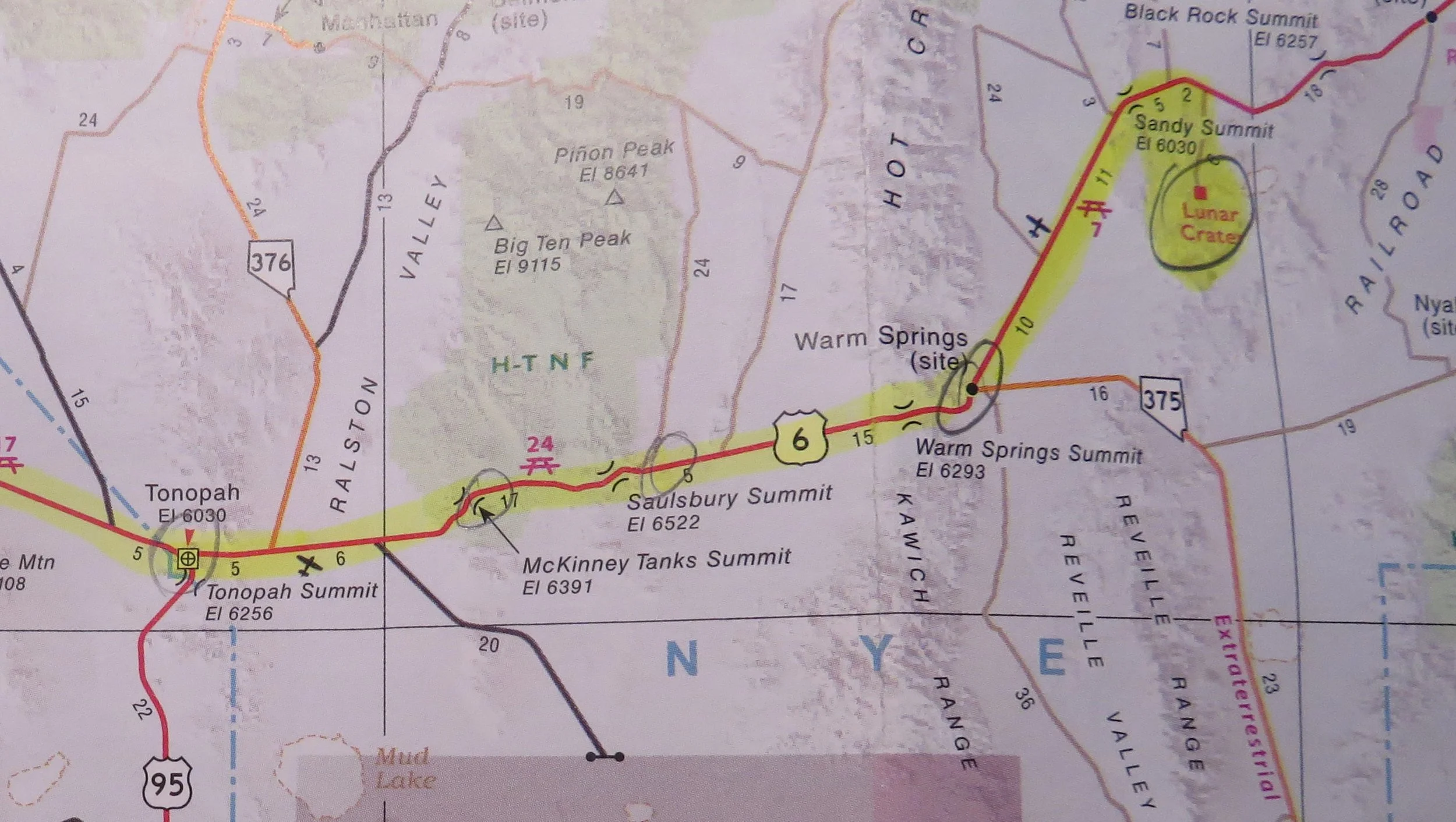
We were heading towards Ely, Nevada (pronounced ee-lee), but I’d previously noticed a tiny red dot indicating a point of interest on the Nevada map – Lunar Crater. It was about 84 miles from Tonopah, a halfway point to Ely. We thought it might be worth checking out… because, why not?
Lunar Crater in the middle of the Great Basin? This required some exploration.
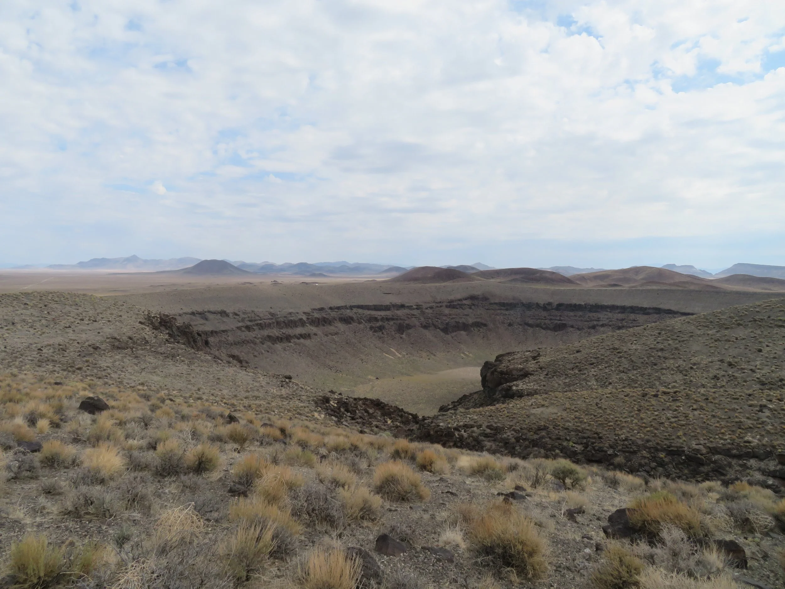
Despite its name, the Lunar Crater was not the result of a meteor hit nor, considering its location, an atomic testing blast site. We learned that it was “the result of a now-extinct volcanic event.” According to the NPS website, “The Lunar Crater landmark is an outstanding example of a maar (a low-relief, broad volcanic crater formed by shallow explosive eruptions). The Lunar Crater maar illustrates the results of volcanism in which the violent release of gases, rather than lava, predominates.” NPS designated it a National Natural Landmark in 1973, one of six in Nevada.
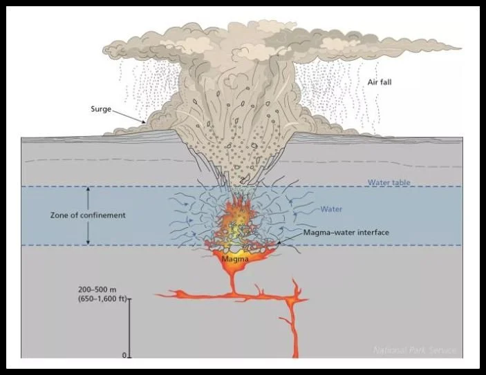
NPS Schematic illustration of a maar explosion.
According to AmericanSouthwest.net, “Nevada has over a dozen volcanic areas... in remote areas of the Great Basin Desert. The best is the Lunar Crater Volcanic Field, a zone of volcanism covering over 100 square miles at the southern end of the Pancake Range, and comprising cinder cones, outcrops of lava, elongated fissures, ash hills, and, most visibly, the 430-foot-deep Lunar Crater - an impressive and rather unexpected site in an otherwise isolated, windswept location.”
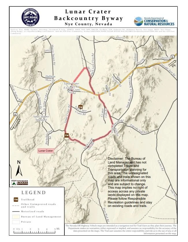
Off Road map of Lunar Backcountry Byway
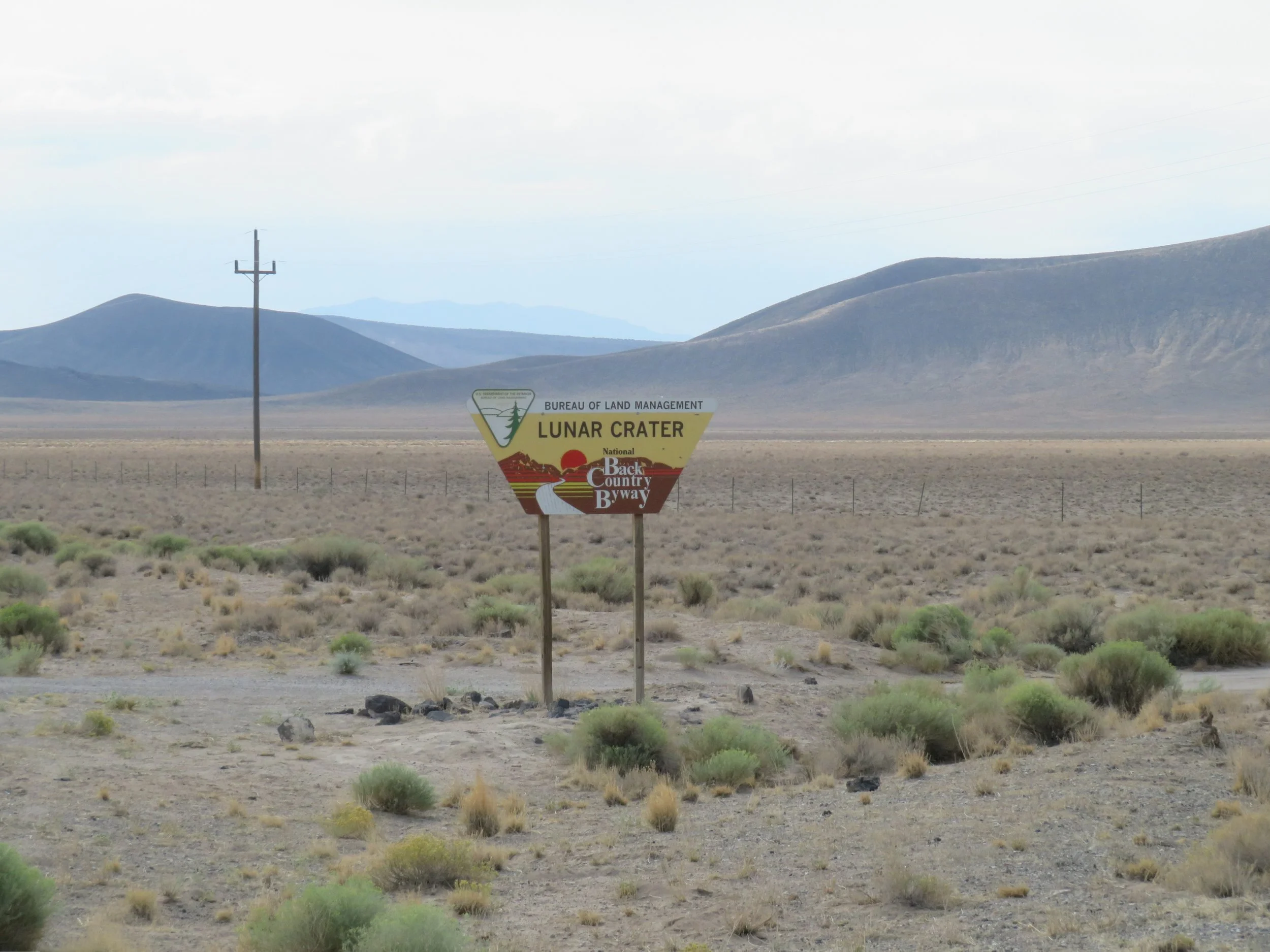
The entrance to the Lunar Crater Backcountry Byway was clearly marked at MM79, indicating a 9-mile drive to our destination. We turned onto the roughly graded, washboard-surfaced BLM-designated Type 2 Byway, which requires high-clearance type vehicles. We bumped and bounced at 10mph for ~ 6 miles (not 9) before reaching the crater, having jarred several dental fillings loose in the process. In places, the road was hard-packed and rutted. In other spots, the sand was deep and would have posed a definite issue for low-clearance vehicles. The ride was never smooth.

The entrance to Lunar Crater Backcountry Byway was well-marked.
We bumped and bounced at 10mph for ~ 6 miles (not 9) before reaching the crater, having jarred several dental fillings loose in the process.
We finally reached the crater and parked. Unfortunately, all the signs at the crater itself have been removed. The initial path along the crater rim led to a bench and an overlook.
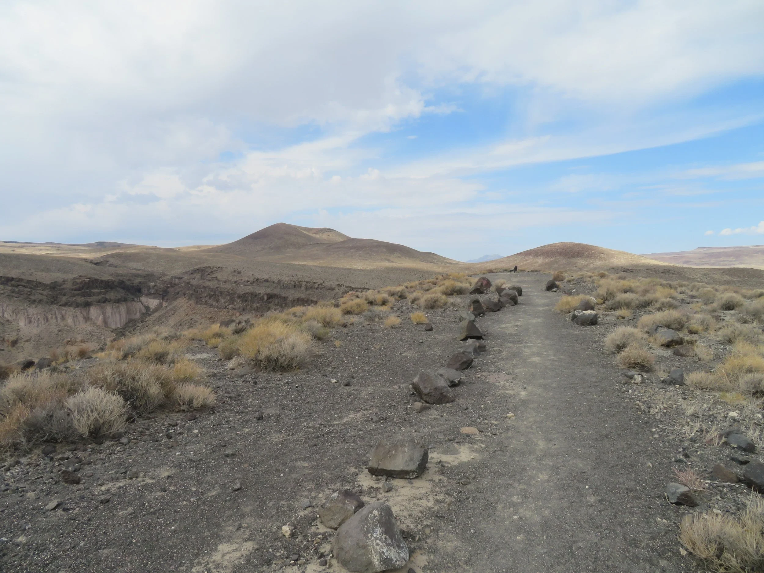
Continuing on past the bench was a 1.7-mile out-and-back trek over a barely discernible, volcanic rock-strewn hint of a path. We estimated the wind at about 25 knots (25-30 mph). We climbed to a hill on the west side of the crater for the best views of the crater.
The best view was from atop a hill on the west end of the crater.
The land is arid and parched, with a few rabbitbrush bushes to lend scant spots of green to the scenery. We spotted lizards and a horned lark hanging out at the crater’s rim.

Horned larks are common in the Great Basin’s open, arid landscapes.
In the distance, the lunar scape was beautiful and otherworldly.

My favorite view in the Lunar Crater volcanic field was both beautiful and otherworldly.
It’s interesting to note that in 1972, astronauts from the Apollo program, including the crews of Apollo 16 and 17 trained at the Lunar Crater in Nevada to learn to recognize volcanic features on the Moon and practice geological field exercises and rover traverses.


This is BLM land and free dry camping is allowed here. We originally thought we might camp here and boondock for the night, but the area is so barren and so very, very windy, we gave it a pass. The Lunar Crater Backcountry Byway is a 24-mile unpaved loop, according to the BLM, but OffRoad Trails indicates it’s actually ~20 miles end to end. The choice of continuing another 14 miles or retracing the initial 6 miles to the paved US-6 highway was a no-brainer. We figured it was time to move on towards Ely, another 87 miles east.