

Cathedral Gorge State Park – Slot Canyons Galore
/Home again, home again! After five weeks traveling in Portugal and Spain, we were glad to be sleeping in our own bed once more, glad to have clothes to change into other than those in our backpack, glad to have a washer and dryer handy. We were not so fond, however, of the triple-digit temperatures that greeted us in Las Vegas when we arrived.
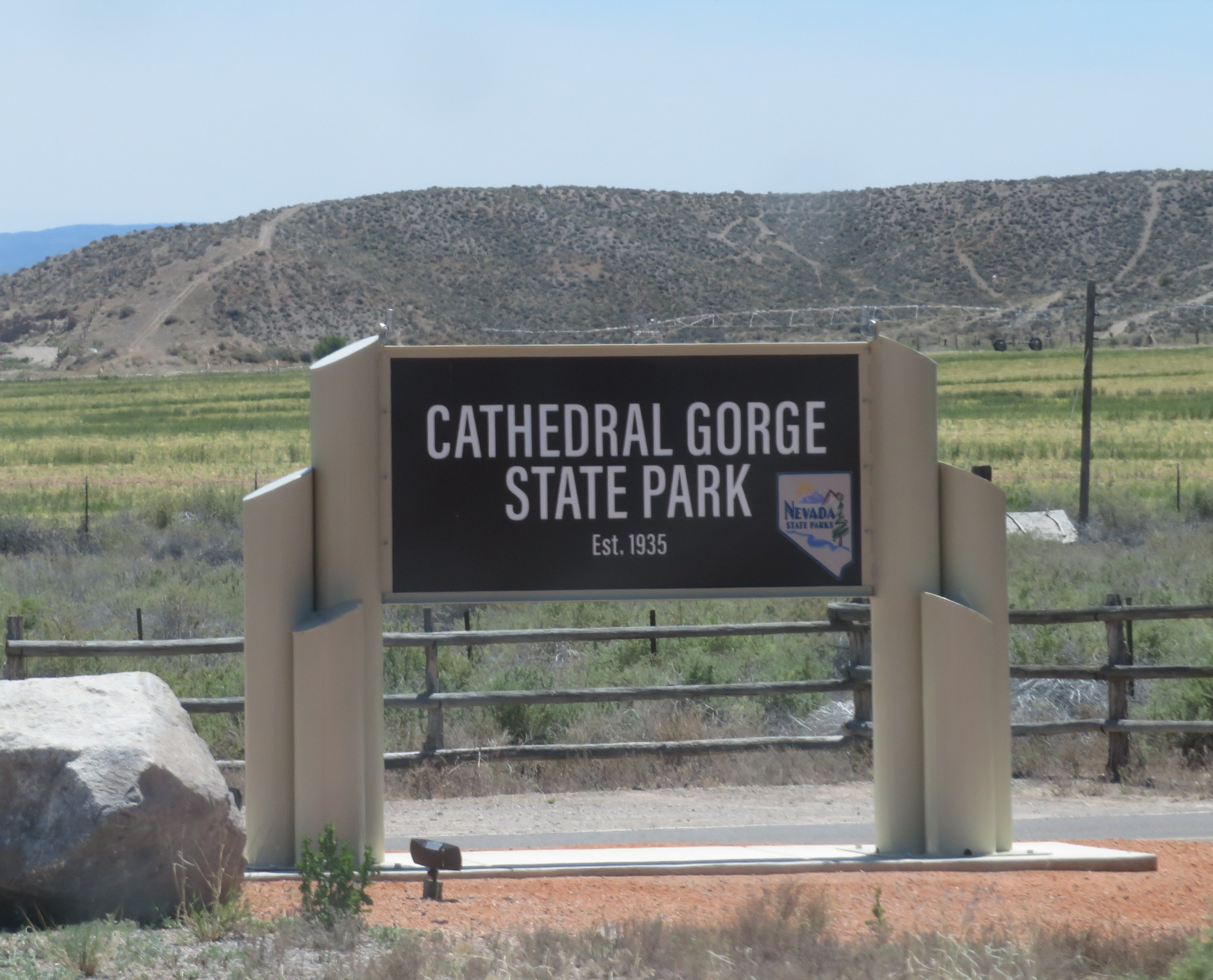
After a week of catching up on piles of mail, routine medical appointments, paying bills, and unpacking, the heat was getting to us, and we were already antsy to be doing something other than sitting in the A/C trying to keep cool. Temperatures a bit further north seemed more moderate, so we headed 180 miles north to Cathedral Gorge State Park. We’d visited this park briefly before, but never to camp or do any serious exploring. With our Nevada State Parks Senior Pass, we were able to book a site for $10/night, including electric and water… quite the bargain.
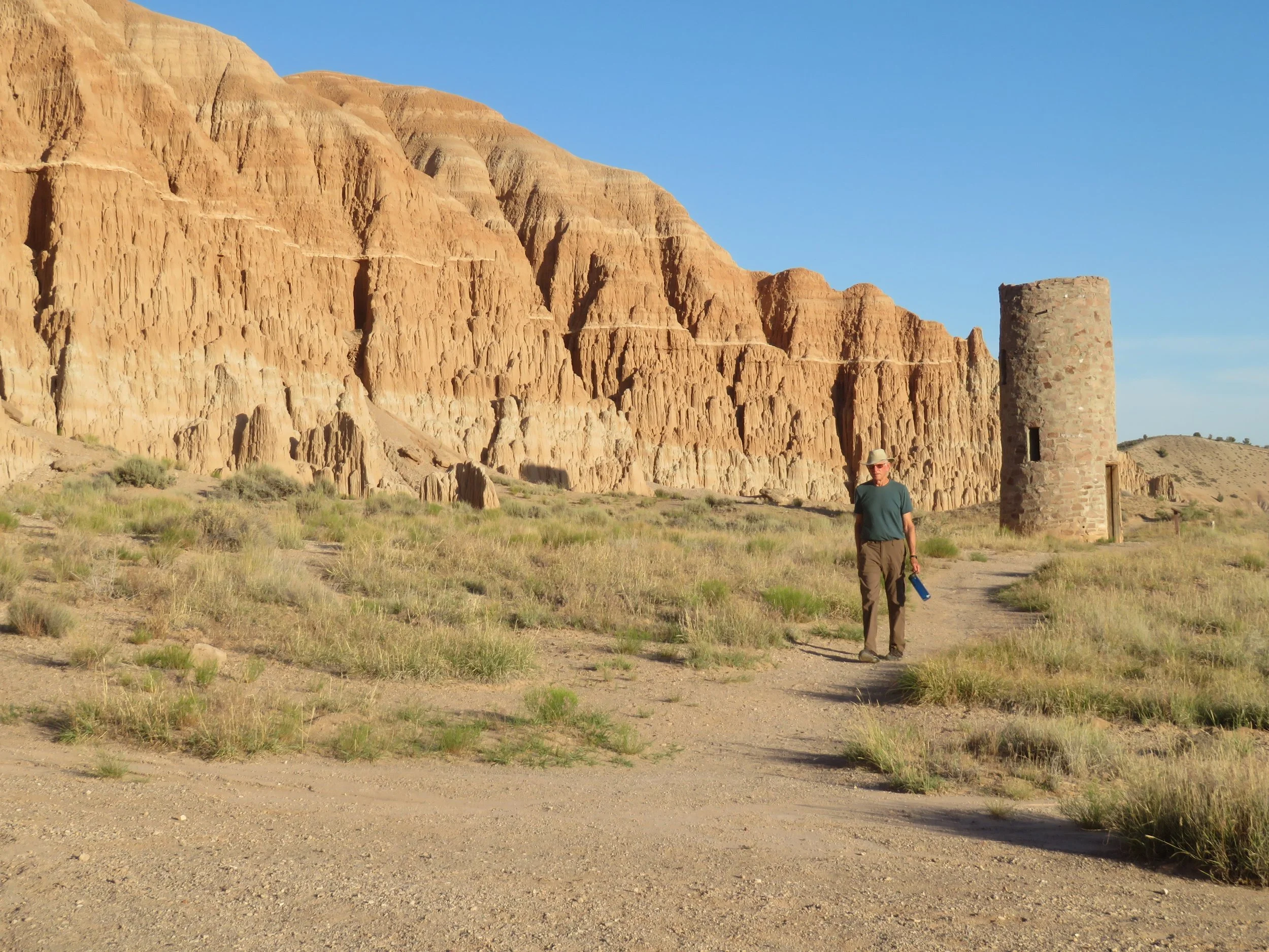
Cathedral Gorge, once home of the Fremont and southern Paiutes, became one of Nevada’s first state parks in 1935. Original facilities were constructed by the CCC in the 1930s, and a few buildings still exist, including an old water tower.
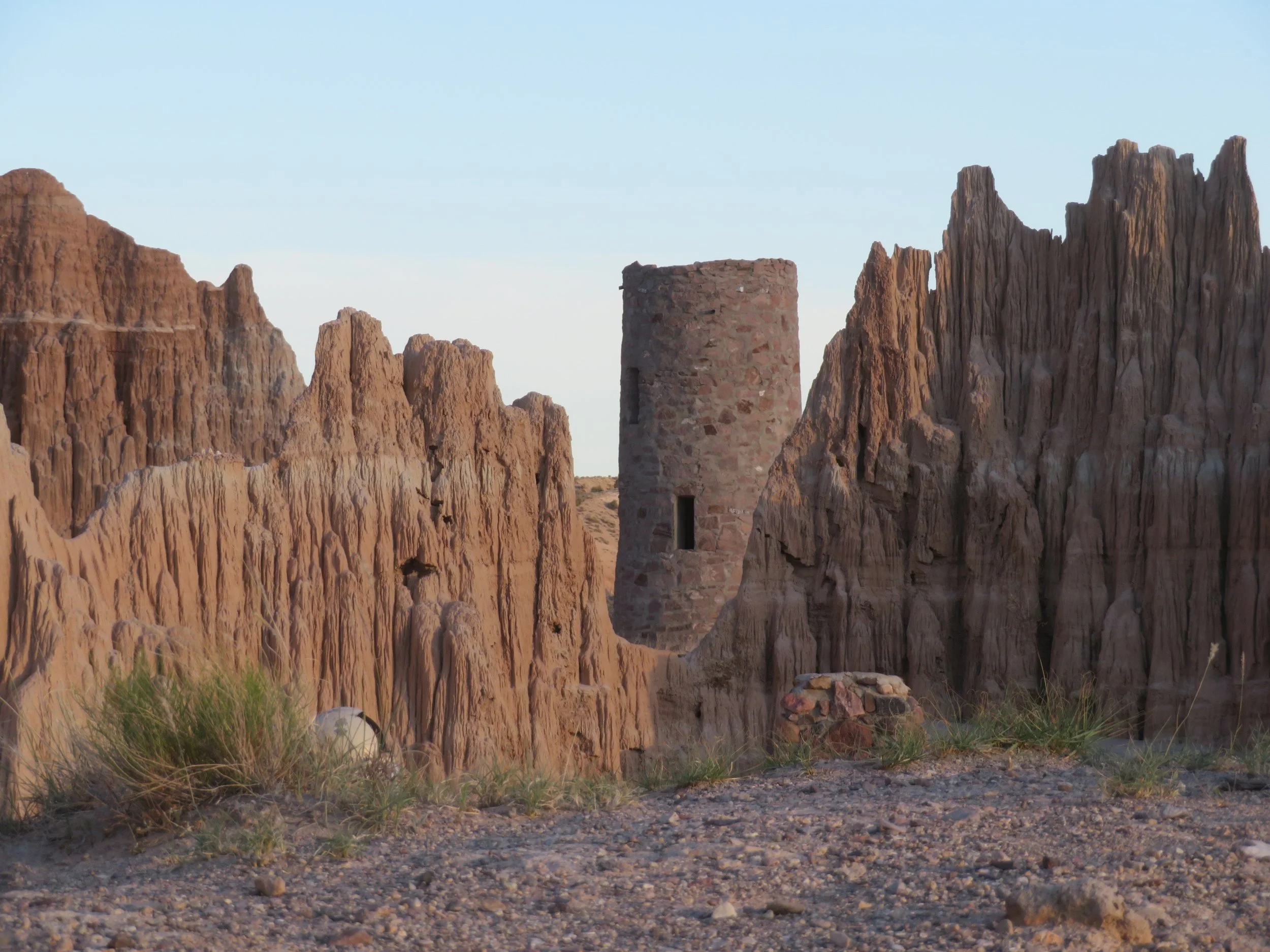
An old CCC-built water tower
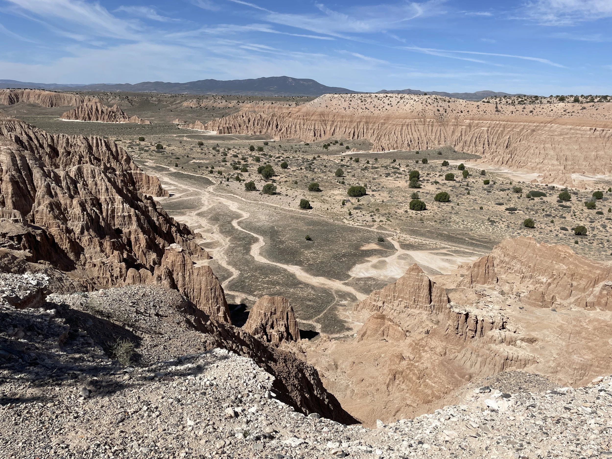
Volcanic action, earthquakes (Nevada is the third most seismically active state in the USA), weather, erosion, and water are responsible for the rugged cliffs and towering spires that have sculpted Cathedral Gorge. The terrain is moonscape badlands previously covered in the Pliocene era with a huge freshwater lake.
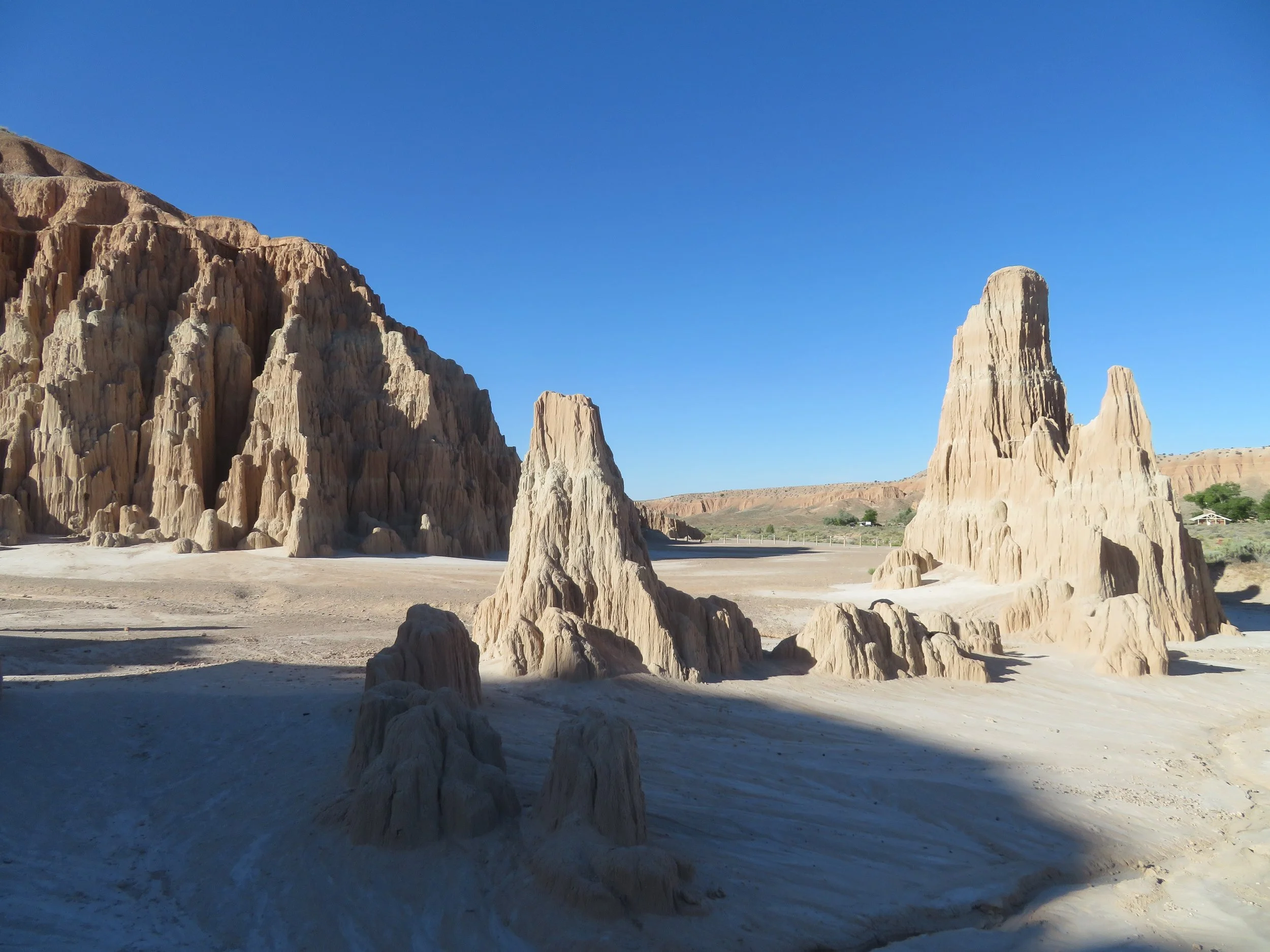
According to the state park brochure, the distinct striations and layers in the rock and sediment attest to “fluctuating lake levels and the flow of rivers and streams that deposited silt and clay into the lake.”
We arrived late afternoon, found our campsite, and set up camp, which for us was setting out two camp chairs, a table, and grabbing two cold beers out of the fridge. I’d packed dinner and snacks so the evening was ours to squander.
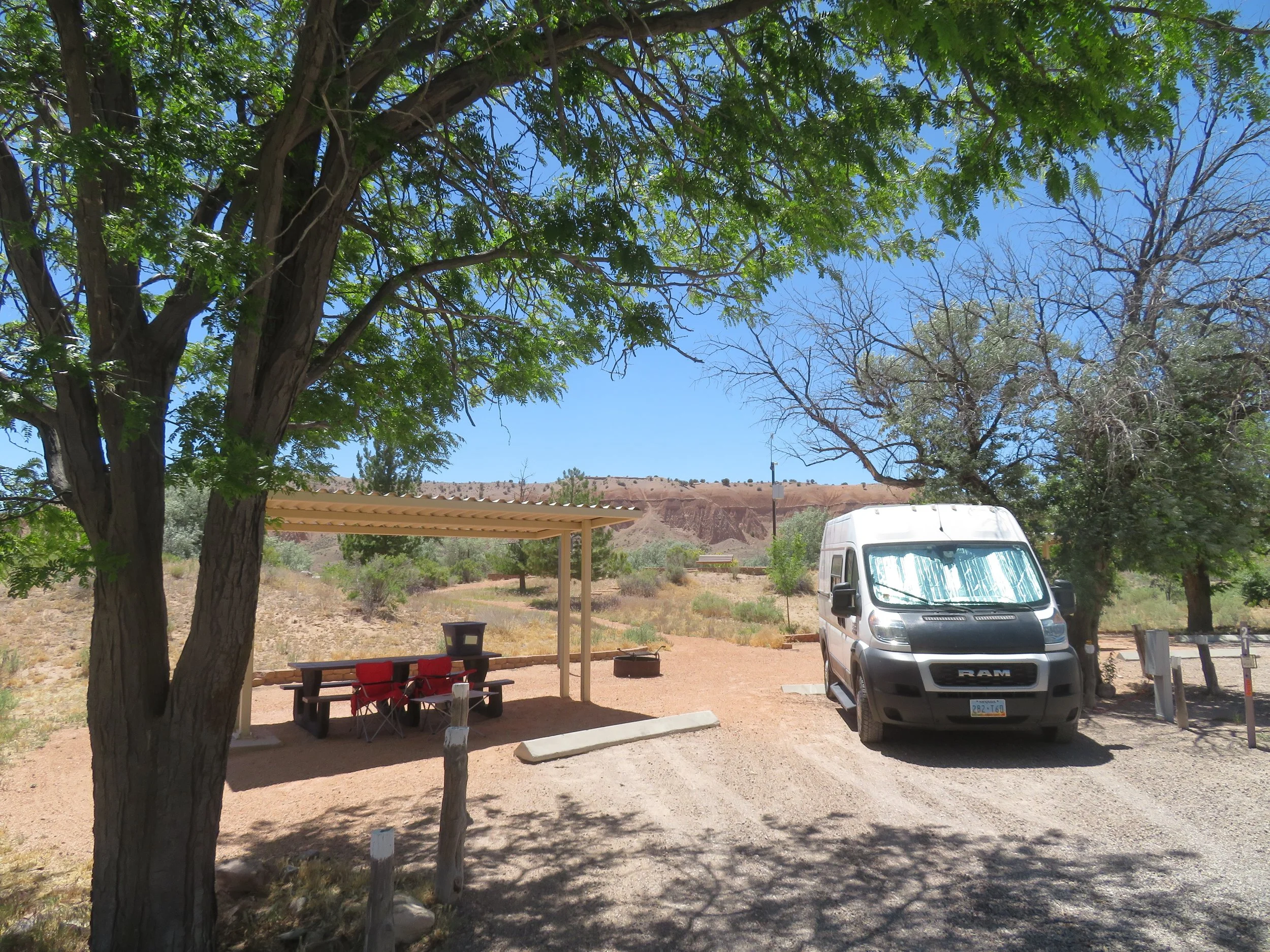
Campsite at Cathedral Gorge SP
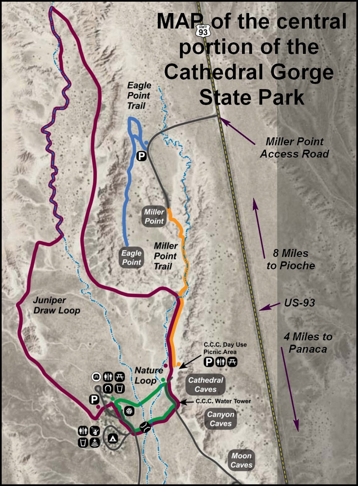
The park has six developed trails, all fairly easy.
Though we were at 4800’ elevation, it was still hot… hotter than we expected, but tolerable. As evening approached and the day started cooling down a bit, we ventured onto the very short interpretive Nature Trail. The sandy path led through sage and juniper across a couple of small washes to a picnic area and the CCC-built water tower, which was abandoned long ago due to high alkali content. Dozens of lizards skittered around. We spotted a black-tailed jack ducking under a bush.
On the Nature Trail
Beyond the tower were the buff-colored cliffs and lofty, cathedral-like spires for which the park is named. Though we estimated the spires were probably 30-50 feet tall, from our perspective on the desert floor, they appeared to be skyscrapers.
We spent the rest of the evening reviewing the park brochure and planning our walks for the next day. We woke early to the incessant cooing of a mourning dove perched on a tree directly above Blanche. The temperature was cool, morning coffee in our camp chairs was delightful, and we were happy to head out onto the 3-mile Juniper Draw Loop Trail for a morning walk.
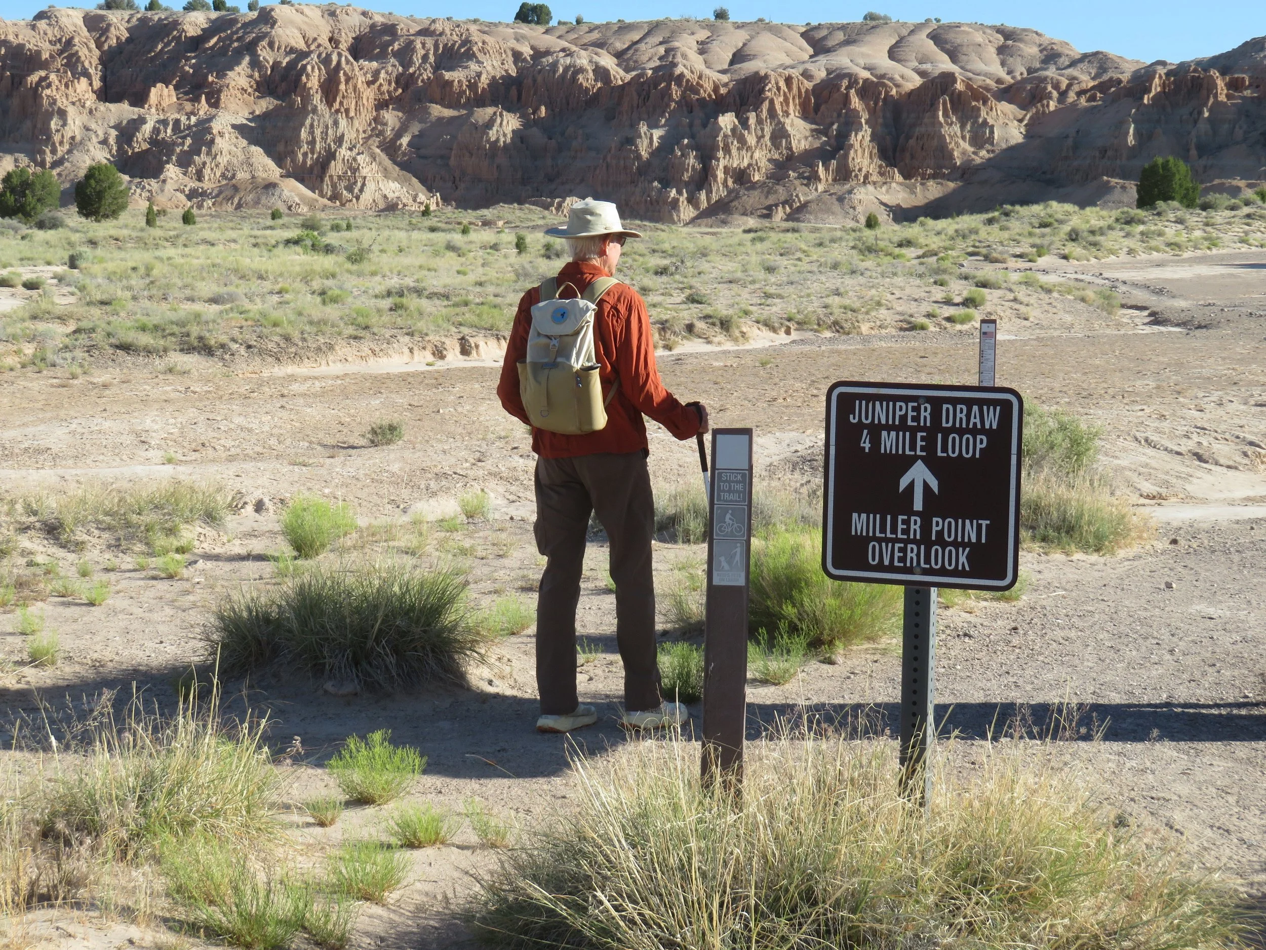
The trail is easy, flat, and sandy on the desert floor and meanders along the base of the rock formations, looping back to the campground. The views were definitely moonscape-ish with multi-leveled spires jutting up out of the ground and towering above us.
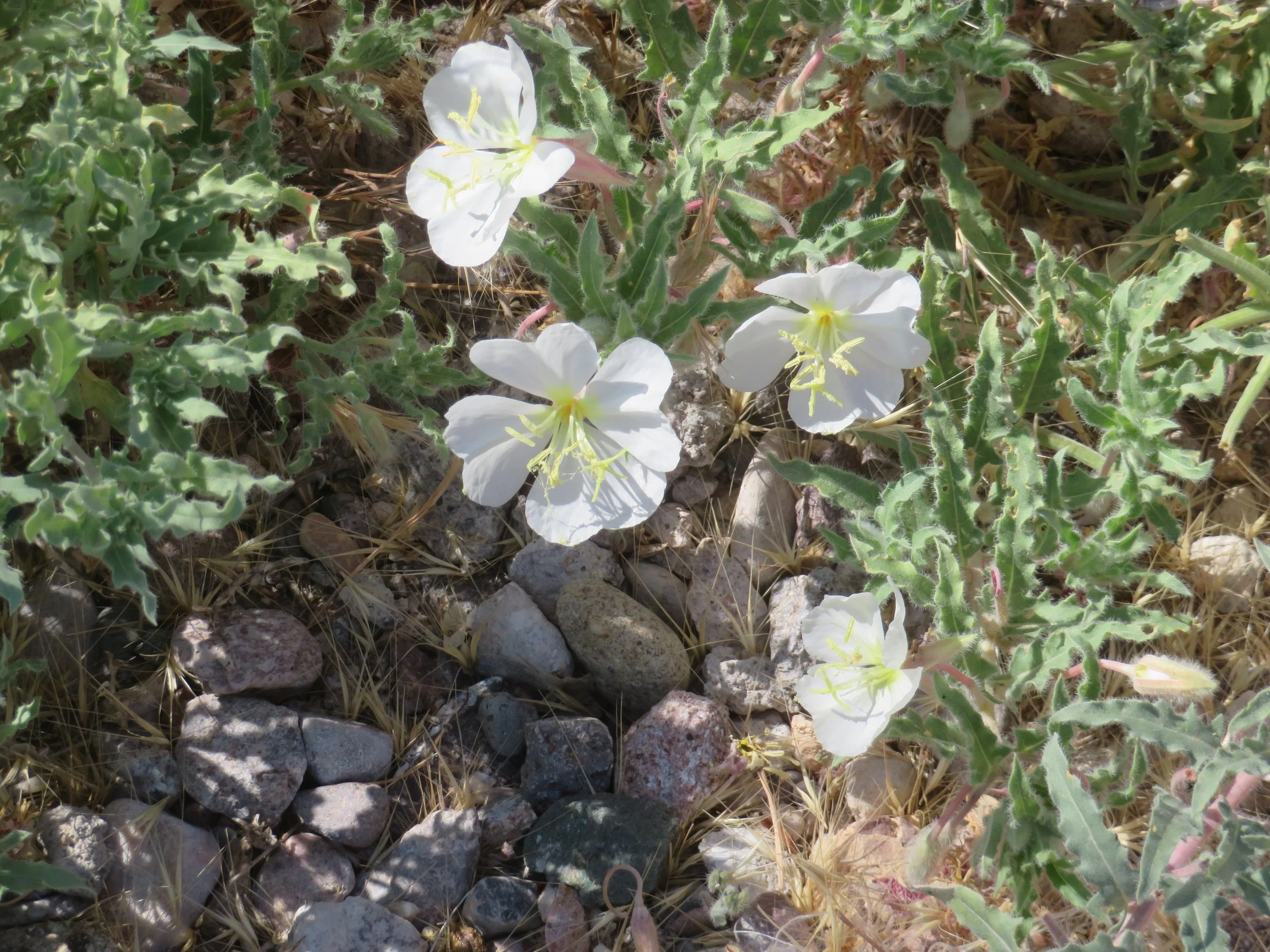
Several wildflowers were in bloom and we wondered how such lovely, seemingly delicate flowers were hardy enough to survive this arid, hot climate. Such are the mysteries of Mother Nature.


We returned to camp for a blueberry pancake breakfast and more coffee. The morning got away from us with planning, chatting, and more coffee and reading. The temperature rose, and we moved our chairs to find shelter under the ramada for a few hours. It was hot!
We headed out for an early evening walk after dinner. This time we chose the Miller Point Trail, a moderate 2-mile out-and-back trail, through a canyon, over some rocky terrain, and up several sets of stairs to the Eagle Landing Overlook. This trail was rougher than the previous trail, but much more interesting, walking along an old dry wash, then maneuvering up stone stairs and wooden staircases.
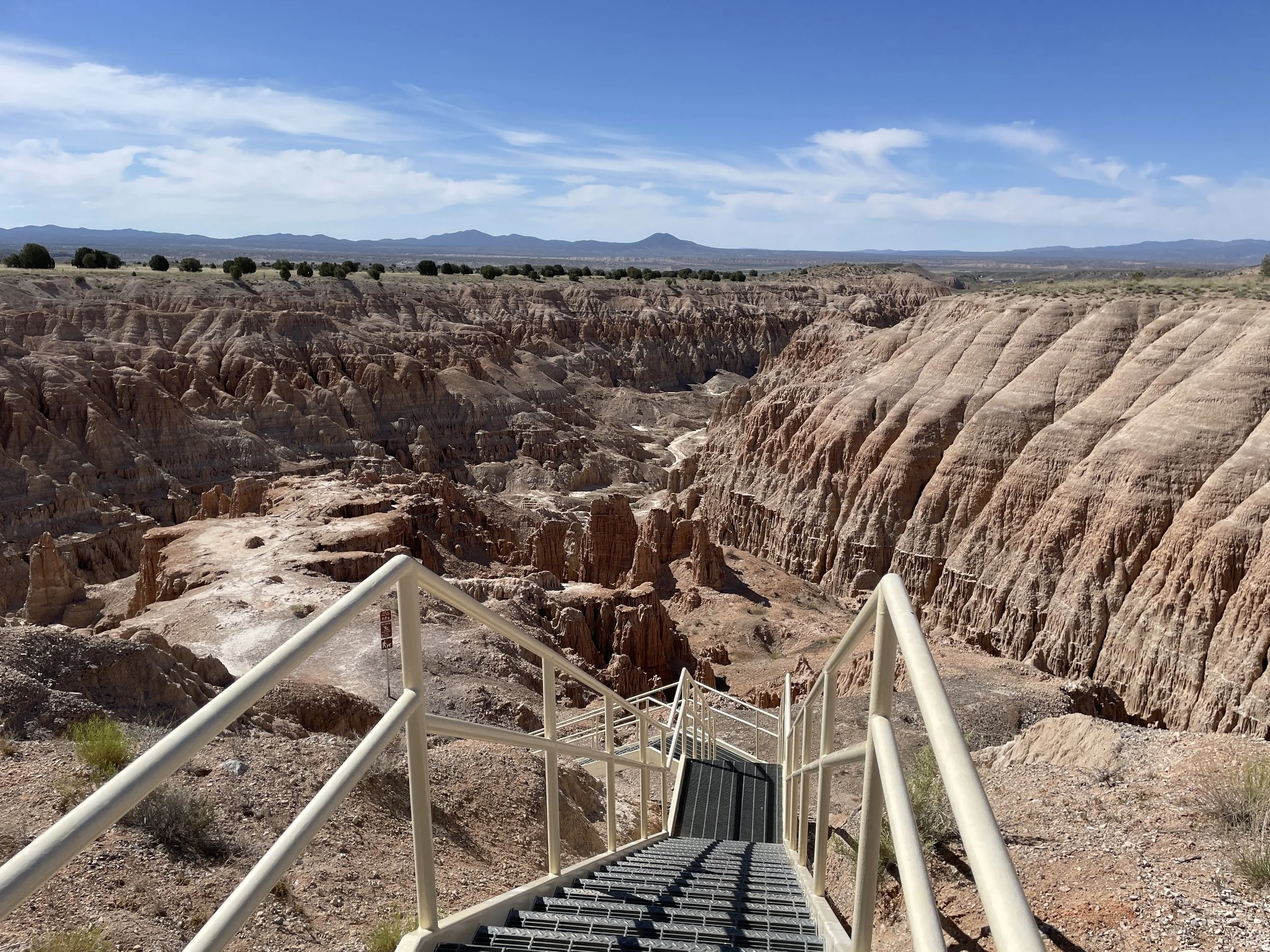
The views from the top of the cliff at Eagle Landing were outstanding.
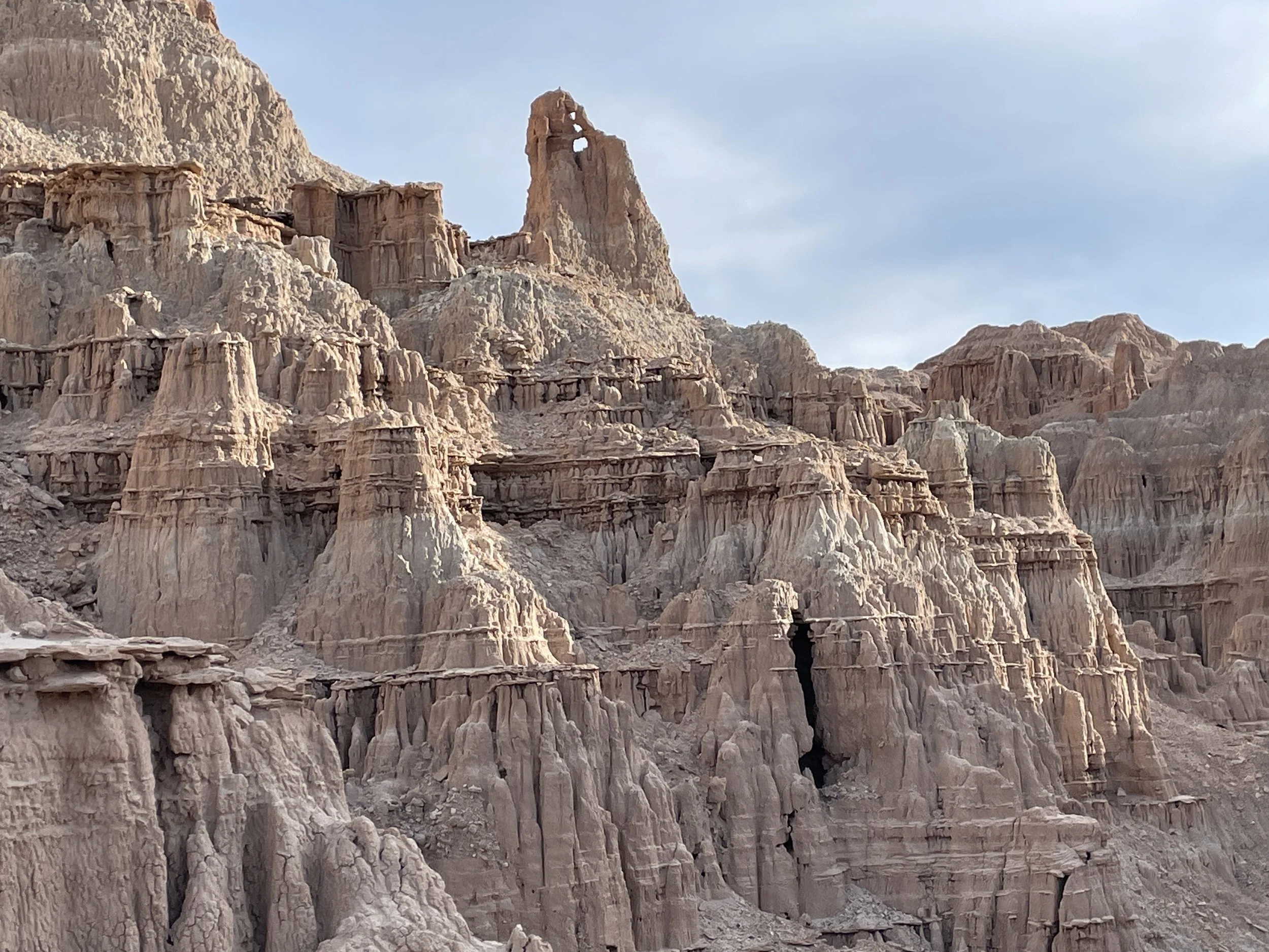
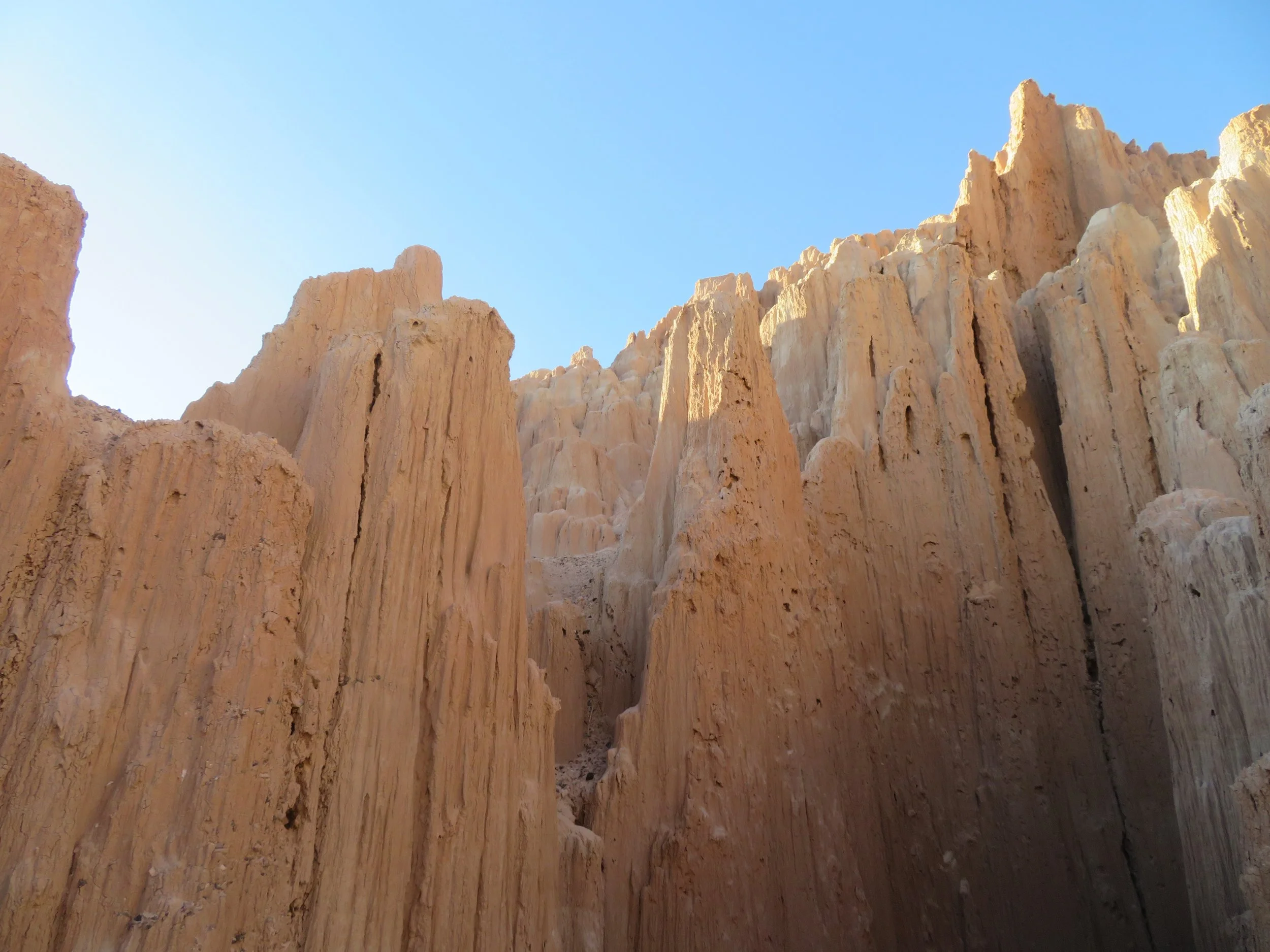
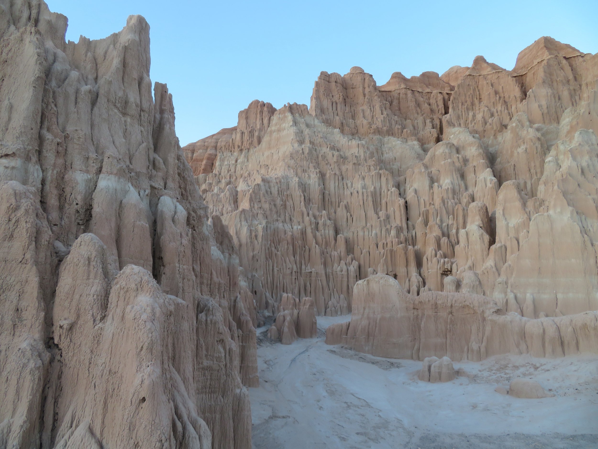
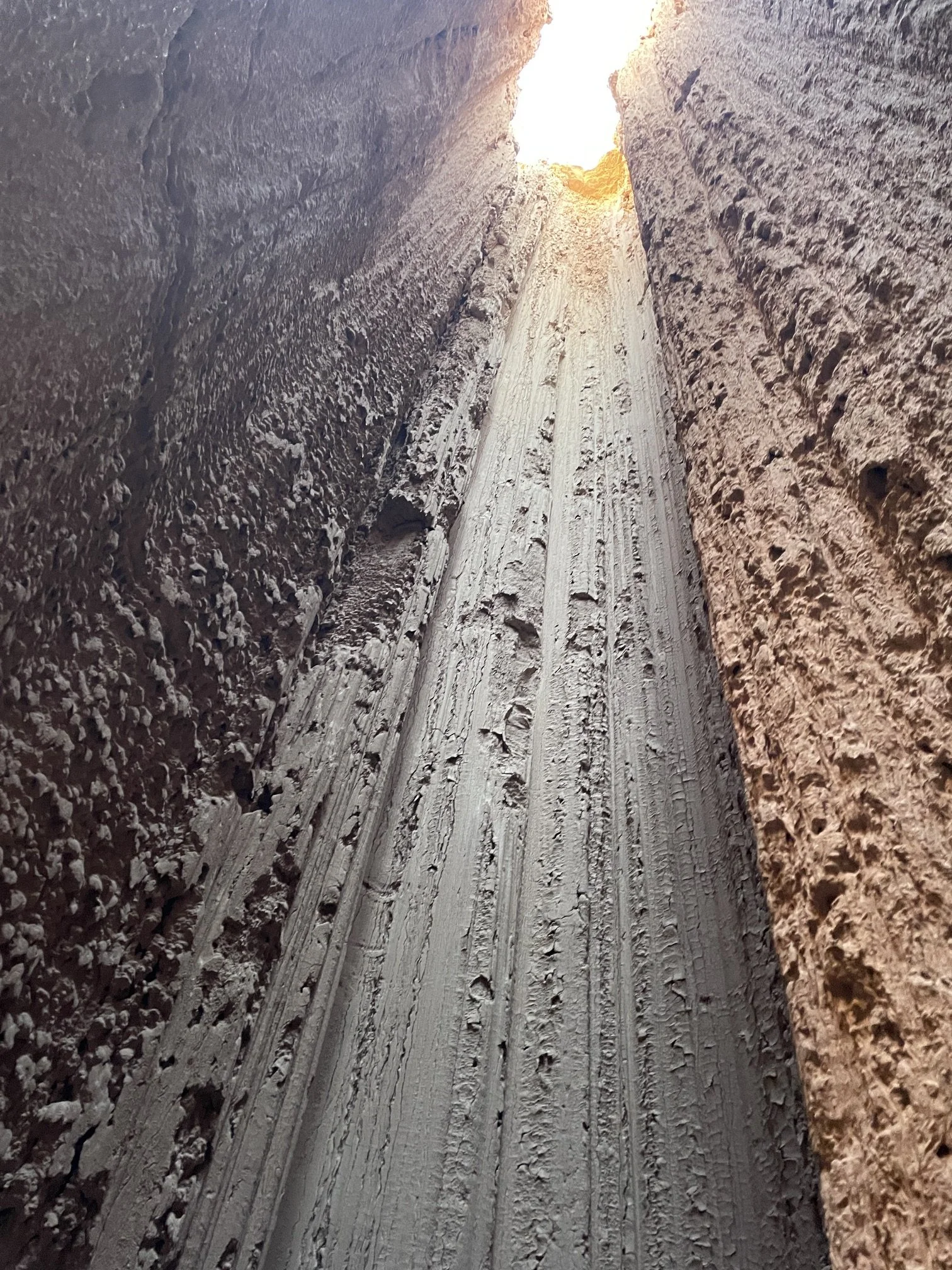
We were up early to avoid the heat and walked directly to the Slot Canyons. We had unknowingly saved the best for last. There were dozens of trails that extended into the spires several hundred feet. We squeezed through narrow passages and followed a labyrinthine path deeper into the rock formations. It was cool in the depths of the spires.

There were some pretty tight fits!
When we looked up, we could see the tips of the spires and a bright, sunny sky above us. It was awesome.
Though we were enjoying the park, it was too hot for comfort, and we decided to head back to Las Vegas. We stopped at the Visitor Center briefly (no one was there), but the vibrant, native red dome blanketflowers were worth the stop.
Nearby, we found the short, rocky trail up the old Bullionville Cemetery. It’s a dry, windswept, lonely place. Sadly, many of the cemetery’s residents were young children.


Bullionville was originally founded c.1870. Because of the availability of water, mills were built here to treat ore from nearby Pioche. In 1872, construction of a narrow gauge railroad (the Pioche & Bullionville RR) was begun to transport ore the 21 miles to the mills. The population of the town grew to 500 by 1875, and businesses began to flourish. Pioche, in the meantime, developed its own waterworks plant to provide water for treating the ore. By the end of the decade, Bullionville was abandoned.
On the way back to Las Vegas, we stopped in two old Nevada towns… Pioche, a mining boomtown with its own Boot Hill and “a notorious reputation for violence”, and Caliente, known for its hot springs and iconic, early 20th century railroad station. Join us.