

Australia ... Land Down Under
Australia, where everyone hangs by their toes trying not to fall off the world! It's a land of inherently friendly people, many of the world's most dangerous snakes and spiders, an inordinate number of marsupial animals you've never heard of before, vast deserts, endless beaches, Great Whites, salt water crocs and the world's deadliest jellyfish. In other words ... it's ace, mate!
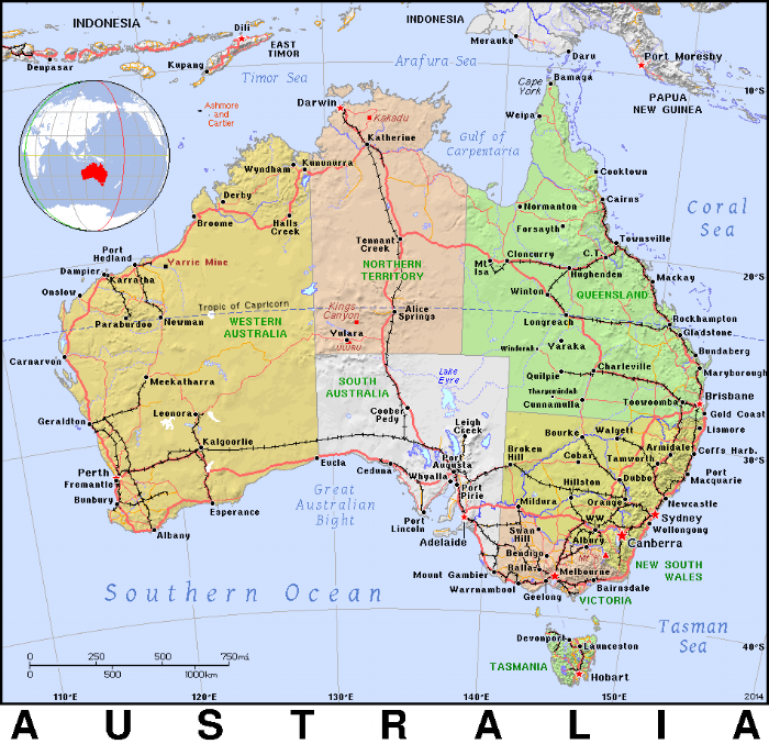
Commonwealth of Australia
Population: 24.3 million (est 2016)
Area: 7,686,850 sq km - 6th largest country in the world and smallest continent. Australia is about the size of the contiguous 48 United States and 50% larger than Europe.
High Point: Mt Kosciuszko-2,228m (7,310') ASL
Low Point: Lake Eyre -15m (-49') BSL
Currency: Australian dollar $AUD
Time Zones: Eastern Standard Time (EST) +10UTC; Central Standard Time (CST); +9-1/2UTC; Western Standard Time (WST) +9UTC
The country is divided into 6 states plus 2 territories*: Australian Capital Territory* (ACT), New South Wales, Northern Territory*, Queensland, South Australia, Tasmania, Victoria, Western Australia.
The thumbnails below are arranged in chronological order to provide some continuity to our passages along the Australian coast. From our arrival port in Bundaberg, Queensland to our departure port from the Cocos Keeling Islands in the Indian Ocean, it's all there to share. We've also included some fun Aussie facts and trivia, too.
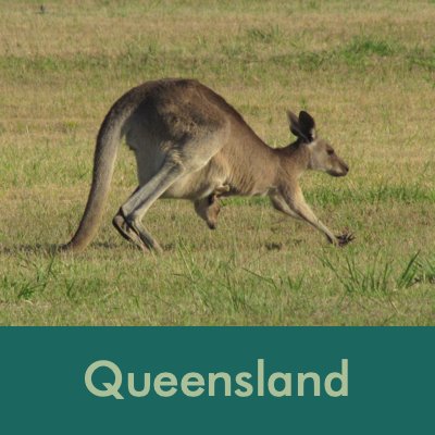
Arrival in Queensland, Australia - Port of Entry Bundaberg

Queensland occupies all of Australia's northeast corner and most of it is protected by the Great Barrier Reef. It's considered to be Australia's "sunshine state" with 300+ days of sunshine per year. That said, they've also experienced substantial flooding in recent years due to cyclones.
Bundaberg, our port of entry, is at the bottom of the Great Barrier Reef and we're not quite sure what our itinerary will be. We planned to go to Sydney for its world-famous New Year's Eve celebration and then who knows? Perhaps we'll go north at some point to explore the reef or continue south and around up the west coast. Both routes have their pros and cons and going south to Tasmania is a big draw for us.
We arrived in Bundaberg on 8 November 2011 as part of the annual Port-to-Port Rally (P2P). The rally was not a "travel in company" type rally, but rather boats mostly leaving from points in Vanuatu and New Caledonia were meeting up in Bundaberg for several weeks of festivities and events. The P2P folks also ran a daily SSB net each morning and when we could, we checked in with our daily position and conditions. The 1000nm passage from Vanuatu was fun and fast with a one-week stop at Chesterfield Reef.
Bundaberg, located on the Burnett River about 20 km inland from the coast, is a thriving city dominated by the sugarcane industry which surrounds it, but it’s also supported by the growth of beef and dairy cattle and tropical fruit, e.g. bananas. The area provides nearly 20% of Australia's sugar and is the country's largest producer of brown rum (known as Bundy Rum) and traditional ginger beer. The city was named in 1867 after an aborigine elder "Bunda" and the Saxon word for town "berg". It became a town in 1902 and a city in 1913. Locals shorten the name of the city to Bundy and the nicknames for Queenslanders are Cane Toads and Banana Benders. More about cane toads later.
Entry to Bundaberg is up the Burnett River past the Southhead Lighthouse. The historic Burnett Heads Lighthouse was moved to its present site in a park when it was replaced by the boring one shown below.


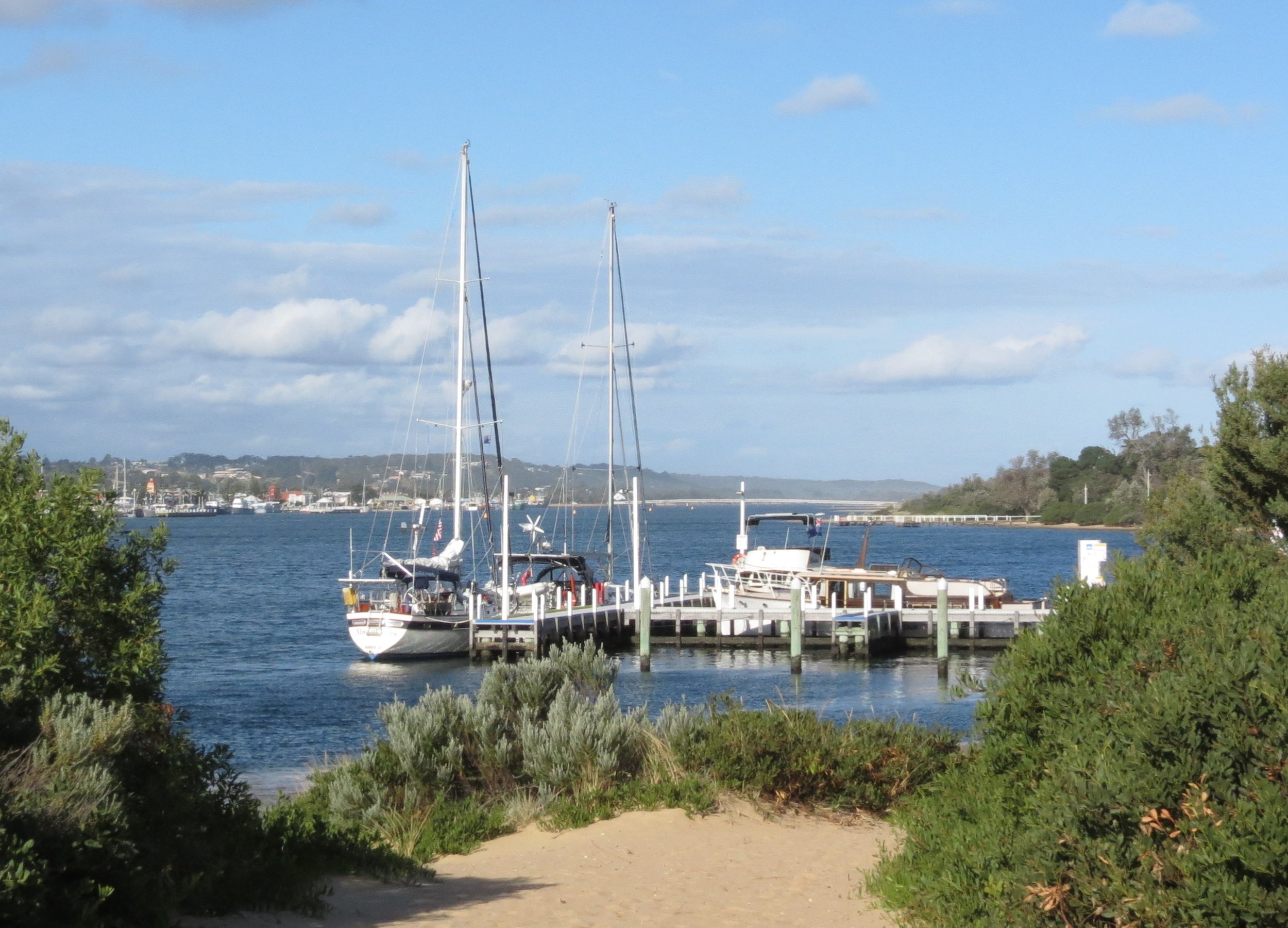
Berthed Bundaberg Port Marina - 24S45.62 / 152E23.30
The marina is located about 20km from the city in the bush which is to our advantage when looking for local wildlife! The iconic kangaroo was our first wildlife sighting. We spotted a dingo (wild dog) and a huge hare right in our own backyard in a field behind the marina. While walking nearby, we spotted so many birds with which we were unfamiliar. The variety and sheer number of birds was incredible.


We walked every morning in a park along the Burnett River. The poinciana trees (aka flambuoyant or flame trees) were all in bloom.


‘Two nations separated by a common language.’ (Churchill, Shaw or Wilde?)
Though the reference was to America and England, the same applies to Australian English and American English. Here's a comical idea of how misunderstandings take place though we thought we were speaking the same language...
David was asking someone about fishing rules and regulations.
What David heard: "If you're fishing Monday, you gotta throw 'em back.
What Tom said: "If you're fishing mundi, you gotta throw them back.
David: If you're fishing Monday, you've gotta throw back what you caught?
Tom: Yup
David: That's a strange rule. Why do you have to do that?
Tom: Ever since the flood, there haven't been as many of them.
David: Mondays???
Tom: Yup
Translation: Tom said: If you're fishing for mundi (that's slang for barrimundi, a type of local fish), you have to catch and release.
On a day trip south of Bundaberg, we spotted a goanna, the generic Australian name for some 20 species of native monitor lizards that call Australia home, 15 of which are endemic. Another instance of not understanding the language, I thought it was an iguana, but no, it’s a gonna. There are all sorts of animals with which we’re unfamiliar here and are surprised to find. While walking on a trail in Burrum NP, for instance, I noticed a large branch across our path in the distance. As we came closer, it was definitely not a branch, but rather a very large (8') python stretched across the track out for his morning stroll... I mean, slither.
A word about snakes: There are 140 species of land snakes in Australia and a further 32 sea snake species. Of the 140 land snakes, 100 are venomous. Of the 10 most venomous snakes in the world, 5 are native to Australia!


When Man Interferes with Nature or Yuck… Cane Toads
As the sugarcane center of Australia, Bundaberg's landscape is flat. The soil is red and field upon field is planted with sugarcane. Narrow gauge rail trains transport the cane from the fields to collection and processing centers. Cane toads are large, warty, poisonous amphibians native to South and Central America and are considered to be one of the worst invasive species in the world. These giant toads averaging 4-6” (10–15 cm) in length, were introduced into Australia in 1935 in an attempt to control pest beetles in the sugar cane industry. They were unsuccessful in their control efforts, but very successful at invading the ecosystems of Australia’s north. They’re now considered a pest species. Watch a very funny Cane Toad Video Clip here.


At the Boomerang Factory
We took a day tour organized by the Port2Port rally folks. The highlight of the afternoon was a visit to a boomerang factory. This mom-and-pop operation was pretty slick. We saw how boomerangs were fabricated and the aerodynamics involved in creating a boomerang that does indeed return to you if you throw it correctly. We'd seen colorful boomerangs in local souvenir stores that were great for show, but didn't actually "come back". These do! In fact, each one is marked "flight tested". We took several out into a cane field and everyone took a turn at throwing them. The men seemed to do much better than the women, the trick being a strong flick of the wrist to get it airborne. Needless to say, several folks back home got boomerangs as Christmas gifts.


Our last morning in Bundaberg was wonderful. We went for an early morning walk and spotted a mob of kangaroos grazing in the cane field behind the marina. We spotted the doe and her joey and got some good shots of the photogenic family. Song & lyrics: Tie Me Kangaroo Down


Down the Queensland Coast to New South Wales
We first left Bundaberg on 1 December, but turned back immediately into the berth with engine problems. The problems were fixed immediately, but we lost our weather window until 6 December when we finally left Bundy and headed down the Sandy Straits behind Fraser Island where we waited for another weather window to head to Mooloolabah, then on to Moreton Bay near Brisbane. On 18 December, we left Southport at the southern end of Queensland and crossed into the state of New South Wales. What should have been a 5-7 day passage from Bundy to Sydney was becoming a major commitment of time, mostly waiting for any weather window with some northerly wind component. The total trip took nearly two weeks. We began to doubt that we'd make it to Sydney for Christmas, but thankfully we entered Sydney Harbour on 22 December. Come on along for the passage south.
Off the Ship Channel near marker S9 - 25S17.04 / 153E00.66 - 40'
Wide Bay Anchorage/ Elbow Point - 25S45.93 / 153E00.57 - 37'
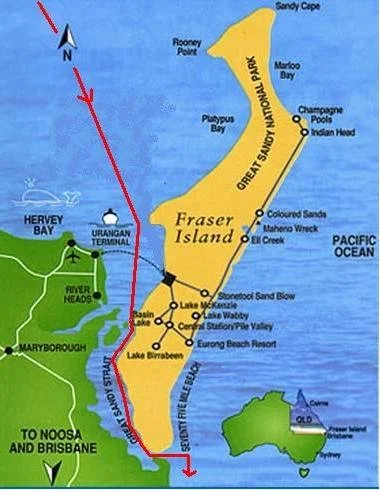
When we were ready to leave Bundy and head south to Sydney, the winds and weather did not cooperate, leaving us with little time to get to Sydney by the time our friends were scheduled to arrive. Only 700 miles, we thought it would be an easy sail.... WRONG! When a weather window finally appeared, we began the passage south, but it was much slower than anticipated because of the short windows of opportunity. We ended up doing mostly day sails, anchorage hopping to gain a few miles each day while awaiting each day's weather surprises. Our first two days we had a good current to help us, but it was offset by SE winds on the nose. To avoid big seas, we ducked behind Fraser Island and through the Great Sandy Strait and waited for the tide to head out over the Wide Bay bar and back into the Coral Sea/Pacific Ocean. The area appeared to be lovely and well worth a stop, but we whizzed through. It's on "the list" for our trip back up this coast.
The Double Island Point Lighthouse has been operating since its completion in 1884. It is constructed of metal cladding on a timber frame as is typical of many Queensland lighthouses. We passed it on our way from Wide Bay to Mooloolaba. The Mooloolah River is shallow and muddy. We had a hard time finding a good anchorage as those areas deep enough for us were very tight and crowded, but we managed.


Continuing down the coast, we sailed past the city of Caloundra stretching across the white beach shoreline with a backdrop of some very distinctive mountains. These distinctive peaks remained highly visible and got us wondering about them. They are part of the Glass House Mountains. Named by Captain James Cook in 1770 as he sailed north up the coast of what is now Queensland as part of his epic voyage aboard the HM Bark Endeavour. He named them because the shape of the mountains reminded Cook of the huge glass furnaces (glasshouses) back in his native Yorkshire. The twelve peaks are the cores of extinct volcanoes that formed ~27 million. These mountains are located in the traditional lands of the Gubbi people and appear in the Aboriginal legend. The area has been part of the Australian national park system since 1994.

A View of The Glass House Mountains near Caloudra

Bongaree, Bribie Island - 27S04.96 / 153E09.38 - 37'
Bribie Island, 34km x 8km at its widest, is the smallest and most northerly of three major sand islands forming the coastline sheltering the northern part of Moreton Bay, Queensland. Bribie Island hugs the coastline and tapers to a long spit at its most northern point near Caloundra. It's separated from the mainland by the narrow Pumicestone Passage. Most of the island is uninhabited national park and forestry plantations. The southern end of the island is intensively urbanized. Buckley's Hole, at the southern tip of the island, is an important bird habitat and refuge.
Bribie Island fortifications were constructed from 1939 to 1943 as part of the defence of southeast Queensland during WWII and to provide artillery training for Australian soldiers. The remnants of the fortifications are still found on the island. Pumicestone Passage, which is located between the island and the mainland is a protected marine park that provides habitat for dugongs, turtles and dolphins. There are also extensive mangrove forests in this area. Eucalypt forests, banksias and heathlands are the predominant vegetation elsewhere. Bribie Island is home to around 350 species of birds, including a range of honeyeater species, lorikeets, waterbirds and birds of prey. Again, in our haste to move south, we only spent the night at anchor and left early the next morning. We could see and hear trees filled with white cockatoos and it only reinforced our plans to come back up the east coast at a leisurely pace.

We anchored across from The Bongaree Jetty located in the ‘urbanized’ area of the island.

Karragarra Island - 27S38.14 / 153E22.92 - 17'
From Bribie Island, we clung to the coast near Brisbane port and then cut across the ship's channel and headed across Moreton Bay along the inside passage and wended our way south. We were somewhat disappointed to have to pass by the entrance to the Brisbane River. Only 12 nm up the river is the state capital city of Brisbane and the third largest city in Australia. But once again, the clock was ticking.
Distance as the crow flies is not very far, but meandering through shallow channels was time-consuming and required motoring. The scenery was pleasant and not unlike wandering down the US's Intra-coastal Waterway. We passed through tiny port towns and threaded our way through moored and anchored boats. At last, we came to Southport to wait for northerly winds that would take us along the New South Wales coast to Sydney. We anchored off Karragarra Island one night. The wind against the strong current coupled with constant ferry traffic made for a less than tranquil anchorage.
We got a kick out of the creative houseboats that we passed by. From airstream trailers, to ranch style to totally tacky tarp.


Southport - Marine Stadium (Bum's Bay) anchorage - 27S57.19 / 153S25.31
We certainly were not used to the noise or the traffic of a city. There were evidently no speed limits for watercraft. Jet skis and small, fast boats darted around us at incredible speeds using anchored sailboats as turning buoys for their chases and races. The SuperDuck tour boat motored past each hour on its harbor tour. Water World was also just in front of the anchorage and the hoots, hollers and screams from the big water slide collided in the air with the rev of the seaplane that took off hourly, using the two-boat length space between us and our neighboring boat as his runway. Then there was a tallship in and out of the harbor and parasailing boats whizzed around.


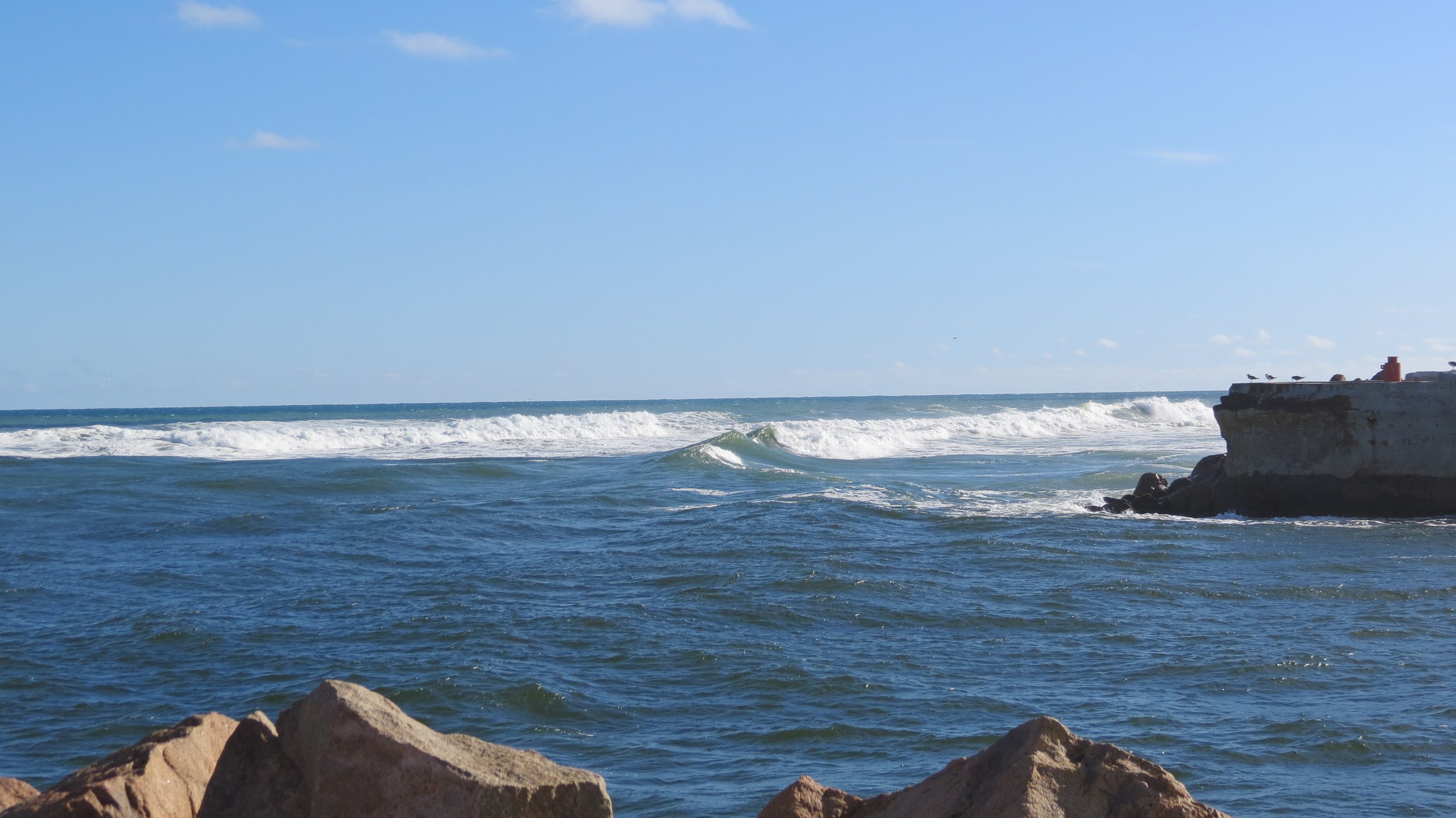
After patiently waiting for a weather window, we headed back into the Pacific Ocean through the Gold Coast Seaway. The Gold Coast Seaway or
Southport Seaway is the main navigation entrance from the Pacific Ocean into the Gold Coast Broadwater and southern Moreton Bay and is one of Australia’s most significant coastal engineering projects. The Seaway enjoys the world's first permanent sand bypassing system which currently delivers all sand that arrives at the Seaway across the entrance and into Moreton Bay Marine Park. Previously, the Southport Bar was a very dangerous entrance until 1986 when the Gold Coast Seaway was constructed. There are now two rock walls that stabilize the position of the entrance.

Passing the breakwater out of the Gold Coast Seaway into the Pacific Ocean was a bit bumpy.

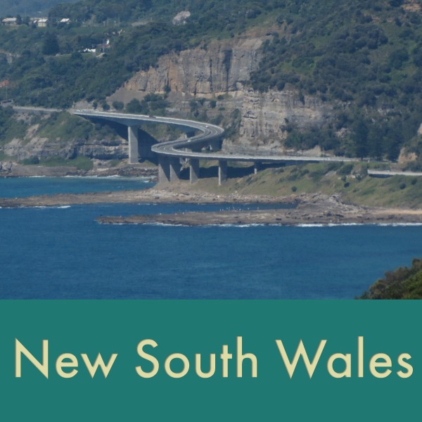
New South Wales
We motored, we sailed and crossed the state border from Queensland into New South Wales, the most populous state in Australia. The original inhabitants of the area were Aboriginal tribes who arrived in Australia approximately forty to sixty thousand years ago. The European discovery of New South Wales was made by Captain James Cook during his voyage along the east coast of Australia in 1770.
The capital of New South Wales is Sydney, the site of the country's oldest European settlement.
Inhabitants of New South Wales are referred to as New South Welshmen or less pleasantly as cockroaches, mostly because of rubgy rivalries.
After leaving Southport, Queensland, we made it as far as Port Stephens, New South Wales (NSW) before the winds changed once again.


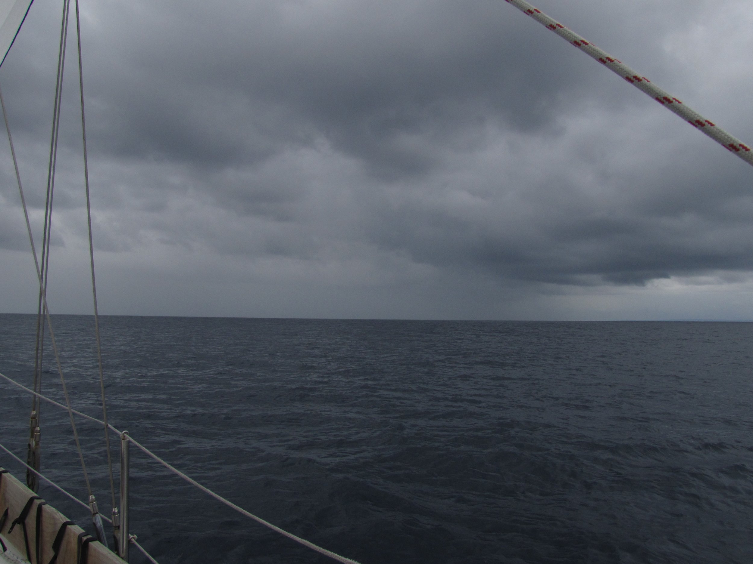
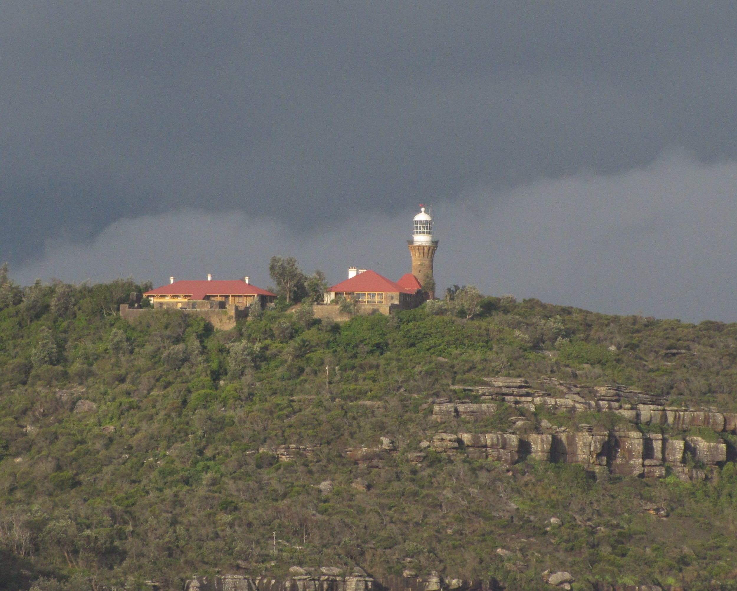
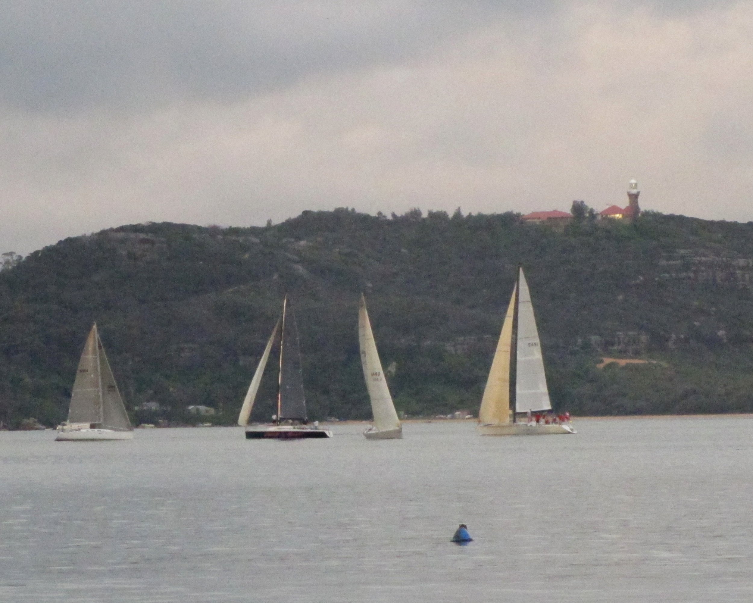
We encountered several squalls and thunder/lightning storms enroute. Just north of Sydney, we anchored for the night at Coaster's Retreat, Broken Bay passing the scenic Barrenjoey Head Lighthouse on our entry. Barrenjoey Head Light was first lit in 1881. In 1788, Arthur Phillip named the headland "Barrenjuee" (meaning little kangaroo or wallaby). The commonly accepted name since 1966 is Barrenjoey. The anchorage gave us a great view of the local yacht club races under way as well as the lighthouse in the distance.
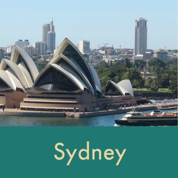
The Macquarie Lighthouse located on South Head at the entrance to Sydney Harbour is Australia's first and longest operating navigational light. There has been a navigational aid on this site since 1791 and a lighthouse since 1818. Once clearing Sydney Heads, the city of Sydney came into view and the approach was thrilling. Sydney is a huge, vibrant, world-famous city and definitely deserves a page of its own. Be sure to visit Sydney here!

The Grand Pacific Drive - Sydney to Wollongong and beyond...
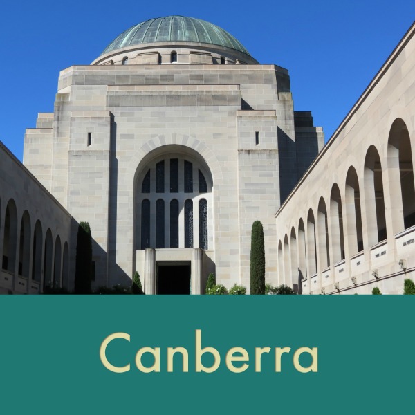
When our friends arrived, we had a rental car at our disposal and decided to make good use of it. After taking a trip to Canberra in Australia’s Capital Territory and celebrating New Year’s Eve in Sydney, we were still keen for more exploring and the Grand Pacific Drive seemed like an excellent way to tour the NSW coastline. We decided to take a loop route south to Kiama and then head back inland through the Southern Highlands countryside back to Sydney. The scenery was touted as "spectacular" and indeed it was. The 140km drive started just south of Sydney. We drove through the sub-tropical rainforests of the Royal National Park, Australia's first national park and the world's second-oldest national park. (The USA's Yellowstone was established as the first national park in the world.) The scenery became more stunning as we wended our way through quaint villages and along the cliff-hugging roads to the coast finally arriving at the Tasman Sea.
A few challenges… it was a holiday (January 1st was a Sunday, so January 2nd was the official day off and many restaurants and services were closed. No matter, we went anyway.

The most stunning sight of all was the 665m (2182 ft) Sea Cliff Bridge which snakes out over the sea. Our view from the Bald Hill Lookout was "gobsmacking".
We stopped for a few short hikes along the way and then stopped in Wollongong for lunch then wandered down to Wollongong Harbour for a closer look. The Wollongong Harbour Light, at the end of a long breakwater, stood sentry over what appeared to be a dicey harbor entrance. A nearby beach was crowded with holidaygoers soaking up Australia’s summer sun. We dipped our toes, but the water was too cold for our taste.
Just south of Wollongong, we were surprised by the Port Kembla Steelworks which definitely mucked up the beautiful views. A few more stops for views and browsing in small towns and we headed back to Sydney and Nine of Cups, already planning the next road trip.


We stopped at Lake Illiwara for a toe-dip in the Tasman Sea and an ice cream and then drove up to Barren Grounds NR for a quick hike. The views were once again spectacular.
The Blue Mountains
Another day, we headed west from Sydney to the Blue Mountains on the Great Western Highway. Our first stop was Wentworth Falls. We opted for a hike on the Charles Darwin Trail which ended up being 5km rather than 1km as advertised, but nobody complained. It was beautiful. After tramping up and down steps, across streams and on and off raised boardwalks, we arrived at what we thought was the Wentworth Falls and were quite disappointed. In actuality, we’d arrived at Weeping Rock and the Wentworth Falls were a bit more impressive. A wind whipped up the canyon and
standing anywhere close to the falls was a drenching experience.


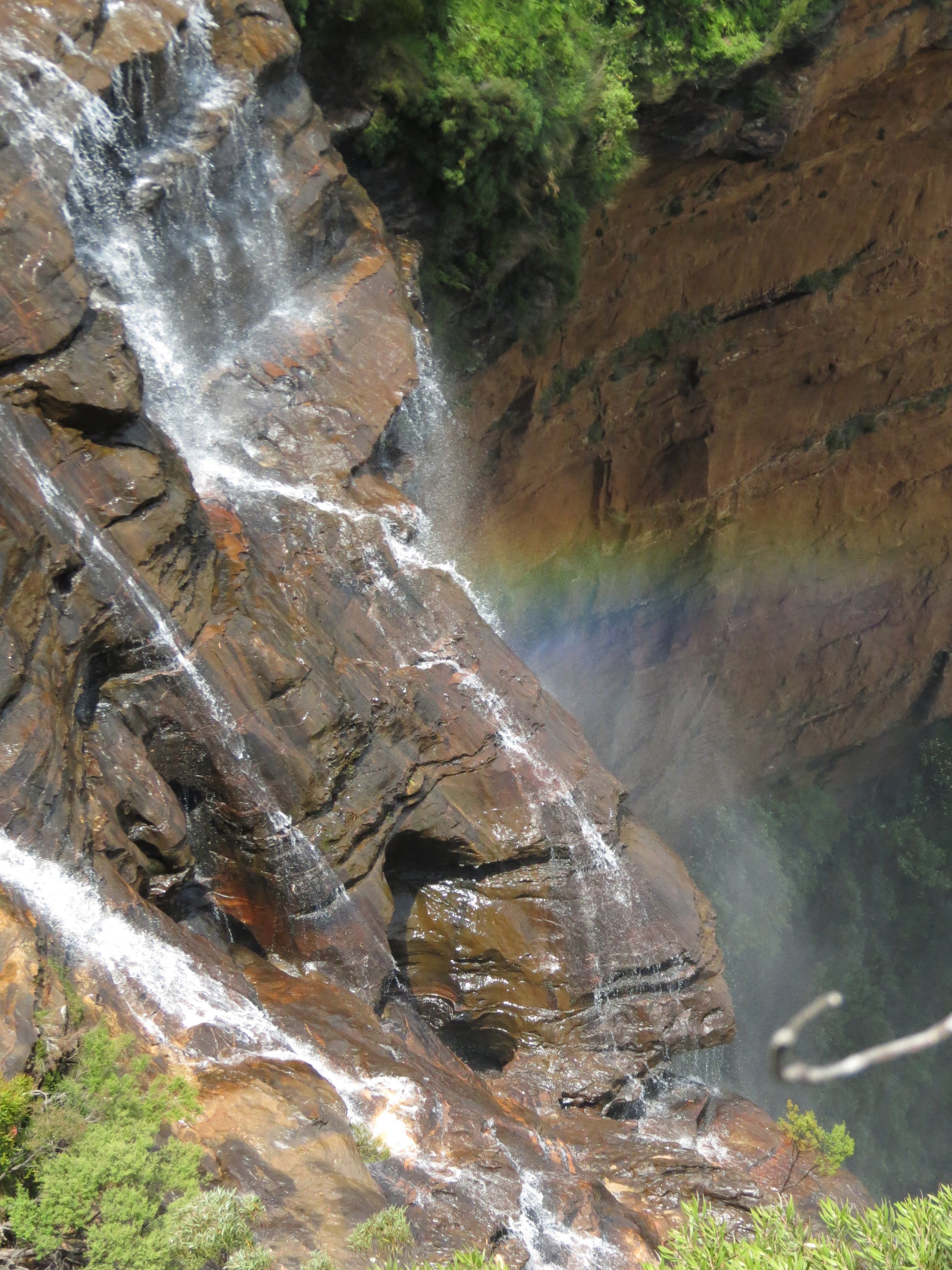
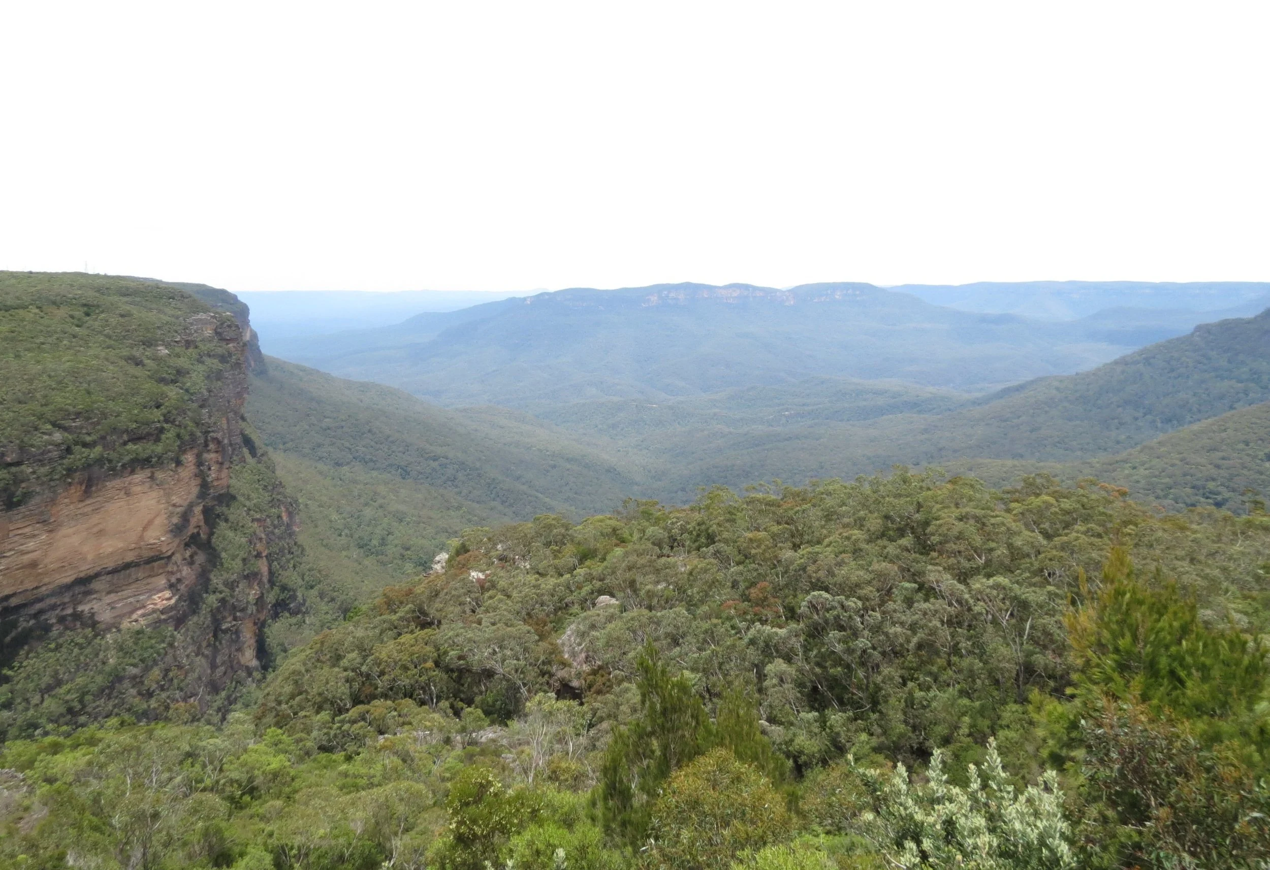
The Blue Mountains, part of Australia's Great Dividing Range, got their name from the blue mist which shrouds them. The blue haze is the result of a fine oily mist that is given off from the local eucalyptus trees. Actually, we learned that these are not mountains at all, but rather dissected sandstone plateaux.
Blue Mountain mist
The Aboriginal Legend of the Three Sisters goes like this. An Aboriginal witch doctor, Tyawan, turned his three daughters to stone to keep them from being harmed by a nasty creature, Bunyip. He planned to return to turn them back to humans, but when he himself became cornered by the monster, he turned himself into a lyrebird to escape. In the process, he lost his magic bone and to this day, he's searching for it while his daughters wait.
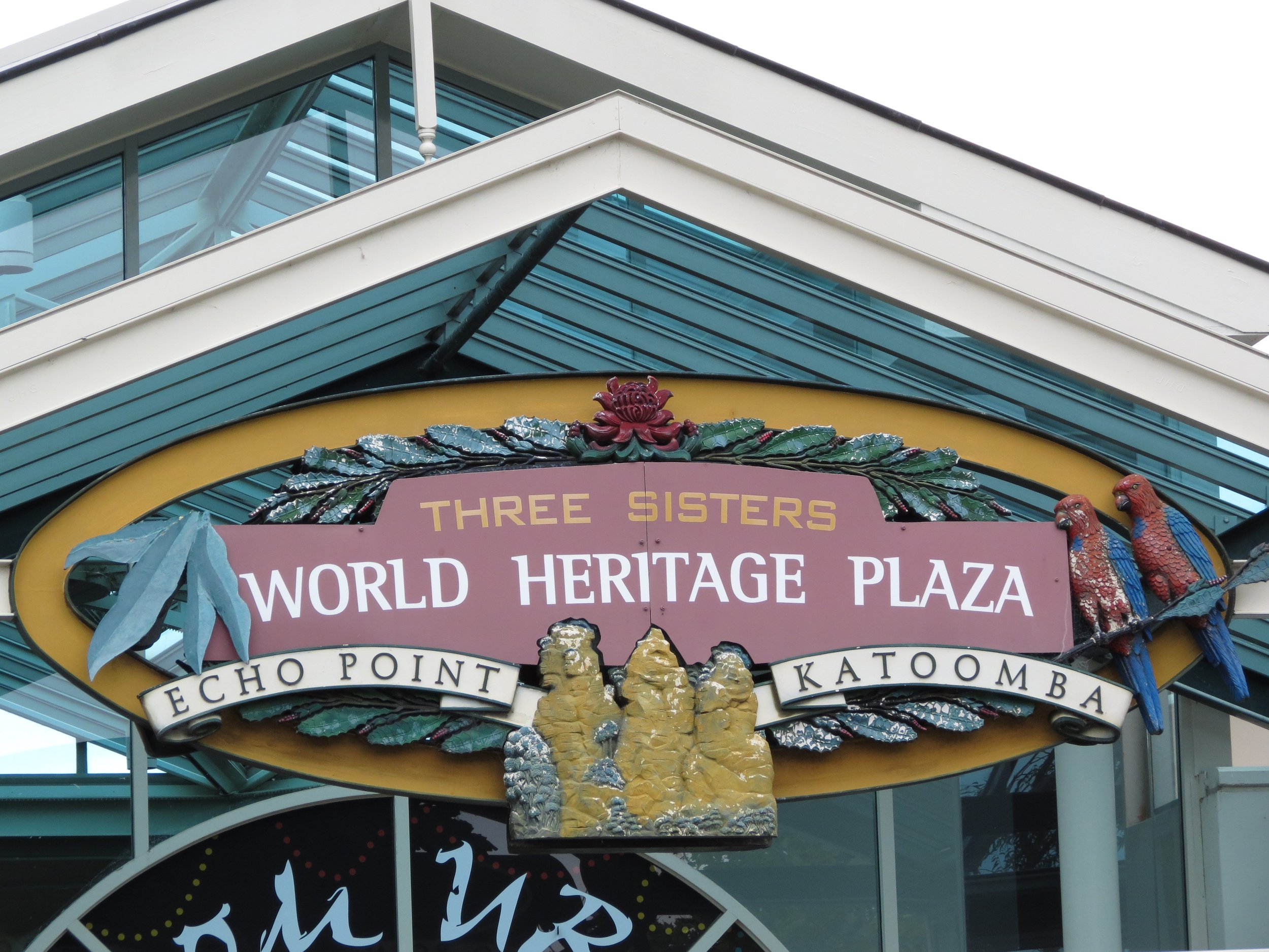


The Three Sisters await their father’s return.
We crossed over Victoria Pass, the highest point in the Blue Mountains, and stopped in the tiny ghost town of Hartley. Once a thriving settlement in the 1830s, it died a slow death when the railroad passed it by in 1887. Now only a few sandstone buildings remain. We noted Australian "Watch out for wildlife" signs were quite different than in the USA. That's a wombat below the roo.


Eden - Twofold Bay/Snug Cove - 37S04.46 / 149E54.13

The Sapphire Coast is the southernmost coastline of New South Wales bordering the state of Victoria. The area became known as the Sapphire
Coast for the clear sparkling waters of the ocean and the many lakes along its coastline. We sailed from Sydney in mid-January 2012 and arrived in
Eden two days later after a boisterous, seasickly passage. We thankfully anchored in Snug Cove in Twofold Bay. We anchored in the bay behind the moored boats in the lee of the breakwater. Red arrow = NoC.
Eden is a charming little town with a rich maritime history including whaling, fishing and lumbering. Though small, the town is rich in views, vistas and interesting things to see and do. We found a brochure/map for a Heritage Trail walk and gave it a go. We visited the Killer Whale Museum and generally got a feel for the town and its people. It's laid-back and friendly ... a nice place to stop and visit and hard to leave. The walk from the bay to town was a steep zig-zag up Warren's Walk... good for the legs.
In 1828, Thomas Raine opened the first shore-based whaling station in Australia at Twofold Bay. The Killer Whale Museum was established in 1931 as a tribute and record of the whalers of Eden and the story of a pod of killer whales (orcas) who assisted them. The bones of "Old Tom", the leader of the killer whale pods, were on display. For decades, the orcas would herd baleen whales into Twofold Bay, and keep them surrounded while alerting the whalers of their catch. "Old Tom" went so far as to tow the whaler's boats out to the captive whale. In return, the orcas feasted on the lips and tongue of the dead whale leaving the rest for the whalers.


Wandering around Eden was a delight. We stopped in the shops, walked along the trails and took in all the scenic views.


We enjoyed browsing through the shops and spotting uniquely Aussie products in the supermarket like the Wallaby Bread Improver, Edgell beetroot and Australia Day special packaging for the kernels.
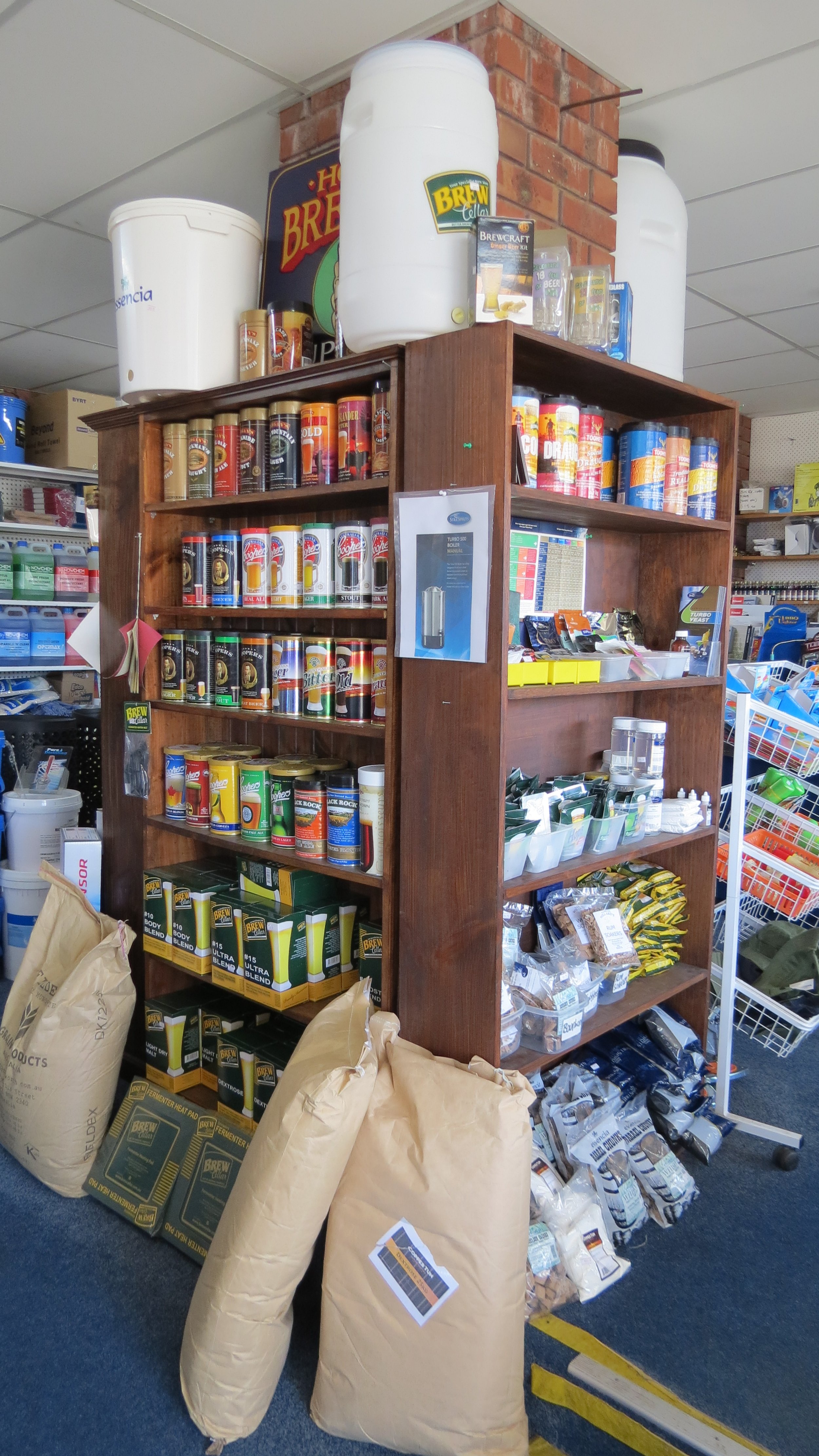
David had just begun brewing beer just before we left Sydney. Imagine his surprise and delight when we entered Eden's Gas & Gear and there, front and center. was an entire display of beer starters and brewing supplies. Stouts, lagers, IPAs and so much more. They even had ciders and ginger beers.
From Eden, we left New South Wales and sailed along Victoria’s coast. What do you say? Wanna come with us?
Victoria’s Coast
Geographically the smallest mainland state, Victoria is Australia's most densely populated state with almost 75% of Victorians living in Melbourne, the state capital and largest city. Victoria, like Queensland, was named after Queen Victoria, the monarch at the time. Victoria calls itself the 'Garden State', a reference to the rolling green hills and valleys which make up the majority of the state though some still refer to Victorians as cabbage patchers.
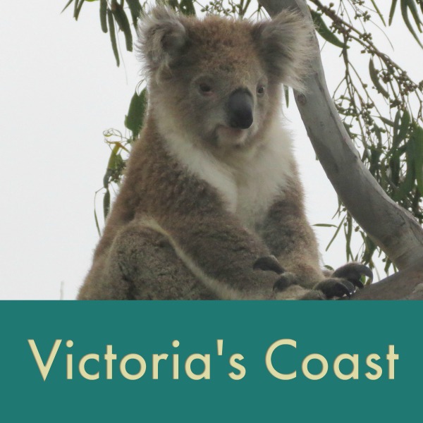
A long day and an overnight and we were in Victoria, rounding Australia's southeast corner and within shooting distance of Tasmania. While in Eden, we had, by chance, picked up a brochure about Victoria's Gippsland Lakes. One photo showed a sailboat on the lakes and we wondered if maybe the lakes were deep enough for bigger boats to navigate, like Nine of Cups, for instance. Lakes Entrance leads into Lake King behind Ninety Mile Beach. Raymond Island there supposedly has a large population of koalas in the wild. Rotamah Island is a wildlife/bird sanctuary with emus, roos, wallabies, wombats and echidnas. A few phone calls to the local VMR (Volunteer Marine Rescue) and local Coast Guard and we were assured that Cups would do just fine all the way to Paynesville. It's all we needed to hear!
From the Sail Blog 23 Jan 2012... En route from Eden to Lakes Entrance:
Hundreds of sooties and petrels attest to the fact that the fishing is good here. Some sit in rafts on the water and move only when the boat is close to them. We saw our first albatross in Australia this morning followed by many, many more as the day progressed. As we turned the corner and started heading west, hugging the coastline of Victoria, we entered into the Bass Strait. Pods of dolphins greeted us, surfing down the waves and seemingly enjoying themselves immensely. We certainly enjoyed their enthusiastic welcome.


Lakes Entrance, as its name suggests, is a direct access off the Bass Strait to the lakes behind the coastal dunes known as Ninety Mile Beach. In actuality, the "lakes" are a network of lakes, marshes and lagoons covering 400 sq km and are Australia's largest inland waterways. We arrived two hours before high tide as planned and the conditions were perfect. That said, the water around the entrance roiled and we could see a standing wave in front of us. We plowed on through and in a matter of minutes we were in tranquil waters where dozens of black swans and hundreds of other birds swam peacefully. The air smelled earthy and the scent of eucalyptus wafted on the breeze.


The 9-mile route from Lakes Entrance to Paynesville was quite circuitous, through a well-marked channel that doglegged around shallow spots in the lake. We came close, but never went aground. Birds, birds, birds. We'd never seen so many diverse birds in such numbers ... pelicans, black swans, gulls, cormorants, herons, coots, ducks... all swimming around looking for a snack. The rafts of birds would part as we motored through.
Montague Point, Raymond Island - 37S55.44 / 147E43.27 - 23'
We anchored just around Montague Point off Raymond Island. Lake traffic was steady, but we sat comfortably, a quick dinghy ride across the harbor to town and within a stone's throw of Raymond Island and its wildlife wonderland.

Black swans came a-calling regularly. Sometimes they brought the family and other times just the parents came by. They'd trumpet a hello and wait patiently for the first mate to bring out the daily ration of bread. They weren't the least bit afraid of Marcie as she fed them by hand from the dinghy.


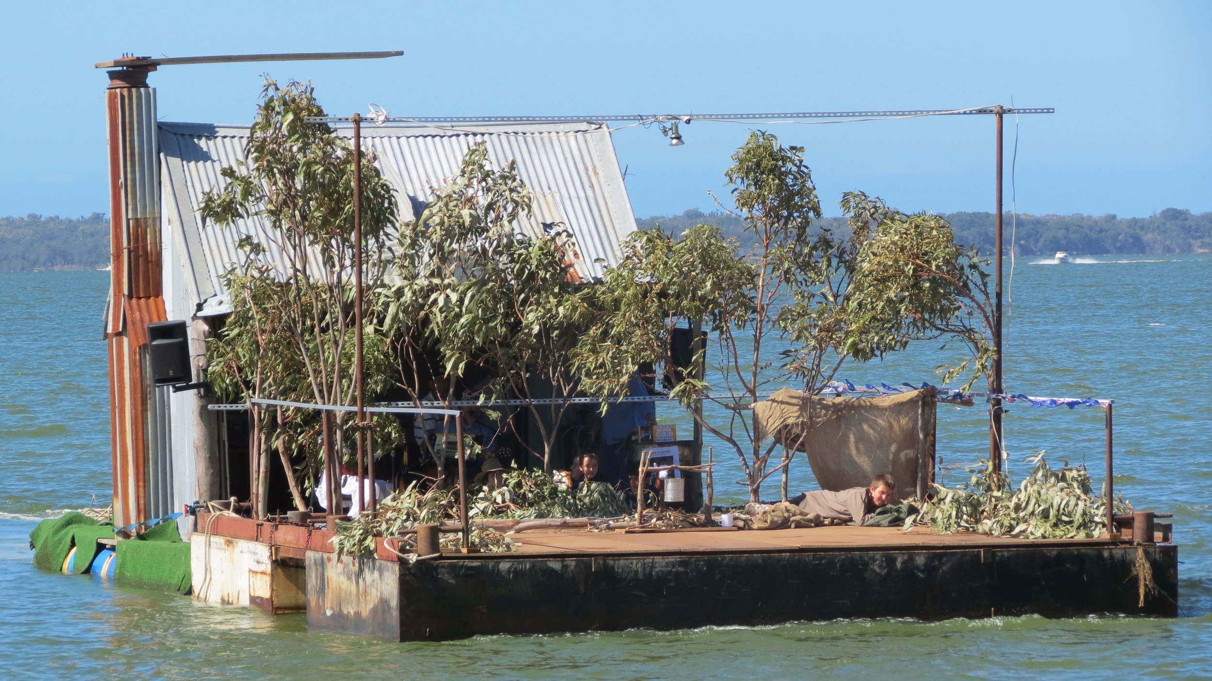
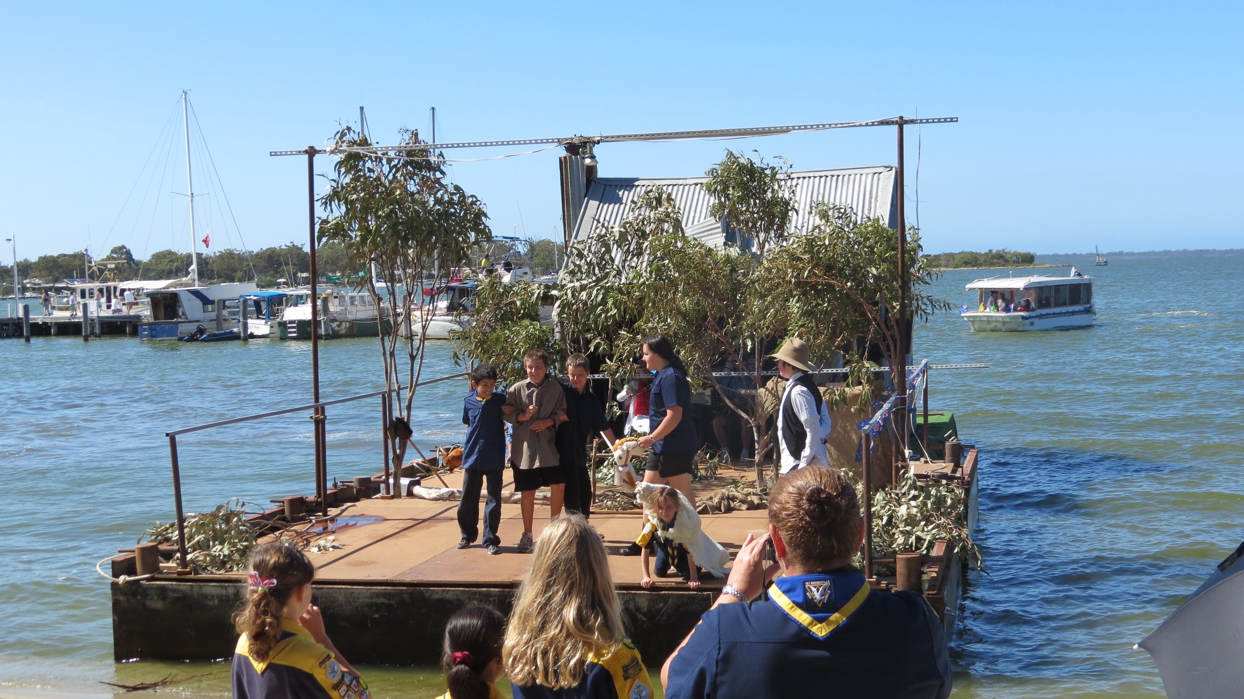
Australia Day is the country's "national"day. Observed annually on 26 January, it celebrates the landing of the First Fleet in 1788 and the raising of the Union Flag of Great Britain by Arthur Phillip at Sydney Cove. Flags were flying, red, white & blue balloons swayed in the breeze, banners waved and even the Raymond Island Ferry was dressed in her colors. Children had their faces painted and their bikes all decorated for a parade later in the day. There was quite a turnout in town. Free breakfast served by the local Lion's Club was an incentive to arrive early. Dignitaries gave speeches; bands played. Twelve people swore their oath of allegiance to the country and in a moving ceremony became new citizens of Australia midst audience applause and smiling faces. The crowd sang "Advance Australia Fair" as the Australian flag was raised.


Bernie's Tin Shed motored slowly into the little bay near the Progress Jetty playing "Waltzing Matilda". The "Tin Shed" is literally a tin shed on pontoons. Young Sea Scouts did a fine re-enactment of the story of Waltzing Matilda's swagman to the delight of the crowd on shore. Check out
Waltzing Matilda here. It'll have you humming all day long. We topped off the day with a BBQ at the Raymond Island home of our new friends.
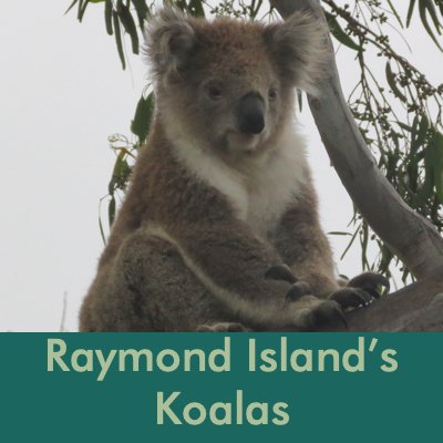
Raymond Island’s Koalas
We had thought we'd visit Raymond Island once and that would be sufficient. As it turned out, we visited nearly every day and every day offered something new to see and experience. The island is a wildlife wonderland and a well-kept secret. Ferries have linked Raymond Island to Paynesville since 1889. It's only a 5-minute ferry ride and it’s free for pedestrians.

Why are there koalas on Raymond Island?
Koalas were not native to Raymond Island but are native to the Victoria area. In 1953, Mrs. Gamble wrote to authorities asking for some koalas. Australia's koala population was dwindling and she thought Raymond Island would make a good habitat for them. 42 koalas were shipped to Raymond Island from Phillip Island and they thrived. By 2003, the koala population grew to over 600 which put their food supply under stress. The government instituted a population control program which includes fertility control and relocation of some of the koalas.
According to Wikipedia, The koala (Phascolarctos cinereus) is an arboreal herbivorous marsupial native to Australia, and the only extant representative of the family Phascolarctidae. The scientific name of the koala's genus, Phascolarctos, is derived from Greek phaskolos "pouch" and arktos "bear". Its species name, cinereus, is Latin and means "ash-colored".
Although the koala is not a bear, English-speaking settlers from the late 18th century first called it koala bear due to its similarity in appearance to bears. Although taxonomically incorrect, the name koala bear is still in use today outside Australia – its use is discouraged because of the inaccuracy in the name. The word koala comes from the Aborigine Dharuk language. Although koalas obtain most of their water from leaves -- the name koala is thought to mean "no drink" in several native Aboriginal tongues -- they do occasionally drink water at the edges of streams.

As soon as we exited the ferry, we knew we were in koala-land. Painted koala signs marked the sidewalk and street signs warned us to beware of island wildlife.
A marked "Koala Trail", only 1.2km long, led us along streets through pleasant neighborhoods on the island. Large rocks with placards provided information about koalas, their habits, their lives and their habitat.


From our reading, we learned that the koala has five fingers that include two opposable thumbs, providing better gripping ability. The first two fingers are positioned in apposition on the front paws and the first three fingers on the hind paws. The koala is one of the few mammals other than primates that has fingerprints. Koala fingerprints are similar to human fingerprints; even with an electron microscope, it can be difficult to distinguish between the two.
The koala was hunted almost to extinction in the early 20th century, mostly for its fur. Millions of furs were traded to Europe and the United States, and the population still has not fully recovered from such decimation. Extensive cullings occurred in Queensland in 1915, 1917, and again in 1919 when over one million koalas were killed with guns, poisons and nooses.
They subsist almost entirely on eucalypt leaves. Like wombats and sloths, the koala has a very low metabolic rate for a mammal and rests motionless for about 16 to 18 hours a day, sleeping most of that time.
Male koalas are referred to as 'bucks', females are 'does' and baby koalas are called 'joey's .
It was hard to spot them at first. They blended into the crooks of the trees in which they slept. We had sore necks from staring up at the eucalyptus trees, trying to sight just one koala. In actuality, there were dozens.


Beware Drop Bears!
An Aussie friend e-mailed us asking if we'd seen any drop bears and advising that we watch our for them. Hmm! After a little internet research, here's what we found out. A drop bear is a fictitious Australian marsupial. They're commonly said to be unusually large, vicious, carnivorous koalas that inhabit treetops and attack their prey by dropping onto their heads from above. They are an example of local lore intended to confuse tourists and amuse locals, similar to the jackalope of Colorado. It was suggested that having forks in our hair or Vegemite spread behind our ears would deter these vicious creatures. So far, these suggestions have worked well for us.
Read an article about us in the Paynesville Post.
We met new friends, Jim & Linda, an ex-pat American couple, who came to Australia 40+ years ago on a teaching contract and never left.
They took us on a short trip to a friend's farm on the north side of Raymond Island. We spotted a mob of kangaroos not far away as we walked across the paddock and grounds.

We saw lots of birds, an echidna at a distance and wombat mound (sans wombat) and several more koala. The best? A mama koala with a fluffy baby nearby. We noticed the female eating leaves first and then upon closer inspection, we noticed her little joey high in the tree above her. As we moved closer to take photos, the mama koala moved protectively closer to her joey.

Lakes Entrance - Flagstaff Jetty - 37S53.22 / 147E58.42
As always, it's time to go before we're ready to leave, but a good weather window appeared and we needed to take advantage of it. The plan was to leave the Raymond Island anchorage so that we'd arrive at the Lakes Entrance channel at just the right time and shoot on through. The wind was up and the exit channel looked a bit dodgy when we arrived. We opted instead to tie up to the Flagstaff Jetty for a free mooring night and wait till the channel looked less dicey. So, left with some free time, we explored a bit. The now-abandoned tiny village of New Works is adjacent to the jetty and offered an illustrated historic walk.
The trip across the Lakes Entrance bar was thankfully uneventful and we were off to Tasmania with a planned stop at Deal Island. Come with us across the sometimes treacherous Bass Strait and visit the island/lighthouse caretakers on Deal Island. You’re gonna love it! Then, sail a little further and you’ll be ‘down under, down under’ exploring Tasmania with us.
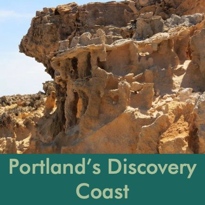
Back to Victoria and Portland’s Discovery Coast
Fast forward to January 2013. After nearly a year in Tasmania, we were back to Australia’s mainland. Arriving in Portland, Victoria, we were out of the Roaring 40s, out of the Bass Strait and out of Tasmania. Portand Harbour is situated behind a large, protective breakwater and turning the corner heading towards the yacht club was a pleasant respite from the rolling seas on the other side. Several ships were loading and unloading at the wharf. Huge piles of wood chips and stacks of timber lined the dock and the air smelled of fresh-cut wood. A new marina was being built, but not yet completed so we anchored nearby.


The city of Portland is the oldest European settlement in the state of Victoria. It’s a pleasant little city, easily accessible on foot. Originally founded by Edward Henty in 1834 (though the Aborigines were here millennia before), there are historical buildings along every one of Portland’s main streets … 200 or more in town that date from the 19th century. Most are constructed of dark bluestone with which we were unfamiliar … a marked contrast to the golden sandstone we’d seen in Tasmania. Victorian bluestone is a basalt, quarried locally and one of the most common building materials of the 1850s during the Victorian Gold Rush. We took a historic walk through town, admiring these sturdy, built-to-last buildings. Most are still in use. The English Gothic style St. Stephens Anglican church, Victoria’s oldest Anglican church founded in 1834, and the old Town Hall, now the Portland History House, were particularly impressive.


After a couple of days of sailing, it was good to stretch our legs. We took a long, self-guided walk along the Norfolk Pine-lined foreshore to the Portland Botanical Garden. The garden is renowned for its manicured croquet lawns and its dahlias. Though it was a bit early in the season (March-April is prime), we still saw some dazzling dahlias. Crazy-looking corellas filled the trees. We watched the Portland Croquet Club play a few wickets while enjoying our picnic lunch.


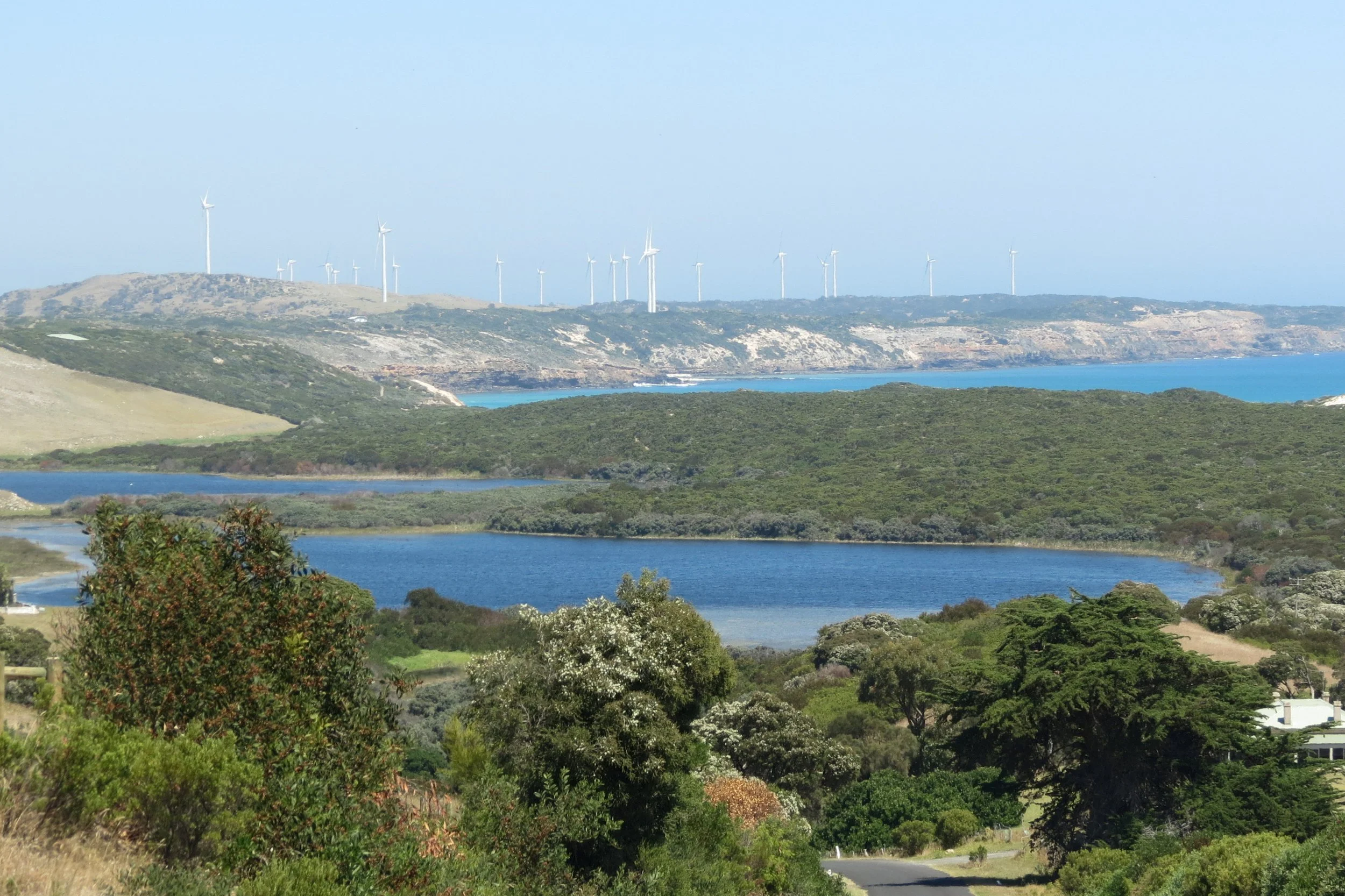
The weather forecast indicated we'd be in Portland for a few days, so we decided to rent a car and drive along Portland's Discovery Coast. First stop was at a gannet colony. We reached the mainland colony via gravel roads near the Alcoa Aluminum smelting plant where great piles of aluminum ingots waiting for transport. The Point Danger gannet colony is the only mainland breeding colony in Australia. Then on to Cape Nelson, a very scenic route along the high cliffed coast. The views were stupendous with miles of white sandy beach at the seaside and verdant rolling hills inland.


The views were stupendous. A Portland Wind Energy Project wind farm whirs in the distance.
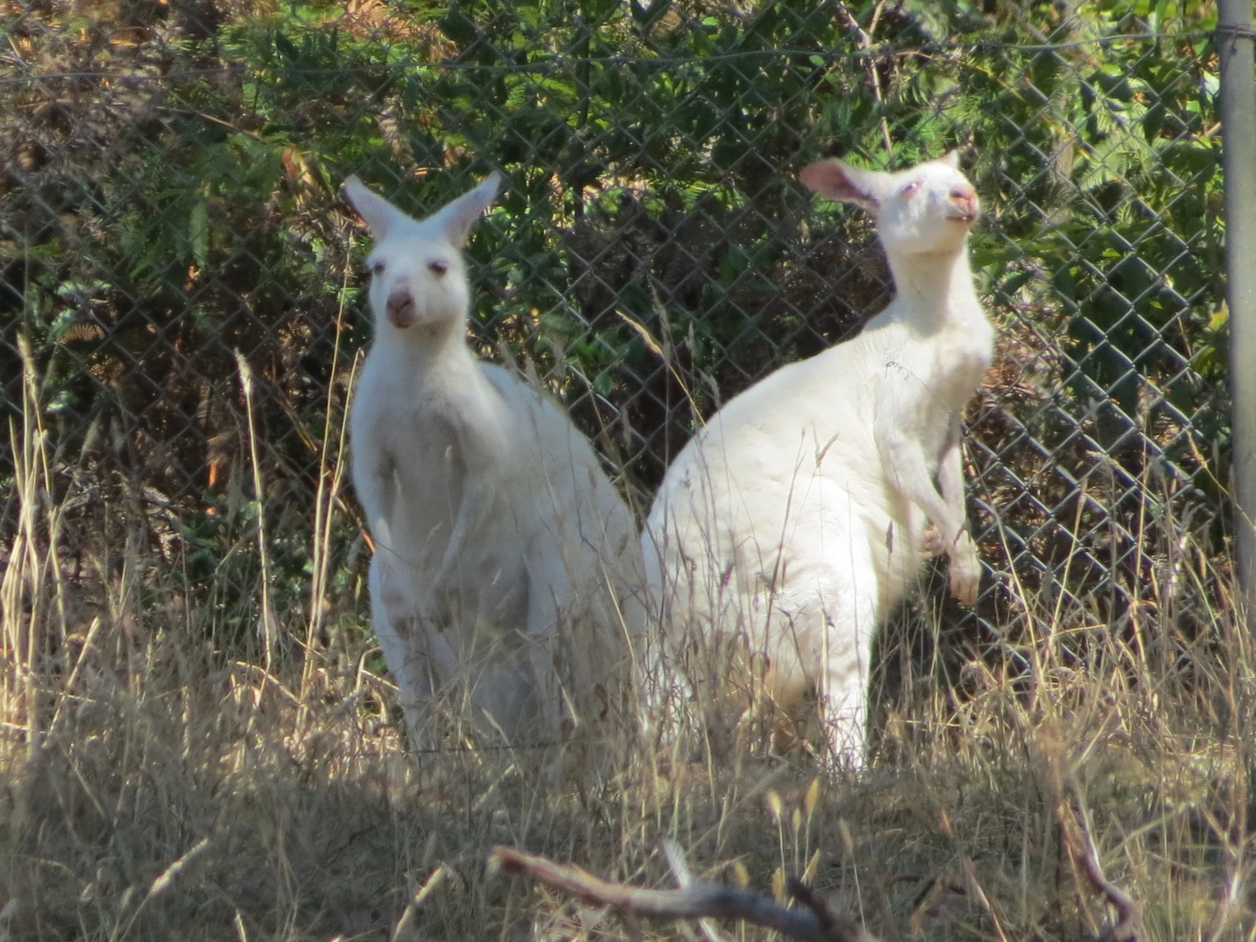
We walked through the Petrified Forest which was not a “petrified forest” at all, but rather natural erosion of stone that looked more like a moonscape. We drove a loop back to Portland and stopped at the Tarragal Limestone Caves as we passed through the beautiful Bridgewater Lakes. We stopped at Fauna Park, a tiny little place just outside Portland, to watch white kangaroos. We passed through farmlands and saw our first emu in the wild which pleasantly surprised us and one field had innumerable ibis feeding. We felt we’d done a good job of discovering ‘Portland’s Discovery Coast’.


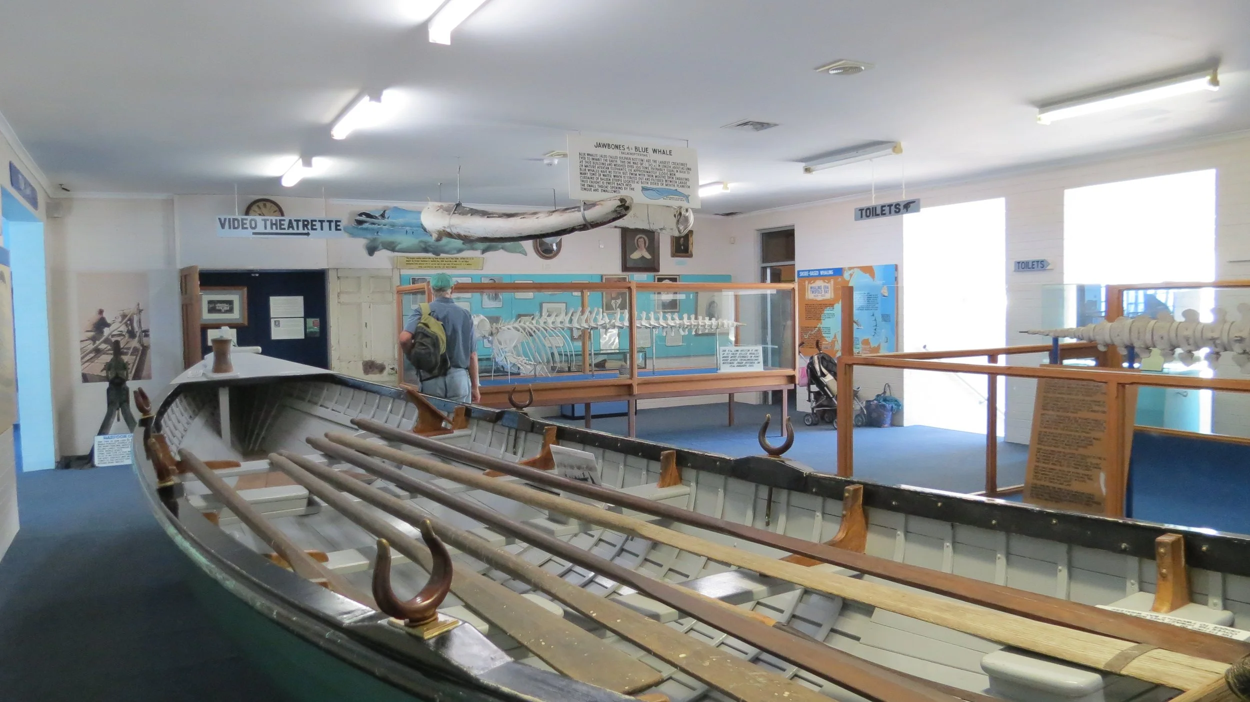
Back in Portland, there was still lots to see and do on foot. We walked to Whaler’s Bluff Lighthouse. Built in 1859, this classic lighthouse structure was originally built elsewhere and transported to this spot later stone by stone. We finished our time in Portland just wandering around and taking in the local sights. We visited the Maritime Discovery Museum which houses the famous Portland Lifeboat used in the rescue of passengers from the sinking ship Admella in 1859. Also on display at the museum was a huge sperm whale skeleton, large enough to walk inside that gives you a Jonah kind of feeling as you sit inside its ribcage. Another day, we checked out the vintage cable tram with a restored 1886 saloon car that travels a 3.5km route along the coast and harbor. We prefer walking, but we enjoyed watching a little bit of history pass by.
But we really didn’t have to travel off the boat for spectacular views, sunrises were knock-your-socks-off beautiful.


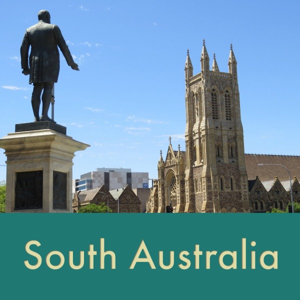
Then a weather window appeared and it was time to move on to North Haven/Port Adelaide, South Australia. Come on along for the ride. Guaranteed you won’t be seasick!