

Newfoundland’s Gros Morne National Park
/
Gros Morne, loosely translated from the French means ‘lone mountain’, was visible from miles away as we approached from the north. Newfoundland’s second highest mountain at 2,644’ (896m), Gros Morne stands tall in the Long Range Mountains, part of the Appalachian chain, believe it or not, that stretch the length of Newfoundland’s west coast.

We could see the Gros Morne from miles away
We’d planned to head to the Shallow Bay Campground in Cow Head (yup, Cow Head), but its location on the end of a point seemed less than pleasant with a 25-30K wind roaring and a torrent of rain pouring down. Looking for a more sheltered spot, we finally found a huge paved area for overnighting right off the highway and hunkered down for the night.

Cow Head, one of many interestingly named towns we would encounter in Newfoundland
While parked for the night, we checked out the ferry schedule for our upcoming Nova Scotia crossing. Surprisingly, it was booked out well over 2-3 weeks and though we hated to make firm plans, we did our best to plan the rest of our Newfoundland itinerary and reluctantly made the reservation. Now we had a schedule to keep. Bah!
The rain cleared by mid-morning and the forecast of sun looked promising as we headed into the national park. The towering cliffs of Gros Morne, even when shrouded in mist, are an impressive sight.

We stopped first at Western Brook Pond for a hike. The 4-mile long (out and back) gravel trail is easy walking. There were scads of folks on the trail all headed to the dock for a 2-hour boat tour of Western Brook Pond.

The Western Brook Pond trail was easy walking.
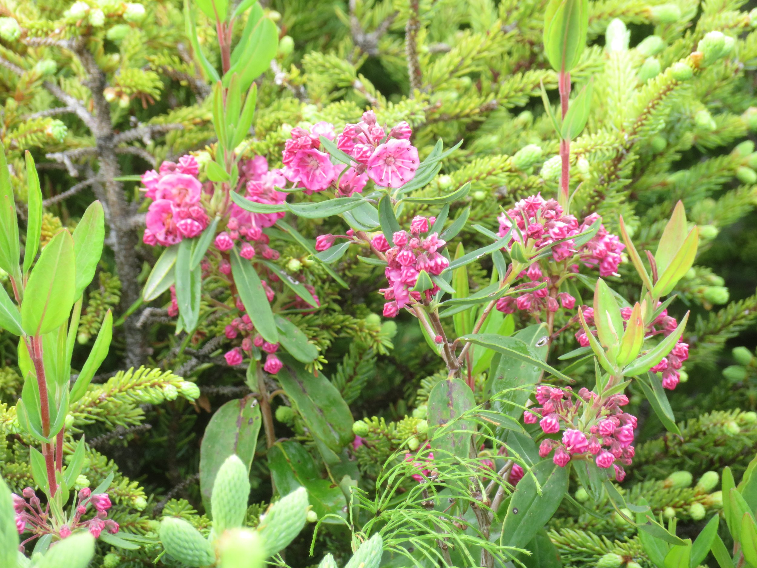
The path crossed bogs and forested areas of coastal lowlands. The highlight of the walk was the myriad of wildflowers in bloom… orange hawkweed, bird’s-foot trefoil, cotton grass, silverweed, sheep laurel, purple iris, yellow pond lilies and the provincial flower, purple pitcher plants.


The views of Gros Morne were spectacular.


The water was calm as a mill pond.
An inland fjord carved by glaciers billions of years ago, the boat tour of Western Brook Pond required reservations which we had not made. Judging by all of the folks queued up at the dock who had reservations ($79/pp), we were just as happy to have given the tour a miss. Once they boarded, we had the whole trail to ourselves.

Hordes of people queued up for the boat tours.
Contrary to the forecast, it was drizzling again as we finished up the hike and climbed back into Blanche in search of lunch. We stopped in Rocky Harbour for a bite to eat (a very mediocre, but expensive lobster roll) and headed to the park visitor center only to find it had moved.
En route to the new facility we stopped for a quick peek of the Lobster Cove Lighthouse.

Lobster Cove Light
We finally located the new visitor’s center which didn’t appear quite ready for visitors. The large, new facility was staffed with a couple of rangers, limited maps and brochures and a small gift shop, but no exhibits or park film was available as yet.
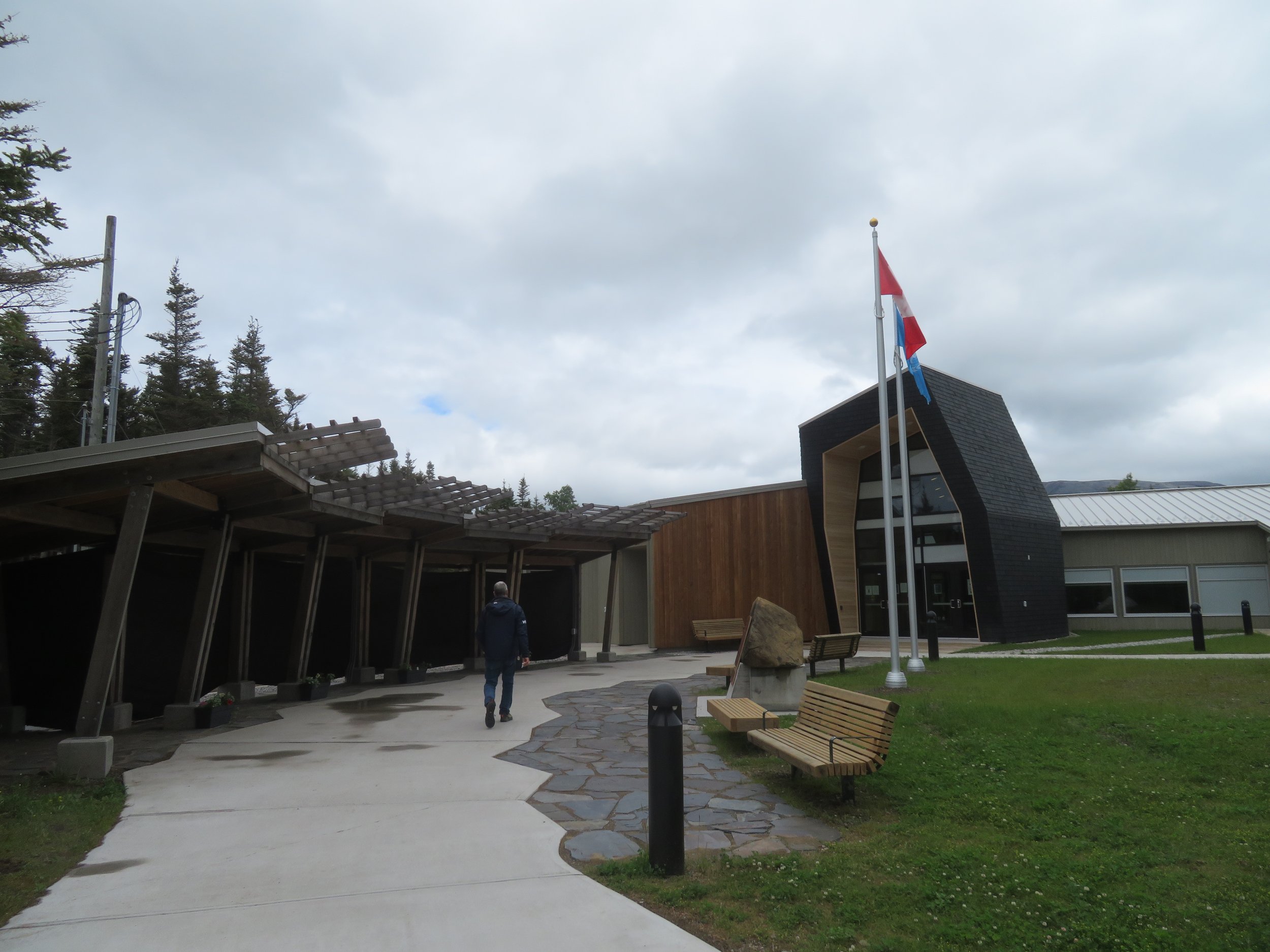
The new Gros Morne Visitor Centre was beautiful, but pretty empty inside.
We learned that the Summit Trail which we’d hoped to hike was closed to hikers for the next week in order “to protect wildlife during critical weeks of growth and reproduction”. We resorted to Plan B.
Our Plan B included camping at Trout River. This plan, too, was altered when we found that we’d missed the small ferry across Bonne Bay from Norris Point to Woody Point and the drive would require an additional 54 mile (88km) trip. We drove some of the way with thoughts of positioning ourselves for an early morning hike the next day. Then the rain started again in earnest with a forecast of even more rain for the next two days.
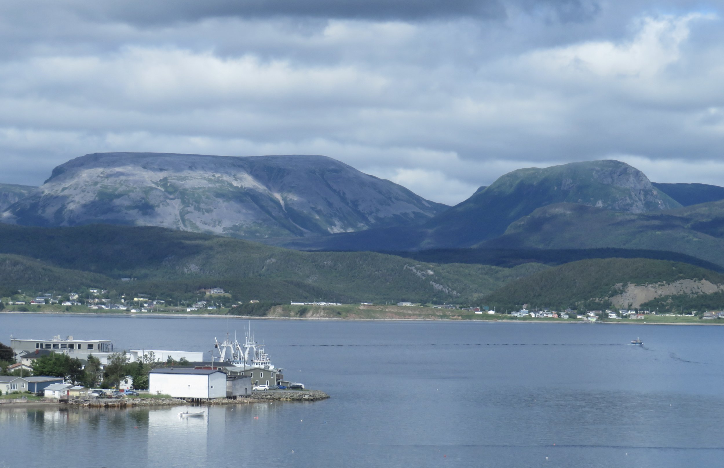
Bonne Bay view… the clouds were moving in.

Woody Point Light… the rain started shortly after we visited Woody Point Light.
There was so much more to see and do on the island and now we had a schedule! Though we were disappointed, we finally concluded that perhaps exploring more of Gros Morne was not in the cards. Instead, we hit the road and headed towards Fogo Island, the largest of Newfoundland Labrador’s offshore islands and a magical kind of place.
Join us next time as we take the ferry to Fogo Island and climb Brimstone Head, one of the four corners of the ‘flat earth’.
Check out the map below to see our current location.
